Home
States
Colorado
Connecticut
Maine
Massachusetts
New Hampshire
New York
Rhode Island
Utah
Vermont
View All
Lists
NE 4,000 Footers
NE 100 Highest
NH 4,000 Footers
NH 100 Highest
NH 52 With A View
NH Belknap Range
NH Ossipee 10
Links
Trail Conditions
Trip Log
Sunrises
Sunsets
About
|
General Stark Mountain
Fayston, VT
Trailheads, measurements, times, distances, and maps are all approximate and relative to the hike(s) as shown below.
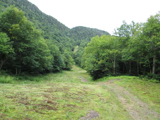
The Stark Mountain Trail
Route: Stark Mountain Trail, Long Trail
Mad River Glen has a hiking trailhead kiosk adjacent to the single chairlift (on the base box side) with hiking trail maps (they have a few suggested routes to the top of the single and double chairlifts). The Stark Mountain Trail basically ascends the gravel access road to the top of the single chairlift (you can hop onto the Long Trail southbound a few tenths of a mile below the top of the chairlift). For those unfamiliar with alpine skiing, Mad River Glen has old fashioned trails with essentially no snowmaking. As a result, hiking up the ski trails here is a much different experience than your average ski area, as the trails are narrower, follow the natural contours of the land, have limited infrastructure, and are quite smoothly manicured. Quite a scenic walk (complete with an impressive waterfall).
The Long Trail south to the wooded highpoint was damp due to afternoon showers. There is a directional viewpoint east, just off the trail near the summit.
| Hike Ratings |
|
Getting To Trailhead: |
Easy |
| Destination: |
General Stark Mountain |
|
Length: |
Moderate |
|
Steepness: |
Difficult |
|
Navigation: |
Easy |
|
Views: |
Moderate |
|
Crowds: |
Heavy |
|
| Hike Stats |
|
Date Hiked: |
Saturday, August 16, 2014 |
| Parking Elevation: |
1,460' |
| Destination: |
General Stark Mountain |
| Time Elapsed: |
01:13 |
| Trailhead Elevation: |
1,650' |
| Summit Elevation: |
3,662' |
| Vertical Gain: |
2,062' |
|
|
| Hike Time Elapsed: |
03:07 |
| Hike Vertical Gain: |
2,162' |
|
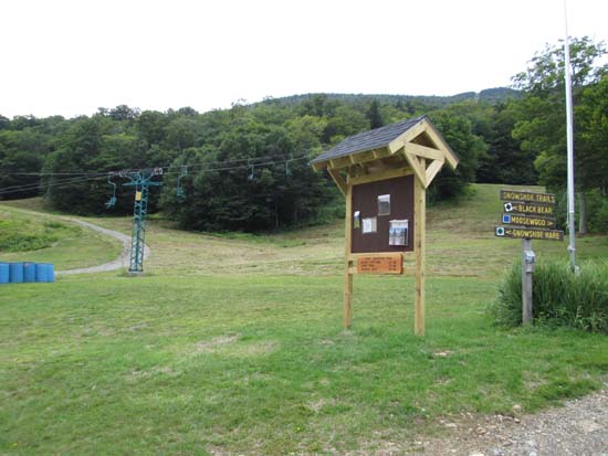
The hiking trailhead at the Mad River Glen base area
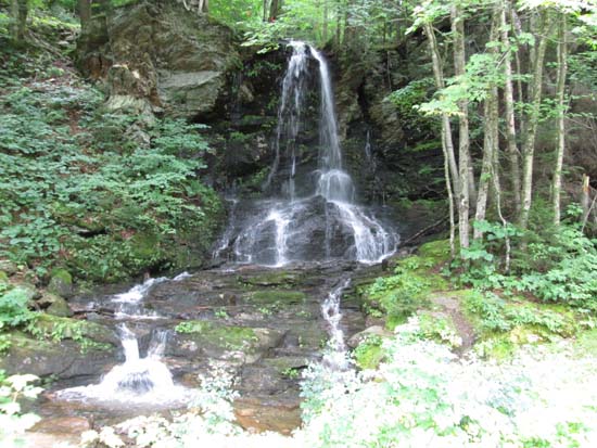
The waterfall along the Stark Mountain Trail
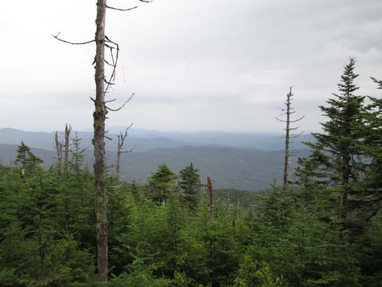
Slight views east from near the summit of General Stark Mountain
Directions to trailhead: From Waitsfield, take Route 17 north to Mad River Glen ski area. The summer hiking kiosk is located near the single chairlift.
Back to General Stark Mountain Profile
|

