Home
States
Colorado
Connecticut
Maine
Massachusetts
New Hampshire
New York
Rhode Island
Utah
Vermont
View All
Lists
NE 4,000 Footers
NE 100 Highest
NH 4,000 Footers
NH 100 Highest
NH 52 With A View
NH Belknap Range
NH Ossipee 10
Links
Trail Conditions
Trip Log
Sunrises
Sunsets
About
|
Jay Peak, Big Jay
Westfield, VT, Montgomery, VT
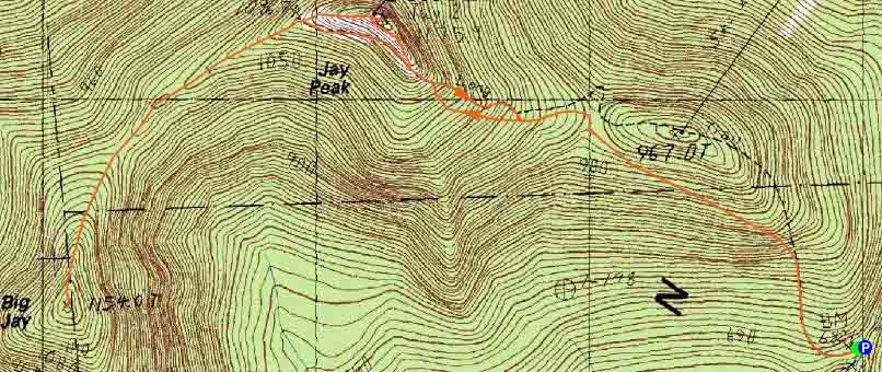
Trailheads, measurements, times, distances, and maps are all approximate and relative to the hike(s) as shown below.
The Long Trail
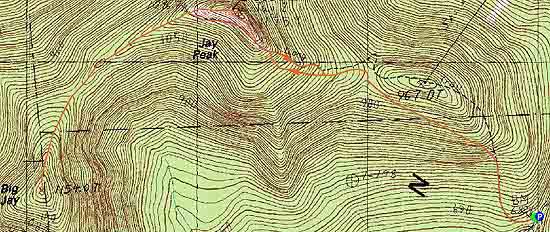
Route: Long Trail, Vermonter, (Jay Peak), Northway, Long Trail, herd path, (Big Jay), herd path, Long Trail, Northway, Vermonter, Long Trail
Long Trail was mostly dry and in good shape. Ski trails were dry and the grass not too tall/thick.
Herd path to Big Jay is more obvious now than I remember a few years ago...head down the Long Trail behind the big fence, then look to your left shortly thereafter for an obvious herd path...there will be a white blaze on the tree adjacent to the path.
Herd path, despite the dry weather, still had a few mud pits. Some blowdowns to climb over as well. Otherwise, generally smooth sailing. No summit register at the moment, but the ski patrol sled is a pretty obvious marker.
| Hike Ratings |
|
Getting To Trailhead: |
Easy |
| Destination: |
Jay Peak |
|
Length: |
Moderate |
|
Steepness: |
Moderate |
|
Navigation: |
Moderate |
|
Views: |
Excellent |
|
Crowds: |
Moderate |
| Destination: |
Big Jay |
|
Length: |
Moderate |
|
Steepness: |
Difficult |
|
Navigation: |
Moderate |
|
Views: |
Excellent |
|
Crowds: |
Minimal |
|
| Hike Stats |
|
Date Hiked: |
Sunday, July 15, 2012 |
| Parking Elevation: |
2,205' |
| Destination: |
Jay Peak |
| Time Elapsed: |
01:01 |
| Distance: |
1.6 miles |
| Trailhead Elevation: |
2,205' |
| Summit Elevation: |
3,858' |
| Vertical Gain: |
1,668' |
| Destination: |
Big Jay |
| Time Elapsed: |
00:59 |
| Trailhead Elevation: |
3,858' |
| Summit Elevation: |
3,786' |
| Vertical Gain: |
466' |
|
|
| Hike Time Elapsed: |
03:48 |
| Hike Vertical Gain: |
2,622' |
|
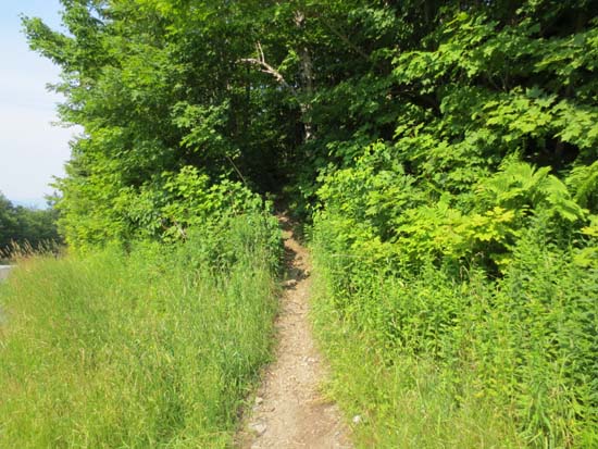
The Long Trail trailhead on Route 242
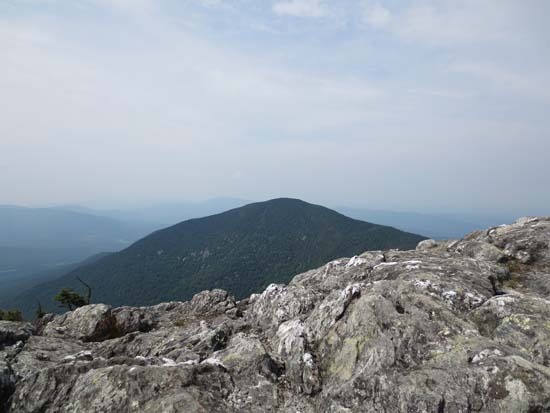
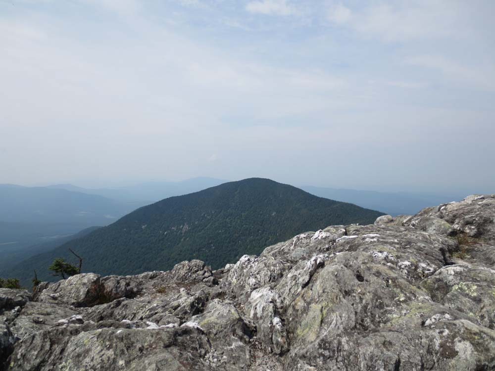
Looking at Big Jay from Jay Peak
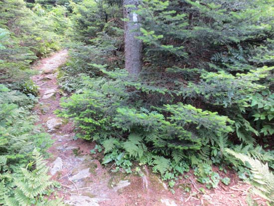
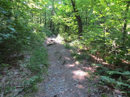
The herd path junction on the way to Big Jay
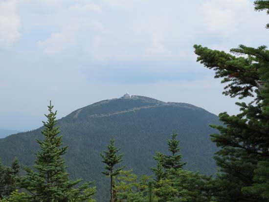
Looking at Jay Peak from near the Big Jay summit

Directions to trailhead: From the town of Jay, take 242 south to the top of the pass. There is a parking lot on the left. The trailhead is just slightly downhill from this, on the right.
Back to Jay Peak Profile
Back to Big Jay Profile
|