Home
States
Colorado
Connecticut
Maine
Massachusetts
New Hampshire
New York
Rhode Island
Utah
Vermont
View All
Lists
NE 4,000 Footers
NE 100 Highest
NH 4,000 Footers
NH 100 Highest
NH 52 With A View
NH Belknap Range
NH Ossipee 10
Links
Trail Conditions
Trip Log
Sunrises
Sunsets
About
|
Mendon Peak, Killington Peak, Pico Peak
Mendon, VT, Killington, VT
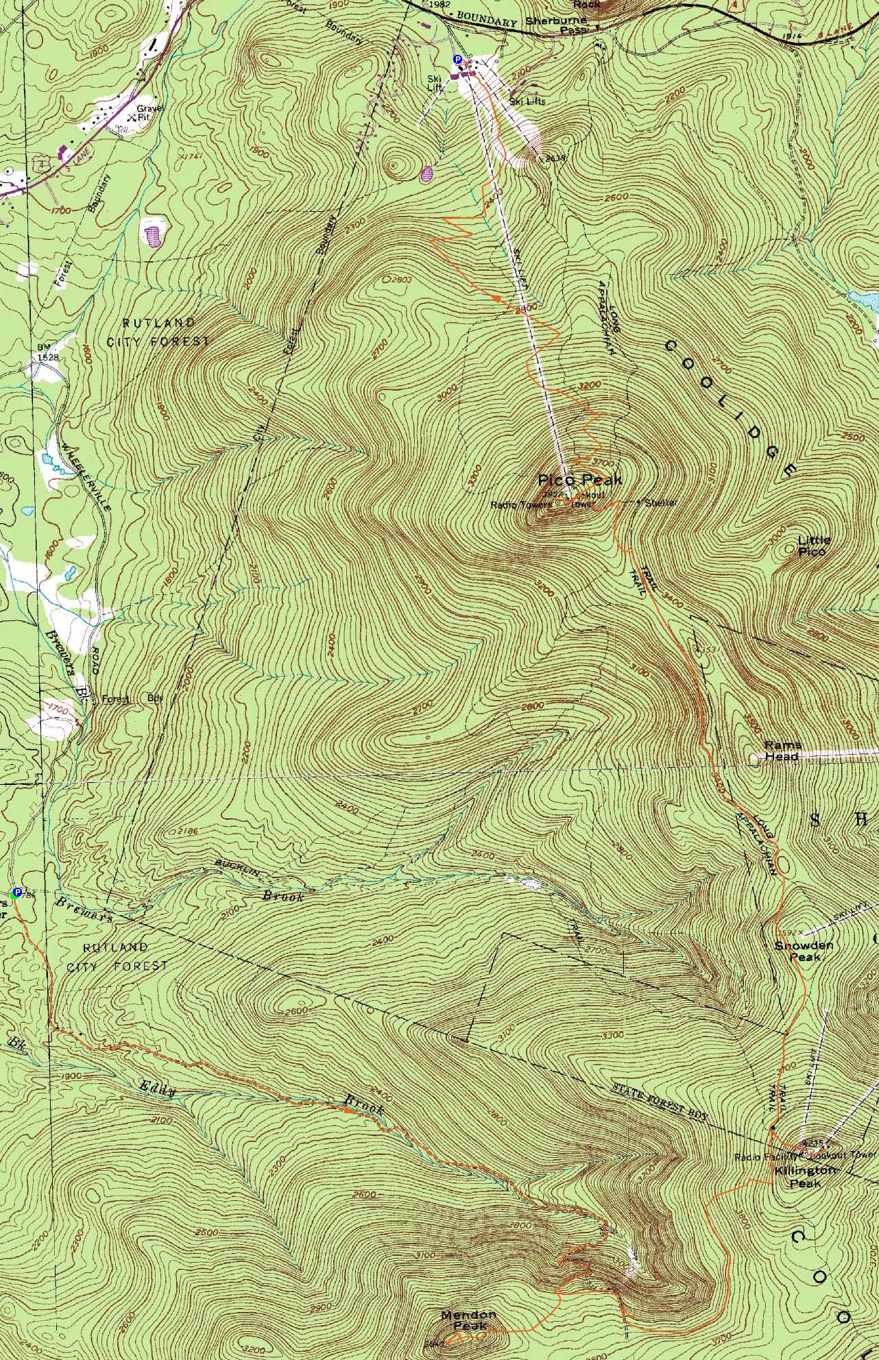
Trailheads, measurements, times, distances, and maps are all approximate and relative to the hike(s) as shown below.

The lower portion of the logging road leading to the Mendon-Little Killington col
Route: Logging road, bushwhack, (Mendon Peak), bushwhack, logging road, herd path, Appalachian Trail, Killington Spur, (Killington Peak), Killington Spur, Appalachian Trail, Sherburne Trail, ski trail, Pico Spur, (Pico Peak), ski trails
Having not been to Vermont in some time, it seemed like a decent day to return to the Killington area. After spotting a vehicle at the Pico ski area (for the option of traversing south from Killington), we headed up Wheelerville Road to the Bucklin Trail parking area.
When looking at the parking lot from Wheelerville Road, the gated logging road heading to Mendon Peak is on the right. We headed up this at first grassy road, passing by a camp of some sort after a few minutes. Continuing straight, we eventually dropped to the first of multiple Eddy Brook crossings - this one the trickiest (due to slippery rocks). Above this, we continued uphill, recrossing a few times. As the road became steeper, we encountered the first cairn. We continued uphill, soon passing a second cairn, and then reaching a third. From here, we bushwhacked southwest in generally open woods, often following herd paths.
We first topped out on a smaller subpeak/plateau of Mendon, then climbed steeply to a higher subpeak, where we pushed southeast a few feet to tremendous view ledges.
After taking in the hazy (due to Quebec wildfires) but nonetheless nice views, we followed a herd path from this peak to the actual highpoint peak, about 4 minutes away. From here, there was a slight view from near the cannister. I bushwhacked toward this opening, then wrapped around in a southerly direction, about 5-10 vertical feet below the summit, and reached much stronger views from a few tiny ledges. Unfortunately, it was a pretty thick (though short) push back to the highpoint.
After taking a break and checking out the log book, we headed toward Killington. We at first attempted to avoid reclimbing the subpeaks of Mendon, however upon reaching thick junk on the northwest side, we opted to climb up to the herd path to the subpeak, then down to the third cairn on the logging road.
At this cairn, we headed uphill on the logging road. At first, we continued straight at a junction marked with a piece of rusty logging equipment leaning on a tree, shortly reaching a 10 foot drop into a wet, boggy area. This didn't quite seem right, so we back tracked to the junction and headed uphill. This worked out better, and appeared to be following a backcountry ski trail of some sort.
The logging road eventually disappeared, however there was an obvious footbed leading up this ski glade, with occasional views back toward Mendon Peak. A few minutes later, we reached the Appalachian Trail. The ski glade (and footbed) appeared to continue up to Killington, however we opted to take a left onto the Appalachian Trail and head to Cooper Lodge.
From the lodge area, we headed uphill on the Killington Spur, climbing up the steep, rocky terrain to the open summit ledges.
After a nice break with decent views (and a brief side trip to the ski area for views east), we headed back down to the Appalachian Trail, continuing downhill to the left of Cooper Lodge.
Heading northbound on the back side of the ski area, the footing on the trail was a treat as compared to the rough White Mountains. We eventually reached the Sherburne Trail junction, where we took a right (onto the Sherburne Trail, the old AT). Soon thereafter, we hit a ski trail (cut as part of a cancelled interconnect of Pico and Killington and thus not actively used by skires), and headed uphill on it to the Pico Spur. We took the spur trail across a few active ski trails and around the summit quad and patrol building, soon reaching the quasi cairn that seems to mark the highpoint.
The views from Pico were decent, though once again hazy due to the smoke. Nonetheless, we could see some of the higher peaks to the north, as well as Kearsarge in southern New Hampshire.
For the descent, we took a dirt road that weaved through the ski trails. This worked out well for awhile, however as it neared the bottom, it meandered a bit. Since we didn't want to deal with potential ticks and hidden mud in the grass, we followed a lesser road from the bottom of the upper quad, then headed down along the alpine slide swath (not yet open).
| Hike Ratings |
|
Getting To Trailhead: |
Easy |
| Destination: |
Mendon Peak |
|
Length: |
Moderate |
|
Steepness: |
Difficult |
|
Navigation: |
Difficult |
|
Views: |
Excellent |
|
Crowds: |
Minimal |
| Destination: |
Killington Peak |
|
Length: |
Moderate |
|
Steepness: |
Difficult |
|
Navigation: |
Difficult |
|
Views: |
Excellent |
|
Crowds: |
Moderate |
| Destination: |
Pico Peak |
|
Length: |
Difficult |
|
Steepness: |
Moderate |
|
Navigation: |
Moderate |
|
Views: |
Excellent |
|
Crowds: |
Minimal |
|
| Hike Stats |
|
Date Hiked: |
Sunday, May 30, 2010 |
| Hike Commenced: |
9:31 AM |
| Parking Elevation: |
1,786' |
| Destination: |
Mendon Peak |
| Ascent Commenced: |
9:31 AM |
| Summit Reached: |
11:51 AM |
| Time Elapsed: |
02:20 |
| Trailhead Elevation: |
1,786' |
| Summit Elevation: |
3,840' |
| Vertical Gain: |
2,174' |
| Destination: |
Killington Peak |
| Ascent Commenced: |
12:14 PM |
| Summit Reached: |
2:13 PM |
| Time Elapsed: |
01:59 |
| Trailhead Elevation: |
3,840' |
| Summit Elevation: |
4,235' |
| Vertical Gain: |
925' |
| Destination: |
Pico Peak |
| Ascent Commenced: |
2:53 PM |
| Summit Reached: |
4:37 PM |
| Time Elapsed: |
00:44 |
| Trailhead Elevation: |
4,235' |
| Summit Elevation: |
3,957' |
| Vertical Gain: |
626' |
|
|
| Hike Ended: |
5:58 PM |
| Hike Time Elapsed: |
08:27 |
| Hike Vertical Gain: |
3,845' |
|
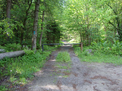
The beginning of the logging road off Wheelerville Road

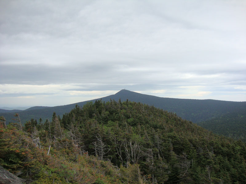
Looking at Killington from the ledgy crag just east of Mendon Peak

Looking down the herd path to the Appalachian Trail from the Mendon Peak area logging road
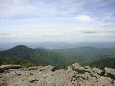
Looking west from Killington Peak (Mendon Peak to the left)
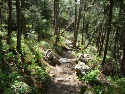
The Appalachian Trail between Killington Peak and Pico Peak
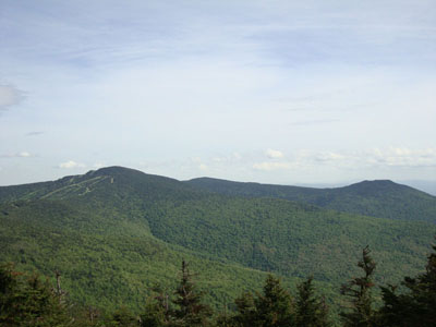
Looking at Killington Peak and Mendon Peak from Pico Peak

Directions to trailhead: To get to the Bucklin Trail trailhead (and adjacent logging road toward Mendon Peak), take US 4 West from Pico Ski Area. A few minutes downhill, on a right curve, take a left onto Wheelerville Road. The Bucklin Trail parking area will be on the left after few miles on this road at a sharp right turn. The gated logging road toward Mendon Peak will be on the left side of this sharp right turn.
Back to Mendon Peak Profile
Back to Killington Peak Profile
Back to Pico Peak Profile
|