Home
States
Colorado
Connecticut
Maine
Massachusetts
New Hampshire
New York
Rhode Island
Utah
Vermont
View All
Lists
NE 4,000 Footers
NE 100 Highest
NH 4,000 Footers
NH 100 Highest
NH 52 With A View
NH Belknap Range
NH Ossipee 10
Links
Trail Conditions
Trip Log
Sunrises
Sunsets
About
|
Shrewsbury Peak, Smith Peak
Shrewsbury, VT
Trailheads, measurements, times, distances, and maps are all approximate and relative to the hike(s) as shown below.
The Black Swamp Trail
Route: Black Swamp Trail, Shrewsbury Peak Trail, (Shrewsbury Peak), Shrewsbury Peak Trail, Black Swamp Trail, unknown trail, bushwhack, (Smith Peak), bushwhack, unknown trail, Black Swamp Trail
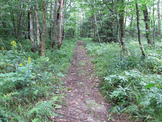
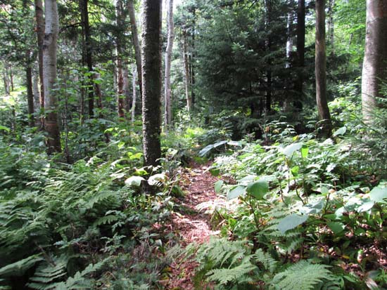
Black Swamp Trail was relocated a few decades ago, so the USGS maps don't show it accurately. The first half of the trail follows a gated logging road. In the vicinity of the swamp, the trail departs from the logging road and becomes more footpath like. It briefly rejoins the trail displayed on the USGS I believe around 3,300 or so feet, but soon departs as it nears the shelter, due to a new reroute. On the whole, there was some slippery rock and occasional mud, but otherwise it wasn't too bad.
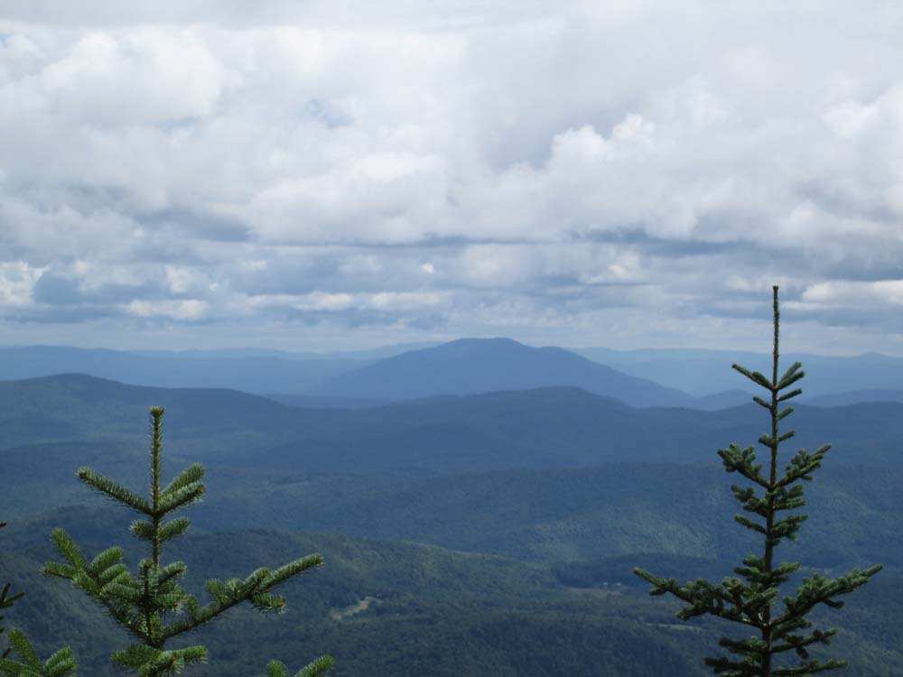
From the south bump (generally displayed as the highpoint on maps), there were two directional views (east/south), though trees are starting to overtake them. It wouldn't take much to improve. According to the altimeter, the wooded north bump is very similar in elevation. There is a directional view a short bushwhack beyond it to the northeast courtesy some blowdowns.
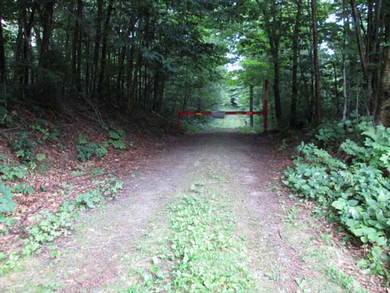
We then descended back to the old trail crossing (there's also a random sign pointing up the trail to Shrewsbury Peak, and if you look down hill, the faded blazes are visible) and hopped on it. The footing is quite good and it appears it still gets a decent amount of use. It too is not quite correct on the USGS, as it nearly climbs up the small 3,000 or so foot bump, then slabs the south side of Smith around 3,000 feet in elevation. We opted to bushwhack up from the south side to the wooded summit in generally open woods with subpar footing. For the descent, we descended toward the col in open woods with better footing, then retraced our steps (assuming that perhaps the lower part of the old trail must be bad enough to warrant a reroute, since the portion we took was excellent, if not superior to the current route) back to the current trail.
| Hike Ratings |
|
Getting To Trailhead: |
Easy |
| Destination: |
Shrewsbury Peak |
|
Length: |
Moderate |
|
Steepness: |
Moderate |
|
Navigation: |
Easy |
|
Views: |
Excellent |
|
Crowds: |
Minimal |
| Destination: |
Smith Peak |
|
Length: |
Moderate |
|
Steepness: |
Moderate |
|
Navigation: |
Difficult |
|
Views: |
Minimal |
|
Crowds: |
Minimal |
|
| Hike Stats |
|
Date Hiked: |
Saturday, August 23, 2014 |
| Parking Elevation: |
2,420' |
| Destination: |
Shrewsbury Peak |
| Time Elapsed: |
00:55 |
| Trailhead Elevation: |
2,420' |
| Summit Elevation: |
3,720' |
| Vertical Gain: |
1,340' |
| Destination: |
Smith Peak |
| Time Elapsed: |
00:51 |
| Trailhead Elevation: |
3,720' |
| Summit Elevation: |
3,200' |
| Vertical Gain: |
280' |
|
|
| Hike Time Elapsed: |
03:45 |
| Hike Vertical Gain: |
2,020' |
|
The Black Swamp Trail trailhead

Looking southeast at Ascutney from Shrewsbury
The abandoned trail near Smith Peak

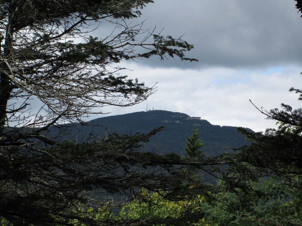
Looking at Killington from near the summit of Smith Peak
Directions to trailhead: Take Route 100 North from Plymouth Notch, then take a left onto Shrewsbury Road (Old CCC Road). The Black Swamp Trail trailhead and parking lot will eventually be on the right near the height of land.
Back to Shrewsbury Peak Profile
Back to Smith Peak Profile
|