Home
States
Colorado
Connecticut
Maine
Massachusetts
New Hampshire
New York
Rhode Island
Utah
Vermont
View All
Lists
NE 4,000 Footers
NE 100 Highest
NH 4,000 Footers
NH 100 Highest
NH 52 With A View
NH Belknap Range
NH Ossipee 10
Links
Trail Conditions
Trip Log
Sunrises
Sunsets
About
|
Mt. Watatic
Ashburnham, MA
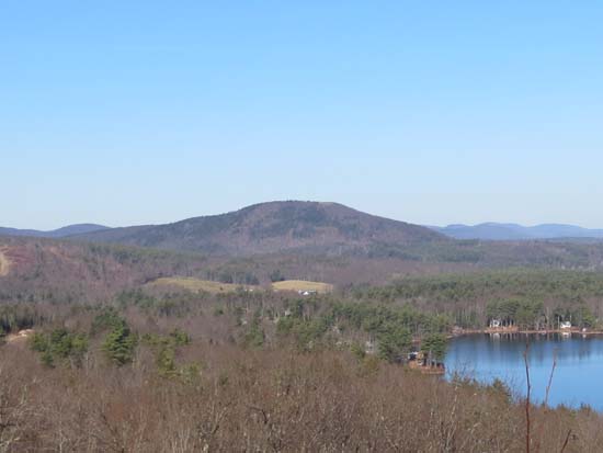
Mt. Watatic as seen from Mt. Hunger
 Summary Summary
Mount Watatic is one of the highest peaks in Central Massachusetts. Once home to an alpine ski area, the summit offers strong views in almost every direction.
Summit Elevation
1,832 feet
Summit Facilities
None.
Trip Reports:
Click on the date for photos, timestamps, and maps.
More Information
Mt. Watatic - NewEnglandSkiHistory.com
|
