Home
States
Colorado
Connecticut
Maine
Massachusetts
New Hampshire
New York
Rhode Island
Utah
Vermont
View All
Lists
NE 4,000 Footers
NE 100 Highest
NH 4,000 Footers
NH 100 Highest
NH 52 With A View
NH Belknap Range
NH Ossipee 10
Links
Trail Conditions
Trip Log
Sunrises
Sunsets
About
|
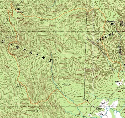
Big Ball Mountain, Black Snoot, Mt. Shaw, Mt. Flagg
Tuftonboro, NH, Moultonboro, NH
Trailheads, measurements, times, distances, and maps are all approximate and relative to the hike(s) as shown below.
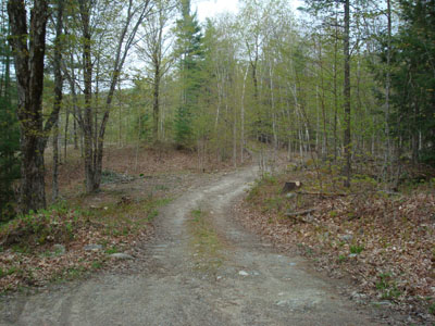
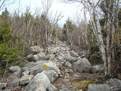
Looking up the Banana Trail
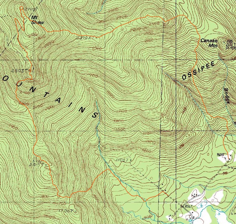
Route: Banana Trail, (Big Ball Mountain), Banana Trail, Black Snout Spur Trail, (Black Snout), bushwack, Black Snout Spur Trail, Black Snout Trail, (Mt. Shaw), Gorilla Trail, (Mt. Flagg), Mt. Flagg Trail
With some recently discovered data on some lesser known trails in the Ossipee Range, we set out early Saturday morning for a seldom hiked traverse.
After meeting at Camp Merrowvista (not yet in session), we left a vehicle behind and headed to McDuffee Road. After scouting possible trailhead locations, we parked at the bottom of the hill and headed up the road on foot. After talking with a resident, we followed an old road downhill a bit (and soon saw blazes on the trees).
The first portion of the Big Ball Mountain Trail, also known as the Banana Trail, is a very gradual old dirt road (complete with what looks to be an abandoned house and barn). The only brook crossing is bridged via a culvert.
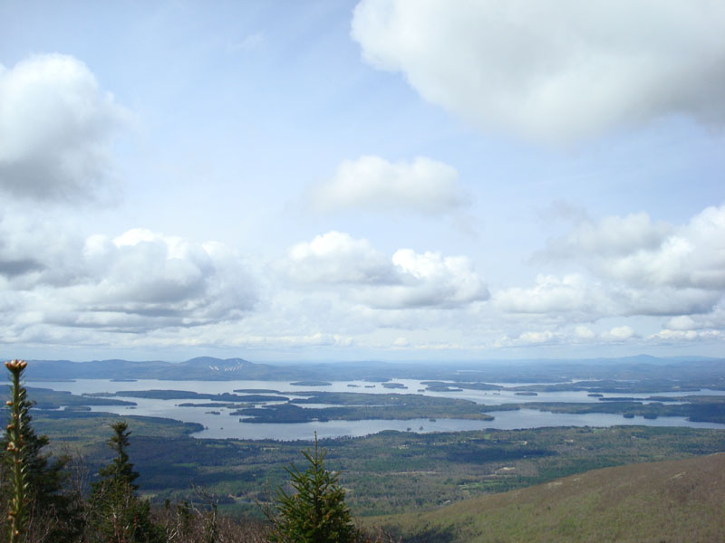
Soon, the trail turns and heads up the slope of Big Ball Mountain (also known as Tate Mountain), somewhat steeply. After clearing the ridge, the trail weaves through a variety of ledges and blueberry fields with excellent views. After meeting up with the red-green blazed trail that returns to the Mt. Shaw Trail, the Big Ball Mountain Trail heads to Big Ball Mountain (the higher of the two knobs). The views from here include much of the Lakes Region.
From here, the trail dives into the col (with a short scramble, which also has a bypass trail), then heads steeply up the slope of the peak known unofficially as Black Snout (not the official Black Snout in the northwestern part of the Ossipees). After ascending steeply for some time, the trail meets up with the Black Snout Spur Trail, an old carriage road. We took our time on the rather flat carriage road, as it was absolutely littered with moose droppings.
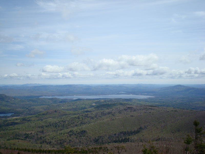
The views from Black Snout are also excellent - slightly better than Big Ball Mountain due to the additional few hundred feet of elevation.
Trying something new, we took a light bushwack/herd path off the summit down to the Black Snout Spur Trail, shaving a few tenths of a mile off the hike. After looking at the Thunderbird Trail trailhead, we continued up the Black Snout Trail to Mt. Shaw.
As usual, the views from Mt. Shaw were tremendous - from Moosilauke to the Carter Range, the White Mountains are on full display. Though we pondered eating lunch here, we decided to continue on, picking up the Mt. Flagg Trail (also known as the Gorilla Trail), at the summit.
This trail was pretty neat - the first portion is a gradual rocky descent through a small-growth birch. After leveling off, the land becomes even more interesting, as there are portions of grass under the birch.
The Mt. Flagg summit features another great view of the White Mountains, as well as an interesting look inside the Ossipees. Another excellent vista ledge is located just past the summit - this is where we ended up eating, with great views into Maine, points south, and of Winnipesaukee.
From here, the Mt. Flagg Trail descends moderately through rocky terrain, before hitting lower slopes and steepening up. The two brook crossings at the bottom of the slope are bridged. Just after the bridges, the trail meets a camp road, which then leads uphill to the house and parking lot.
Especially considering the forecasts leading up to the hike were poor at best, this ended up being a very fun hike. Knowing there are some additional well marked trails up Mt. Shaw now, I'll probably be back more often!
| Hike Ratings |
|
Getting To Trailhead: |
Moderate |
| Destination: |
Big Ball Mountain |
|
Length: |
Moderate |
|
Steepness: |
Difficult |
|
Navigation: |
Easy |
|
Views: |
Excellent |
|
Crowds: |
Minimal |
| Destination: |
Black Snoot |
|
Length: |
Moderate |
|
Steepness: |
Difficult |
|
Navigation: |
Easy |
|
Views: |
Excellent |
|
Crowds: |
Minimal |
| Destination: |
Mt. Shaw |
|
Length: |
Moderate |
|
Steepness: |
Easy |
|
Navigation: |
Easy |
|
Views: |
Excellent |
|
Crowds: |
Minimal |
| Destination: |
Mt. Flagg |
|
Length: |
Moderate |
|
Steepness: |
Difficult |
|
Navigation: |
Easy |
|
Views: |
Excellent |
|
Crowds: |
Minimal |
|
| Hike Stats |
|
Date Hiked: |
Saturday, May 10, 2008 |
| Hike Commenced: |
8:06 AM |
| Parking Elevation: |
900' |
| Destination: |
Big Ball Mountain |
| Ascent Commenced: |
8:09 AM |
| Summit Reached: |
9:29 AM |
| Time Elapsed: |
01:20 |
| Trailhead Elevation: |
940' |
| Summit Elevation: |
2,060' |
| Vertical Gain: |
1,240' |
| Destination: |
Black Snoot |
| Ascent Commenced: |
9:32 AM |
| Summit Reached: |
10:27 AM |
| Time Elapsed: |
00:55 |
| Trailhead Elevation: |
2,060' |
| Summit Elevation: |
2,803' |
| Vertical Gain: |
903' |
| Destination: |
Mt. Shaw |
| Ascent Commenced: |
10:36 AM |
| Summit Reached: |
11:04 AM |
| Time Elapsed: |
00:28 |
| Trailhead Elevation: |
2,803' |
| Summit Elevation: |
2,990' |
| Vertical Gain: |
285' |
| Destination: |
Mt. Flagg |
| Ascent Commenced: |
11:10 AM |
| Summit Reached: |
12:18 AM |
| Time Elapsed: |
01:08 |
| Trailhead Elevation: |
2,990' |
| Summit Elevation: |
2,390' |
| Vertical Gain: |
210' |
|
|
| Hike Ended: |
2:18 PM |
| Hike Time Elapsed: |
06:12 |
| Hike Vertical Gain: |
2,728' |
|
The Banana Trail trailhead on McDuffee Road
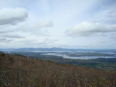
Looking at Lake Winnipesaukee from the Big Ball Mountain summit
Looking up the Banana Trail on the way to Black Snoot
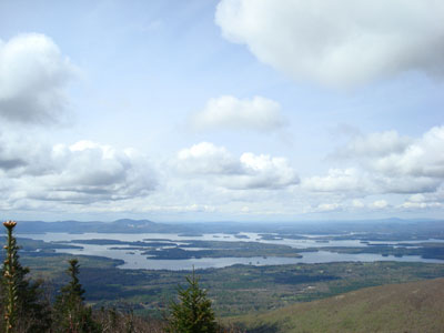
Looking at Lake Winnipesaukee from Black Snoot

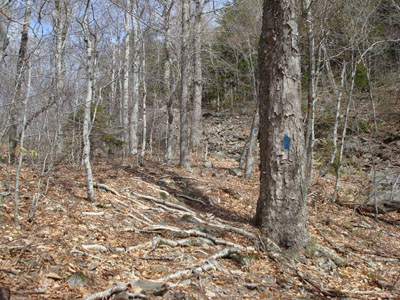
A little bit of snow left on the Black Snout Spur Trail
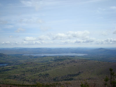
Looking east at Ossipee Lake and Green Mountain from the Mt. Shaw summit
Looking up the Mt. Flagg Trail
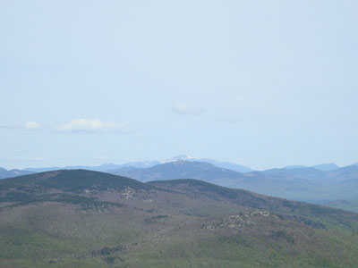
Looking north from Mt. Flagg at Mt. Chocorua and Mt. Washington

Directions to trailhead: Take 171 southeast from Route 25, past Castle in the Clouds. Take a left onto Canaan Road. The Flagg Mountain Trail trailhead is located downhill, beyond the farm house at Camp Merrowvista. Permission should be attained to park there (the camp should be avoided when in session). The Camp is located at the end of Canaan Road. The Big Ball Mountain Trail trailhead is located on McDuffee Road (a left off Canaan Road before the camp). There is some room to park on the left side of McDuffee Road at the bottom of the hill, though it is recommended that hikers park at the McDuffee Road-Canaan Road intersection (please do not block any driveways or logging roads). The unmarked trailhead is also on the left (actually a seldom used dirt road), a few dozen vertical feet up McDuffee Road, across the street from a house.
Back to Big Ball Mountain Profile
Back to Black Snoot Profile
Back to Mt. Shaw Profile
Back to Mt. Flagg Profile
|