Home
States
Colorado
Connecticut
Maine
Massachusetts
New Hampshire
New York
Rhode Island
Utah
Vermont
View All
Lists
NE 4,000 Footers
NE 100 Highest
NH 4,000 Footers
NH 100 Highest
NH 52 With A View
NH Belknap Range
NH Ossipee 10
Links
Trail Conditions
Trip Log
Sunrises
Sunsets
About
|
Boott Spur, Mt. Monroe, Mt. Washington
Pinkham's Grant, NH, Sargent's Purchase, NH
Trailheads, measurements, times, distances, and maps are all approximate and relative to the hike(s) as shown below.
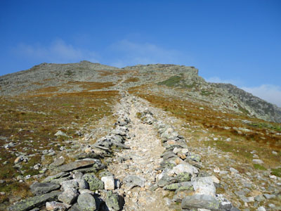
Looking down the Boott Spur Trail
Route: Tuckerman Ravine Trail, Boott Spur Trail, rockhop, (Boott Spur), rockhop, Boott Spur Trail, Davis Path, Camel Trail, Crawford Path, Monroe Loop, (Mt. Monroe), Monroe Loop, Crawford Path, (Mt. Washington), Crawford Path, Southside Trail, Tuckerman Crossover, Tuckerman Ravine Trail
With a very hot day forecasted, I tried to get an early start to beat the heat. Starting on the rocky Tuckerman Ravine Trail, I soon took a left onto the Boott Spur Trail. The trail was generally not that tough (in comparison to other trails on this side), though the footing was rocky in places.
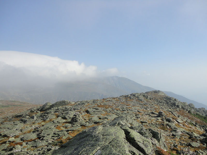
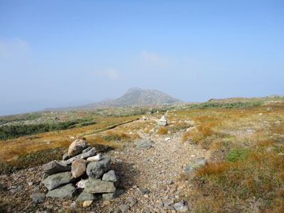
Clearing treeline, the views were hazy but nice. While the temperature was soaring, the wind picked up as I climbed. Reaching the summit of Boott Spur, there were some views, though the fog and the haze minimized them.
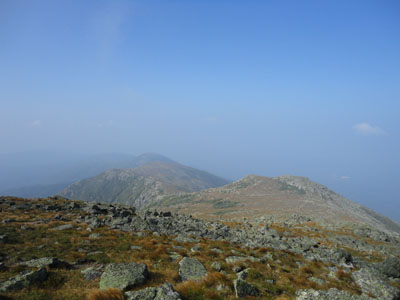
After taking the Davis Path for a bit, I turned onto the Camel Trail and worked my way down do the Lakes of the Clouds hut. Arriving on Mt. Monroe, I had hazy views of the Southern Presidentials, while Mt. Washington was still in the fog to the north.
Heading up to Washington, I soon entered the fog. By the time I reached the summit, temperatures felt like the 50s with the wind and moisture - quite a contrast to the 90 degree weather in the valleys.
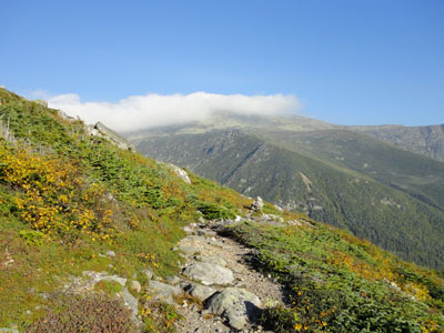
After some lunch at the cafeteria (very limited menu this year), I turned around and headed back down the Crawford Path, as to avoid the overly rocky upper Tuckerman Ravine Trail. Crossing over to the top of the ravine, I headed down the Tuckerman Ravine Trail (which was surrounded in wildflowers in the ravine proper) and back to the hot weather below.
| Hike Ratings |
|
Getting To Trailhead: |
Easy |
| Destination: |
Boott Spur |
|
Length: |
Moderate |
|
Steepness: |
Very Difficult |
|
Navigation: |
Easy |
|
Views: |
Excellent |
|
Crowds: |
Minimal |
| Destination: |
Mt. Monroe |
|
Length: |
Moderate |
|
Steepness: |
Difficult |
|
Navigation: |
Moderate |
|
Views: |
Excellent |
|
Crowds: |
Moderate |
| Destination: |
Mt. Washington |
|
Length: |
Difficult |
|
Steepness: |
Difficult |
|
Navigation: |
Moderate |
|
Views: |
Minimal (due to weather) |
|
Crowds: |
Heavy |
|
| Hike Stats |
|
Date Hiked: |
Wednesday, September 1, 2010 |
| Hike Commenced: |
6:36 AM |
| Parking Elevation: |
2,025' |
| Destination: |
Boott Spur |
| Ascent Commenced: |
6:37 AM |
| Summit Reached: |
8:41 AM |
| Time Elapsed: |
02:04 |
| Trailhead Elevation: |
2,032' |
| Summit Elevation: |
5,500' |
| Distance: |
3.3 miles |
| Vertical Gain: |
3,568' |
| Destination: |
Mt. Monroe |
| Ascent Commenced: |
8:45 AM |
| Summit Reached: |
9:47 AM |
| Time Elapsed: |
01:02 |
| Trailhead Elevation: |
5,500' |
| Summit Elevation: |
5,372' |
| Vertical Gain: |
502' |
| Destination: |
Mt. Washington |
| Ascent Commenced: |
10:04 AM |
| Summit Reached: |
11:03 AM |
| Time Elapsed: |
00:59 |
| Trailhead Elevation: |
5,372' |
| Summit Elevation: |
6,288' |
| Vertical Gain: |
1,301' |
|
|
| Hike Ended: |
2:05 PM |
| Hike Time Elapsed: |
07:29 |
| Hike Vertical Gain: |
5,448' |
|
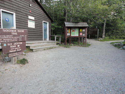
The Tuckerman Ravine Trail trailhead
Looking up the Boott Spur Trail

Looking across Tuckerman Ravine from Boott Spur
The Camel Trail on the way to Mt. Monroe
Looking at the Southern Presidentials from Mt. Monroe

The Crawford Path on the way to Mt. Washington

Fog as seen from Mt. Washington
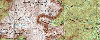

Directions to trailhead: Take Route 16 North from Jackson to Pinkham Notch. The Pinkham Notch Visitor Center, parking lots, and Tuckerman Ravine Trail trailhead are on the left, shortly before Wildcat Ski Area.
Back to Boott Spur Profile
Back to Mt. Monroe Profile
Back to Mt. Washington Profile
|