Home
States
Colorado
Connecticut
Maine
Massachusetts
New Hampshire
New York
Rhode Island
Utah
Vermont
View All
Lists
NE 4,000 Footers
NE 100 Highest
NH 4,000 Footers
NH 100 Highest
NH 52 With A View
NH Belknap Range
NH Ossipee 10
Links
Trail Conditions
Trip Log
Sunrises
Sunsets
About
|
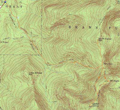
Carter Dome, Mt. Hight, South Carter Mountain
Green's Grant, NH, Bean's Purchase, NH
Trailheads, measurements, times, distances, and maps are all approximate and relative to the hike(s) as shown below.
Looking up the Carter Dome Trail
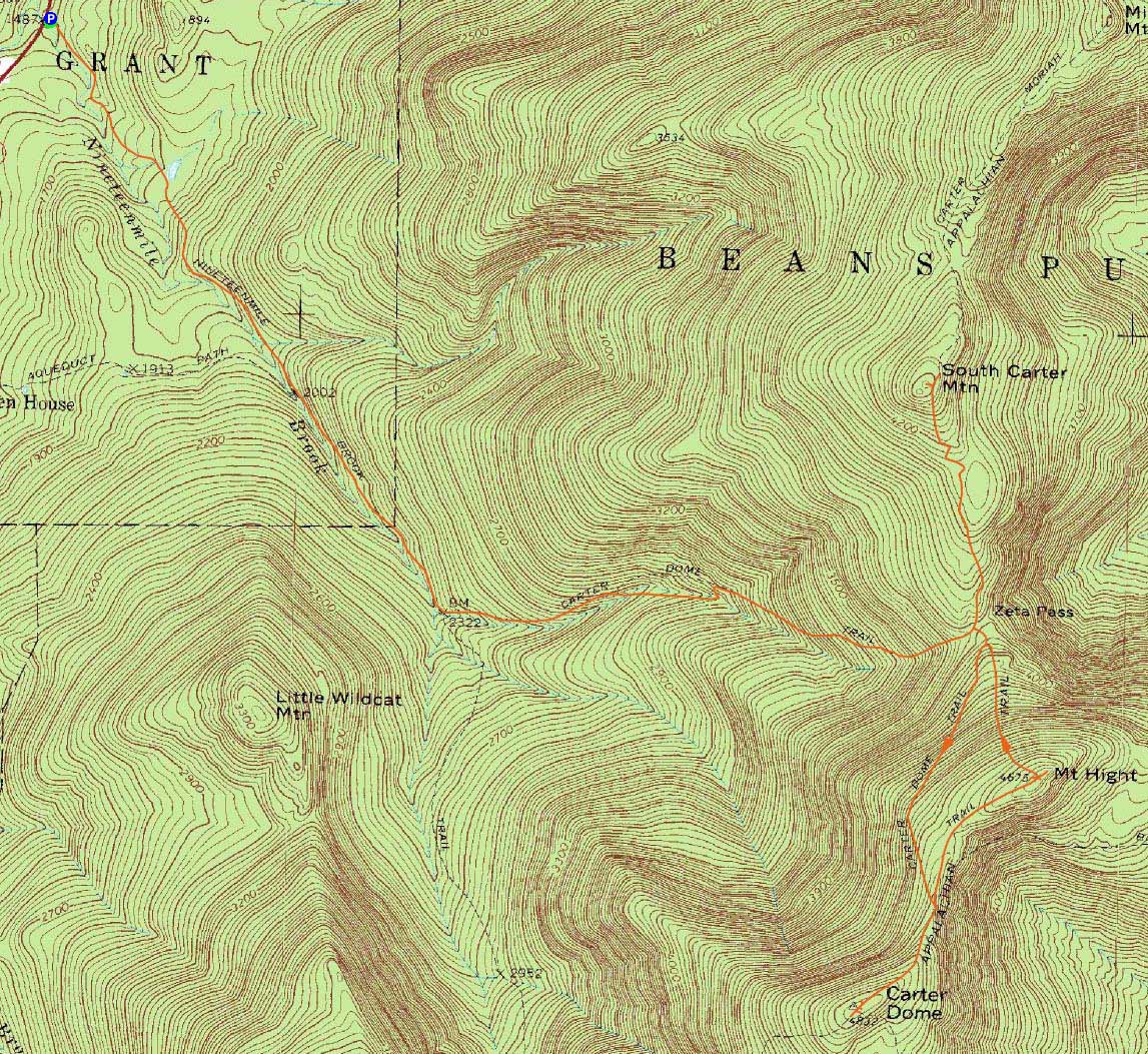
Route: Nineteen Mile Trail, Carter Dome Trail, (Carter Dome), Carter Dome Trail, Carter-Moriah Trail, (Mt. Hight), Carter-Moriah Trail, (South Carter Mountain), Carter-Moriah Trail, Carter Dome Trail, Nineteen Mile Trail
Fresh off two days of rain, I headed up to Pinkham Notch to hike two Carters.
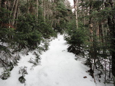
The Nineteen Mile Brook Trail was snow free, however as I headed up the Carter Dome Trail, I eventually reached 1-2" by the time I reached Zeta Pass.
Reaching the summit of Carter Dome, there was an excellent undercast under the Presidentials, just barely creeping through Zeta Pass. With such nice scenery, I had to head over to Mt. Hight for more views.
Reaching the summit of Mt. Hight, the undercast continued around the Presidentials, while to the east it was a cloudy day.
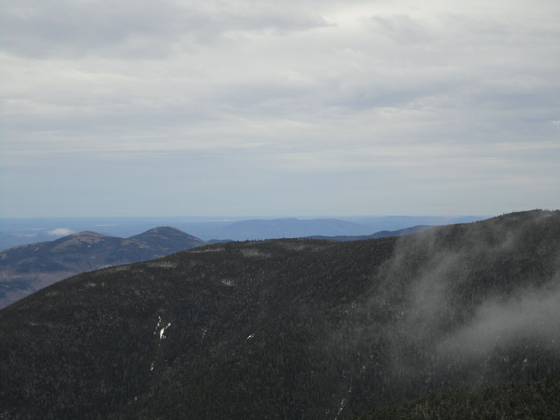
After dropping steeply down the icy trail off Hight, I headed through Zeta Pass and up to South Carter, where I had decent views to the southeast from the near-summit obscure viewpoint.
While it had been quiet most of the day, the crowds were working their way up by the time I descended.
| Hike Ratings |
|
Getting To Trailhead: |
Easy |
| Destination: |
Carter Dome |
|
Length: |
Moderate |
|
Steepness: |
Moderate |
|
Navigation: |
Easy |
|
Views: |
Excellent |
|
Crowds: |
Minimal |
| Destination: |
Mt. Hight |
|
Length: |
Moderate |
|
Steepness: |
Moderate |
|
Navigation: |
Easy |
|
Views: |
Excellent |
|
Crowds: |
Minimal |
| Destination: |
South Carter Mountain |
|
Length: |
Moderate |
|
Steepness: |
Difficult |
|
Navigation: |
Easy |
|
Views: |
Excellent |
|
Crowds: |
Minimal |
|
| Hike Stats |
|
Date Hiked: |
Saturday, November 6, 2010 |
| Hike Commenced: |
8:17 AM |
| Parking Elevation: |
1,485' |
| Destination: |
Carter Dome |
| Ascent Commenced: |
8:17 AM |
| Summit Reached: |
10:27 AM |
| Time Elapsed: |
02:10 |
| Trailhead Elevation: |
1,485' |
| Summit Elevation: |
4,832' |
| Vertical Gain: |
3,392' |
| Destination: |
Mt. Hight |
| Ascent Commenced: |
10:29 AM |
| Summit Reached: |
10:52 AM |
| Time Elapsed: |
00:23 |
| Trailhead Elevation: |
4,832' |
| Summit Elevation: |
4,675' |
| Vertical Gain: |
165' |
| Destination: |
South Carter Mountain |
| Ascent Commenced: |
10:55 AM |
| Summit Reached: |
11:36 PM |
| Time Elapsed: |
00:41 |
| Trailhead Elevation: |
4,675' |
| Summit Elevation: |
4,430' |
| Vertical Gain: |
580' |
|
|
| Hike Ended: |
2:02 PM |
| Hike Time Elapsed: |
05:45 |
| Hike Vertical Gain: |
4,217' |
|
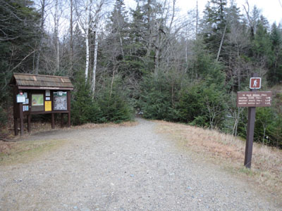
The Nineteen Mile Brook Trail trailhead on Route 16
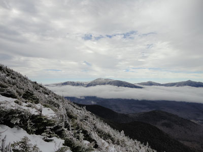
Looking at Mt. Washington from near the Carter Dome summit
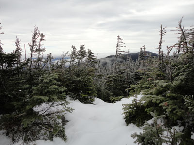
The Carter-Moriah Trail to Mt. Hight
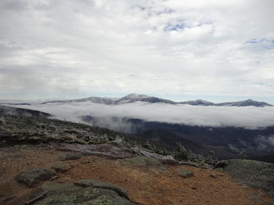
Looking Mt. Washington from the Mt. Hight summit
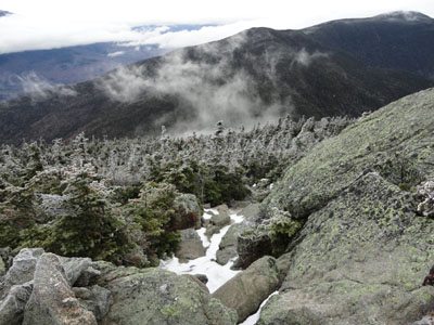
The Carter-Moriah Trail leaving Mt. Hight on the way to South Carter Mountain
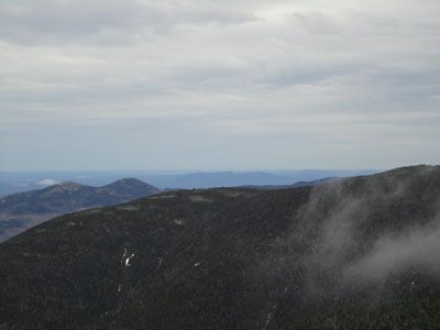
The Baldfaces and Pleasant Mountain as seen from the ledge near the summit of South Carter

Directions to trailhead: Take Route 16 North past the Mt. Washington Auto Road entrance. Shortly thereafter, the Nineteen Mile Brook Trail WMNF fee parking area and trailhead are on the right side of the road, immediately after the brook.
Back to Carter Dome Profile
Back to Mt. Hight Profile
Back to South Carter Mountain Profile
|