Home
States
Colorado
Connecticut
Maine
Massachusetts
New Hampshire
New York
Rhode Island
Utah
Vermont
View All
Lists
NE 4,000 Footers
NE 100 Highest
NH 4,000 Footers
NH 100 Highest
NH 52 With A View
NH Belknap Range
NH Ossipee 10
Links
Trail Conditions
Trip Log
Sunrises
Sunsets
About
|
East Doublehead Mountain, West Doublehead Mountain
Sandwich, NH
Trailheads, measurements, times, distances, and maps are all approximate and relative to the hike(s) as shown below.
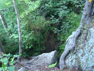
Looking down the scramble on the Crawford Ridgepole Trail on the way to East Doublehead
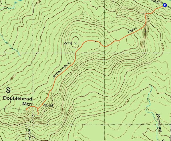
Route: Crawford Ridgepole Trail, (East Doublehead Mountain), Crawford Ridgepole Trail, (West Doublehead Mountain), Crawford Ridgepole Trail, Doublehead Trail, Crawford Ridgepole Trail, (East Doublehead Mountain), Crawford Ridgepole Trail
The forecast looked terrible, but I spent the entire day looking at partly to mostly sunny skies. So much for mostly cloudy with thunderstorms!
Still believing the weather forecast, I decided to stay local, rather than head up north. It was finally time to try the Doubleheads in the Squam Range.
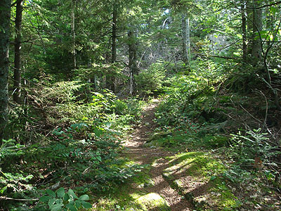
The Crawford Ridgepole Trail trailhead on Sandwich Notch Road basically has a sign and room for two vehicles to park. The trail starts with a moderate pitch almost instantly, steepening up for a short rock scramble (rather than climb up the narrow crevice, I found it much easier to climb up to the right of it), then going back to a constant moderate pitch.
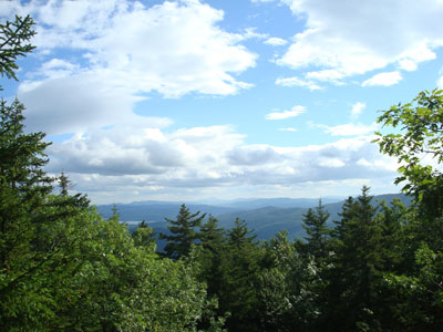
Soon, the trail reached the top of the ridge, and then lollygagged around for some time, before arriving at the East Doublehead summit (I kept thinking I was at the summit, only to realize there was a higher point in front of me...the highpoint is just before a dip that goes immediately to the Doublehead Trail junction). While there were some views toward Waterville near the summit, as well as some peaks toward the Sandwich Dome before it, the summit area was nothing like the scenic ledge views of Mt. Percival.
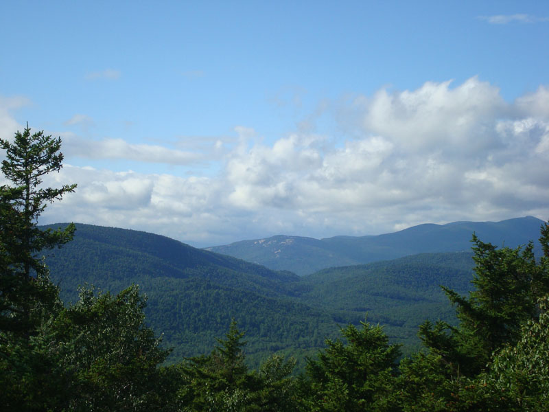
My next stop was West Doublehead, which was a fairly short hike from the east peak. The views toward the Waterville area were stronger than on East Doublehead, but again nothing to write home about as compared to other peaks on the Squam Range.
On my way back, I headed down the Doublehead Trail a bit to check out another viewpoint near East Doublehead. From the trail, I had decent views toward Kearsarge Mountain (but come to find out, I was perhaps 100 yards from some excellent view ledges...oh well).
All in all, not a bad hike - I was certainly glad to be out under some unexpected blue skies!
| Hike Ratings |
|
Getting To Trailhead: |
Easy |
| Destination: |
East Doublehead Mountain |
|
Length: |
Moderate |
|
Steepness: |
Very Difficult |
|
Navigation: |
Easy |
|
Views: |
Excellent |
|
Crowds: |
Minimal |
| Destination: |
West Doublehead Mountain |
|
Length: |
Moderate |
|
Steepness: |
Moderate |
|
Navigation: |
Easy |
|
Views: |
Excellent |
|
Crowds: |
Minimal |
|
| Hike Stats |
|
Date Hiked: |
Monday, August 4, 2008 |
| Hike Commenced: |
3:43 PM |
| Parking Elevation: |
815' |
| Destination: |
East Doublehead Mountain |
| Ascent Commenced: |
3:43 PM |
| Summit Reached: |
4:41 PM |
| Time Elapsed: |
00:58 |
| Trailhead Elevation: |
1,220' |
| Summit Elevation: |
2,158' |
| Distance: |
2.0 miles |
| Vertical Gain: |
1,138' |
| Destination: |
West Doublehead Mountain |
| Ascent Commenced: |
4:41 PM |
| Summit Reached: |
4:47 PM |
| Time Elapsed: |
00:06 |
| Trailhead Elevation: |
2,158' |
| Summit Elevation: |
2,130' |
| Distance: |
.2 mile |
| Vertical Gain: |
70' |
|
|
| Hike Ended: |
6:01 PM |
| Hike Time Elapsed: |
02:18 |
| Hike Vertical Gain: |
1,556' |
|
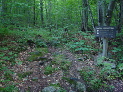
The Crawford Ridgepole Trail trailhead on Sandwich Notch Road
Looking at Kearsarge Mountain from near the East Doublehead Mountain summit
Looking down the Crawford-Ridgepole Trail near West Doublehead Mountain

Looking at Welch Mountain from near the summit of West Doublehead Mountain
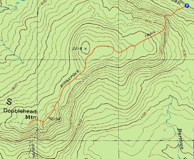

Directions to trailhead: Take Route 109 into Center Sandwich. Route 113 will enter on your right and bear left shortly thereafter. Go straight onto Grove Street instead, then bear left onto Diamond Ledge Road. Sandwich Notch Road will be on the left a few minutes up this road. The Crawford Ridgepole Trail trailhead will be on the left side of the road a few minutes thereafter.
Back to East Doublehead Mountain Profile
Back to West Doublehead Mountain Profile
|