Home
States
Colorado
Connecticut
Maine
Massachusetts
New Hampshire
New York
Rhode Island
Utah
Vermont
View All
Lists
NE 4,000 Footers
NE 100 Highest
NH 4,000 Footers
NH 100 Highest
NH 52 With A View
NH Belknap Range
NH Ossipee 10
Links
Trail Conditions
Trip Log
Sunrises
Sunsets
About
|
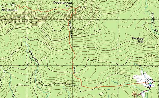
East Doublehead Mountain, West Doublehead Mountain, Mt. Squam
Sandwich, NH
Trailheads, measurements, times, distances, and maps are all approximate and relative to the hike(s) as shown below.
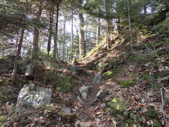
Looking up the Doublehead Trail
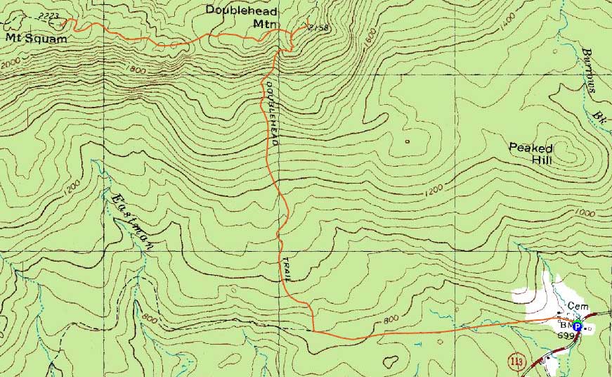
Route: Old Highway, Doublehead Trail, Crawford Ridgepole Trail, (East Doublehead Mountain), Crawford Ridgepole Trail, (West Doublehead Mountain), Crawford Ridgepole Trail, (Mt. Squam), Crawford Ridgepole Trail, (West Doublehead Mountain), Crawford Ridgepole Trail, Doublehead Trail, Old Highway
With subpar weather forecasted up north, I opted to stay local and enjoy a late start.
Starting at the beginning of Thompson Road (Old Highway), I jogged to the Doublehead Trail junction (a logging road junction prior to it was a little confusion, as it looked like a yellow blazed trail could be departing it...alas, the actual trailhead was further up the Old Highway, marked with a sign and yellow blazes).
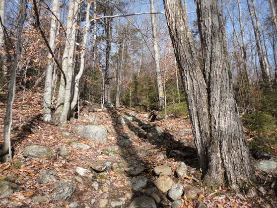
The Doublehead Trail started gradually with good footing, as it headed up a series of old logging roads. Upon reaching the beginning of the climb proper, I switched over to a hiking speed. Continuing up the trail, things became steeper as I approached some ledges.
From the ledges, there were excellent views to the east, south, and west. Not too far above this, I reached the Crawford-Ridgepole Trail, and turned right to head up to East Doublehead. Just beyond the likely highpoint (cairn), there were views to the north of snow-covered peaks in the Waterville area.
After backtracking to the junction, I continued west to West Doublehead, pausing at the northern viewpoint just prior to the summit (cairn).
Beyond West Doublehead, the trail dropped into a wet col, then scrambled steeply back up. Awhile later, the trail reached a really nice set of ledges (staying on the side of them - the views from the ledges proper were excellent), then climbed steeply again (some ice and light snow), then eventually approached the ledgy summit of Mt. Squam (cairn at the top of a ledge). From the highpoint, there were decent views to the east, south, and west. While it was tempting to continue west, I opted to turn back and make my way back to the trailhead, jogging the lower logging road and roadwalk portions again.
| Hike Ratings |
|
Getting To Trailhead: |
Easy |
| Destination: |
East Doublehead Mountain |
|
Length: |
Moderate |
|
Steepness: |
Difficult |
|
Navigation: |
Easy |
|
Views: |
Excellent |
|
Crowds: |
Minimal |
| Destination: |
West Doublehead Mountain |
|
Length: |
Moderate |
|
Steepness: |
Moderate |
|
Navigation: |
Easy |
|
Views: |
Excellent |
|
Crowds: |
Minimal |
| Destination: |
Mt. Squam |
|
Length: |
Moderate |
|
Steepness: |
Very Difficult |
|
Navigation: |
Easy |
|
Views: |
Excellent |
|
Crowds: |
Minimal |
|
| Hike Stats |
|
Date Hiked: |
Saturday, December 4, 2010 |
| Hike Commenced: |
11:04 AM |
| Parking Elevation: |
720' |
| Destination: |
East Doublehead Mountain |
| Ascent Commenced: |
11:04 AM |
| Summit Reached: |
12:04 PM |
| Time Elapsed: |
01:00 |
| Trailhead Elevation: |
720' |
| Summit Elevation: |
2,158' |
| Distance: |
2.4 miles |
| Vertical Gain: |
1,508' |
| Destination: |
West Doublehead Mountain |
| Ascent Commenced: |
12:06 PM |
| Summit Reached: |
12:13 PM |
| Time Elapsed: |
00:07 |
| Trailhead Elevation: |
2,158' |
| Summit Elevation: |
2,130' |
| Distance: |
.2 mile |
| Vertical Gain: |
70' |
| Destination: |
Mt. Squam |
| Ascent Commenced: |
12:15 PM |
| Summit Reached: |
12:46 PM |
| Time Elapsed: |
00:31 |
| Trailhead Elevation: |
2,130' |
| Summit Elevation: |
2,223' |
| Distance: |
.9 mile |
| Vertical Gain: |
403' |
|
|
| Hike Ended: |
2:28 PM |
| Hike Time Elapsed: |
03:24 |
| Hike Vertical Gain: |
2,431' |
|
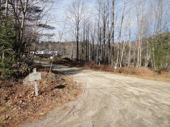
The beginning of the Old Highway roadwalk

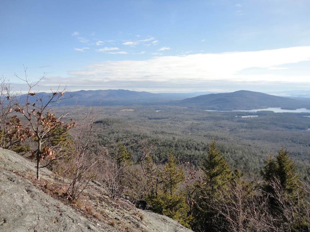
The Ossipees and Red Hill as seen from the ledges below East Doublehead along the Doublehead Trail
The Crawford-Ridgepole Trail on the way to West Doublehead Mountain
Looking north from West Doublehead Mountain

The Crawford-Ridgepole Trail on the way to Mt. Squam

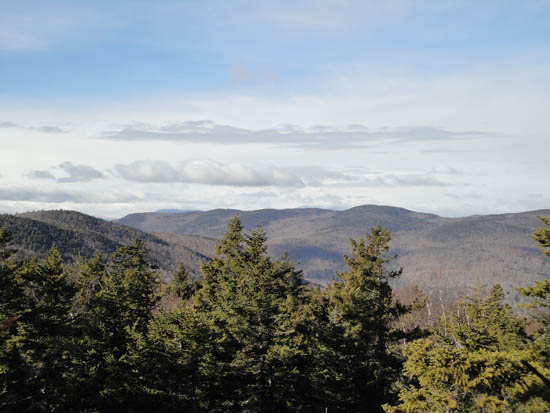
Looking at the Ossipees from Mt. Squam

Directions to trailhead: Take Route 113 West from Center Sandwich. Thompson Road will eventually be on the right. There a small dirt parking area located on the side of Route 113. The Old Highway starts as a roadwalk up Thompson Road
Back to East Doublehead Mountain Profile
Back to West Doublehead Mountain Profile
Back to Mt. Squam Profile
|