Home
States
Colorado
Connecticut
Maine
Massachusetts
New Hampshire
New York
Rhode Island
Utah
Vermont
View All
Lists
NE 4,000 Footers
NE 100 Highest
NH 4,000 Footers
NH 100 Highest
NH 52 With A View
NH Belknap Range
NH Ossipee 10
Links
Trail Conditions
Trip Log
Sunrises
Sunsets
About
|
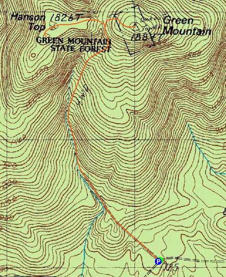
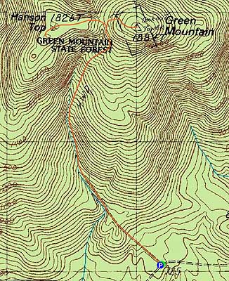
Green Mountain, Hanson Top
Effingham, NH
Trailheads, measurements, times, distances, and maps are all approximate and relative to the hike(s) as shown below.
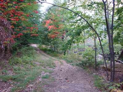
The Libby Trail, adjacent to the 2008 tornado damage
Route: Libby Trail, (Green Mountain), Libby Trail, spur trail, (Hanson Top), spur trail, Libby Trail
With a cloudy day and some warmer, humid weather, I decided to stay local and check out the previous year's tornado damage on the Libby Trail of Green Mountain.
Essentially a road walk, I found portions of it challenging, due to the dry weather - loose gravel and rocks. The tornado damage, limited to the area alongside the brook, was quite striking - and colorful with the fall foliage.
Avoiding the false early left turn (fourwheeler trail), I stayed on the old Jeep road all the way to the fire warden's cabin.
The views from the fire tower, though hazy, were nonetheless decent - rays of sun breaking through the clouds to the west were particularly striking.
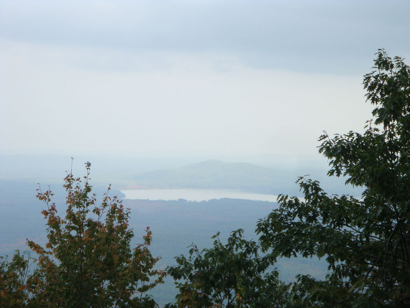
On the way down, I decided to check out the trail to Hanson Top. Though the sign was knocked down, I was able to see roughly where it departed the Libby Trail, in sort of a col. The path was not overly obvious, due to blowdowns and varying types of trail markings. After reaching the summit area, I cotinued along the path to the viewpoint - though hazy, it presented nice views of the Province Lake area and beyond.
Though it is my least favorite trail up Green Mountain, it was still nice to get out and hike the Libby Trail again.
| Hike Ratings |
|
Getting To Trailhead: |
Easy |
| Destination: |
Green Mountain |
|
Length: |
Moderate |
|
Steepness: |
Moderate |
|
Navigation: |
Moderate |
|
Views: |
Excellent |
|
Crowds: |
Minimal |
| Destination: |
Hanson Top |
|
Length: |
Moderate |
|
Steepness: |
Moderate |
|
Navigation: |
Moderate |
|
Views: |
Excellent |
|
Crowds: |
Minimal |
|
| Hike Stats |
|
Date Hiked: |
Wednesday, September 23, 2009 |
| Hike Commenced: |
3:33 PM |
| Parking Elevation: |
725' |
| Destination: |
Green Mountain |
| Ascent Commenced: |
3:33 PM |
| Summit Reached: |
4:14 PM |
| Time Elapsed: |
00:41 |
| Trailhead Elevation: |
725' |
| Summit Elevation: |
1,907' |
| Distance: |
1.5 miles |
| Vertical Gain: |
1,192' |
| Destination: |
Hanson Top |
| Ascent Commenced: |
4:19 PM |
| Summit Reached: |
4:33 PM |
| Time Elapsed: |
00:14 |
| Trailhead Elevation: |
1,907' |
| Summit Elevation: |
1,826' |
| Vertical Gain: |
126' |
|
|
| Hike Ended: |
5:20 PM |
| Hike Time Elapsed: |
01:47 |
| Hike Vertical Gain: |
1,388' |
|
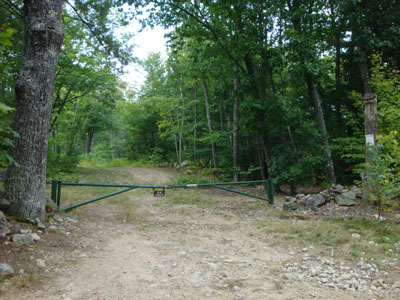
Trailhead on Libby Road
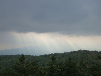
Looking at the Ossipees from the Green Mountain fire tower
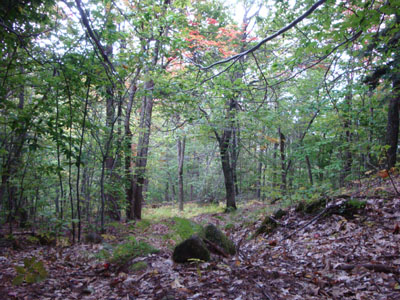
The spur trail to Hanson Top

Looking at Province Lake from near the summit of Hanson Top

Directions to trailhead: Take Green Mountain Road from Route 25. Bear left onto Champion Road. Libby Road will be shortly thereafter on the left (dirt road, small firetower sign). The road is a bit rough (Class IV). Trailhead is at the top of the hill on the left.
Back to Green Mountain Profile
Back to Hanson Top Profile
|