Home
States
Colorado
Connecticut
Maine
Massachusetts
New Hampshire
New York
Rhode Island
Utah
Vermont
View All
Lists
NE 4,000 Footers
NE 100 Highest
NH 4,000 Footers
NH 100 Highest
NH 52 With A View
NH Belknap Range
NH Ossipee 10
Links
Trail Conditions
Trip Log
Sunrises
Sunsets
About
|
Loon Mountain (North Peak), Scar Ridge (West Peak), Scar Ridge (Middle Peak), Scar Ridge (East Peak)
Lincoln, NH, Livermore, NH
Trailheads, measurements, times, distances, and maps are all approximate and relative to the hike(s) as shown below.
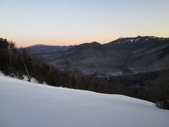
Looking down the ski trails
Started at Loon at 6AM, using ski glades to ascend much of the North Peak area (as grooming was still ongoing). From near the top of the chairlift, we followed skier herd paths to the two potential highpoints of Loon's North Peak (either side of the Sunset trail). We left the ski area boundary prior to the area opening. Bitter cold and windy up top, but fortunately temperatures moderated later.
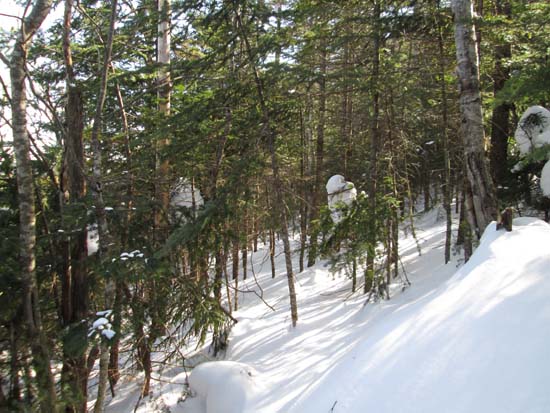
From near the top of the chairlift, we hopped onto the bootleg ski trail (ski area boundary sign) and followed it east. Prior to it heading toward Black Mountain proper, we started the bushwhack to West Scar, taking a weaving course up it to stay in reasonable woods. Snow conditions were subpar, every step was a crap shoot in terms of floating on the snowpack or sinking in a foot or more. Areas of granular, powder, and drifts. Perhaps three feet of snowpack with much deeper drifts.
From the western west peak summit, we continued to the eastern west peak summit (reportedly lower) in scrappy woods (herd path not follow-able in this snowpack).
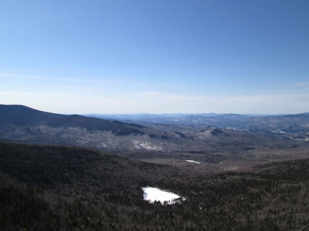
We then dropped toward Middle Scar, favoring north. With the current snowpack and the route we chose, the woods weren't terrible. Relatively smooth sailing from the col to the summit. With nice weather, we went to the cliffs on the south side of the summit (a few hundred feet in distance away) for an early lunch.
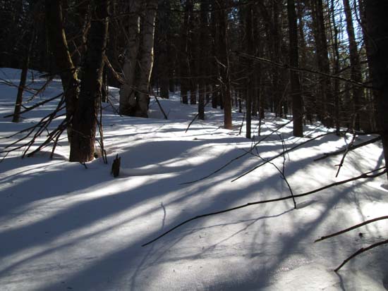
From Middle, we opted to drop directly down to about 3,200 feet, favoring east. Steep going with some thick spots, but once we neared the contour, the woods were scrappy but not super thick. Snow going due to the previously mentioned snow conditions, but it allowed us to avoid the ridge and the peaks along the way, as well as to get some nice views of the higher peaks. Upon arriving under the col before East, we ascended to the ridge and took it up to east in not terrible woods. We then skirted around the west and north side of the blowdown infested summit, remembering lessons learned from searching for the highpoint a few years ago. Very deep drifted snow in places.
From there, we dropped a little south of east in very steep and unsavory woods initially, before finding a steep but open line that dropped us onto the East Pond Trail perhaps around 2,900 feet. The trail had been broken out prior to the recent dusting of snow, and down lower had had a decent amount of skier traffic, so it was pretty smooth sailing down to the parking lot, followed by a brief walk along Route 112 to the Otter Rocks parking lot.
| Hike Ratings |
|
Getting To Trailhead: |
Easy |
| Destination: |
Loon Mountain (North Peak) |
|
Length: |
Moderate |
|
Steepness: |
Difficult |
|
Navigation: |
Moderate |
|
Views: |
Excellent |
|
Crowds: |
Minimal |
| Destination: |
Scar Ridge (West Peak) |
|
Length: |
Moderate |
|
Steepness: |
Moderate |
|
Navigation: |
Very Difficult |
|
Views: |
Minimal |
|
Crowds: |
Minimal |
| Destination: |
Scar Ridge (Middle Peak) |
|
Length: |
Very Difficult |
|
Steepness: |
Difficult |
|
Navigation: |
Very Difficult |
|
Views: |
Excellent |
|
Crowds: |
Minimal |
| Destination: |
Scar Ridge (East Peak) |
|
Length: |
Very Difficult |
|
Steepness: |
Difficult |
|
Navigation: |
Very Difficult |
|
Views: |
Excellent |
|
Crowds: |
Minimal |
|
| Hike Stats |
|
Date Hiked: |
Friday, March 13, 2015 |
| Parking Elevation: |
990' |
| Destination: |
Loon Mountain (North Peak) |
| Time Elapsed: |
01:08 |
| Trailhead Elevation: |
1,000' |
| Summit Elevation: |
3,065' |
| Vertical Gain: |
2,125' |
| Destination: |
Scar Ridge (West Peak) |
| Time Elapsed: |
01:35 |
| Trailhead Elevation: |
3,065' |
| Summit Elevation: |
3,774' |
| Vertical Gain: |
1,074' |
| Destination: |
Scar Ridge (Middle Peak) |
| Time Elapsed: |
01:25 |
| Trailhead Elevation: |
3,774' |
| Summit Elevation: |
3,500' |
| Vertical Gain: |
250' |
| Destination: |
Scar Ridge (East Peak) |
| Time Elapsed: |
02:15 |
| Trailhead Elevation: |
3,500' |
| Summit Elevation: |
3,610' |
| Vertical Gain: |
510' |
|
|
| Hike Time Elapsed: |
9:42 |
| Hike Vertical Gain: |
3,989' |
|
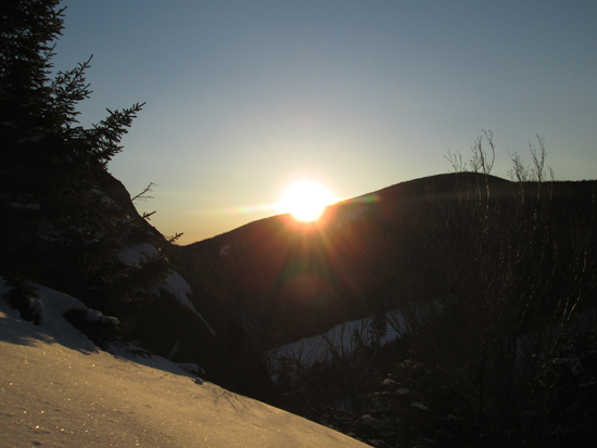
The sunrise from Loon Mountain North Peak
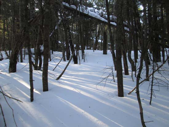
Bushwhacking to Scar Ridge West Peak
Looking at Cannon Mountain from a snow drift near West Scar
Bushwhacking between East West Peak and Middle Peak

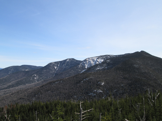
Looking at Little East Pond and beyond from the Scar Ridge Middle Peak ledges
Bushwhacking between Middle and East
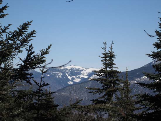
Looking at the Osceolas from near the summit of East Scar
Back to Loon Mountain (North Peak) Profile
Back to Scar Ridge (West Peak) Profile
Back to Scar Ridge (Middle Peak) Profile
Back to Scar Ridge (East Peak) Profile
|