Home
States
Colorado
Connecticut
Maine
Massachusetts
New Hampshire
New York
Rhode Island
Utah
Vermont
View All
Lists
NE 4,000 Footers
NE 100 Highest
NH 4,000 Footers
NH 100 Highest
NH 52 With A View
NH Belknap Range
NH Ossipee 10
Links
Trail Conditions
Trip Log
Sunrises
Sunsets
About
|
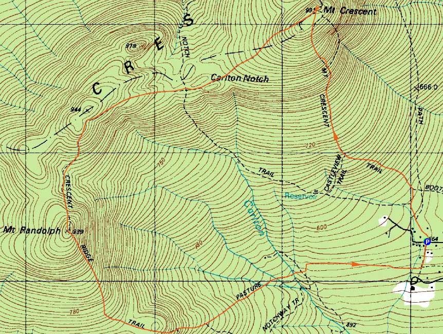
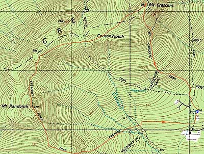
Mt. Crescent, Mt. Randolph
Randolph, NH
Trailheads, measurements, times, distances, and maps are all approximate and relative to the hike(s) as shown below.
Looking up the Mt. Crescent Trail
Route: Mt. Crescent Trail, bushwhack, (Mt. Crescent), bushwhack, Crescent Ridge Trail, bushwhack, Crescent Ridge Trail, (Mt. Randolph), Crescent Ridge Trail, Pasture Path, Grassy Lane
Sort of a last minute decision, I decided to finally check out Mt. Crescent and Mt. Randolph. After wandering around the Randolph area, I finally found a place to park and hike from. At first, the ascent up the Mt. Crescent Trail was easy going with good footing. After every trail junction, however, the trail steepened up a bit - though, other than some short, steep sctions, it never was overly tough.
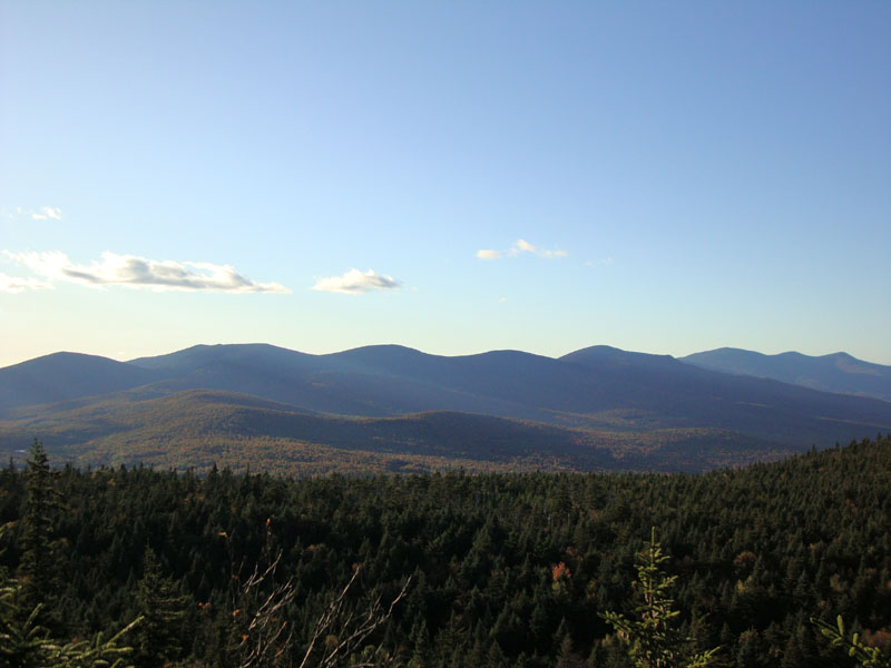
Reaching the southern viewpoint, I had an excellent look at the Presidentials. After a short bushwhack to an apparently highpoint, I continued down the trail to the next junction - then bushwhacked to an apparent highpoint there. Back at the junction, I went to the north view and enjoyed a nice look at the Kilkenny Ridge and beyond.
The Crescent Ridge Trail didn't appear to get much use - nonetheless, it was a nice enough walk between the peaks. The Lafayette viewpoint was nice (and, as far as I could tell, superior to any views on nearby Mt. Randolph) - though it was a butt kicker, as I saw how much further I had to go to get to Randolph (and how little daylight was remaining).
Nearing the summit of Randolph, and using a digital copy of the Maps Adventures map, I bushwhacked off the trail toward a height of land - and popped back onto the trail adjacent to the summit sign. While the Maps Adventures map had displayed the summit of Crescent being on trail (it wasn't), it showed Mt. Randolph being off trail (also apparently not the case). Unless I missed a vista during my brief bushwhack, there was only a limited view from near the summit of Mt. Randolph, about a couple of minutes south on the trail.
Reaching Lookout Ledge after sunset, I had a nice final glimpse at the Northern Presidentials - unfortunately, I never had a glimpse at the western horizon.
Headlamp on, it was a long walk out - numerous stream crossings and mud patches, as well as loud owl calls.
| Hike Ratings |
|
Getting To Trailhead: |
Moderate |
| Destination: |
Mt. Crescent |
|
Length: |
Moderate |
|
Steepness: |
Difficult |
|
Navigation: |
Moderate |
|
Views: |
Excellent |
|
Crowds: |
Minimal |
| Destination: |
Mt. Randolph |
|
Length: |
Moderate |
|
Steepness: |
Difficult |
|
Navigation: |
Moderate |
|
Views: |
Moderate |
|
Crowds: |
Minimal |
|
| Hike Stats |
|
Date Hiked: |
Friday, September 25, 2009 |
| Hike Commenced: |
4:38 PM |
| Parking Elevation: |
1,850' |
| Destination: |
Mt. Crescent |
| Ascent Commenced: |
4:38 PM |
| Summit Reached: |
5:28 PM |
| Time Elapsed: |
00:50 |
| Trailhead Elevation: |
1,850' |
| Summit Elevation: |
3,251' |
| Vertical Gain: |
1,441' |
| Destination: |
Mt. Randolph |
| Ascent Commenced: |
5:33 PM |
| Summit Reached: |
6:25 PM |
| Time Elapsed: |
00:52 |
| Trailhead Elevation: |
3,251' |
| Summit Elevation: |
3,081' |
| Vertical Gain: |
581' |
|
|
| Hike Ended: |
7:32 PM |
| Hike Time Elapsed: |
02:54 |
| Hike Vertical Gain: |
2,132' |
|
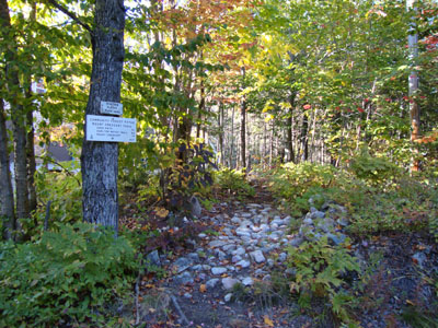
Mt. Crescent Trail trailhead on Randolph Hill Road
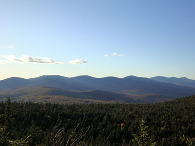
Looking at Pliny, the Waumbeks, the Weeks, Cabot, Bulge, and Horn from near the summit of Mt. Crescent
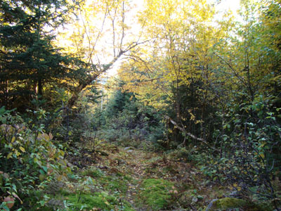
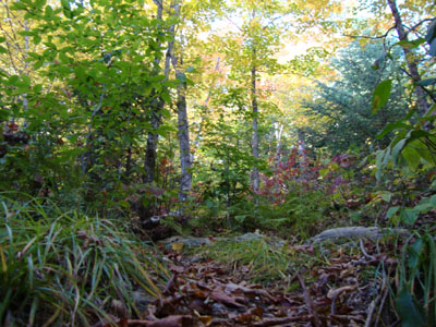
The Crescent Ridge Trail near Carlton Notch

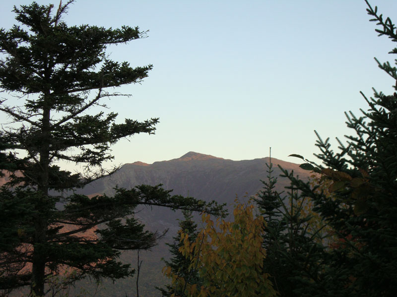
Mt. Adams as seen from near the summit of Mt. Randolph
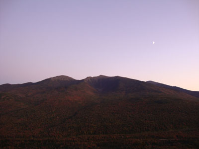
The Northern Presidentials after sunset as seen from Lookout Ledge

Directions to trailhead: Take US 2 West from Gorham to the height of land. Take a right onto Randolph Hill Road. Head up the road and around the corner. The Mt. Crescent Trail trailhead will eventually be on the right, across from Grassy Lane. There is a small parking area (2-3 cars) adjacent to the trailhead.
Back to Mt. Crescent Profile
Back to Mt. Randolph Profile
|