Home
States
Colorado
Connecticut
Maine
Massachusetts
New Hampshire
New York
Rhode Island
Utah
Vermont
View All
Lists
NE 4,000 Footers
NE 100 Highest
NH 4,000 Footers
NH 100 Highest
NH 52 With A View
NH Belknap Range
NH Ossipee 10
Links
Trail Conditions
Trip Log
Sunrises
Sunsets
About
|
Mt. Huntington, Mt. Huntington (South Peak)
Lincoln, NH, Livermore, NH
Trailheads, measurements, times, distances, and maps are all approximate and relative to the hike(s) as shown below.
Looking up the Hancock Notch Trail
Route: Hancock Notch Trail, bushwhack, (Mt. Huntington), bushwhack, (South Huntington), bushwhack, Hancock Notch Trail
Hancock Notch Trail from the highway to the Cedar Brook Trail junction (ie the portion you hike when doing the Hancocks) was well packed for bareboot traffic. Occasional open mudpit areas. I snowshoed on the way in, but opted to boot on the way out.
Beyond the junction, it appears there had been some traffic at some point this month, but snowshoes were a must, especially as the snow softened later in the day. Snow depths of probably 1-2 feet.
Just prior to reaching the height of land, we descended from the trail in open woods, then ascended Huntington, initially in okay woods, but then in some rubbish (worsened by the morning rain that lasted a lot longer than the forecast had suggested yesterday). We stayed west of the talus slope, but eventually hooked around it and to the summit. Snowpack generally ranging 1-2 feet. Much easier a few Aprils ago in deep snowpack.
Heading to south, we went north a little bit to skirt some cliffy steeps, but ended up in thicker spruce. On the return trip, we went directly up the steeps to stay out of the wet, thick junk. Eventually, though, there is a nice stand of mature trees in the col, which was welcome in the Chappaquiddick bushwhacking conditions. A little thicker nearing the summit of South Huntington (again, much easier in deeper snowpack).
Above maybe 3,200 feet, the snowpack was generally firm enough to allow snowshoe flotation. As the day progressed, the snowpack below that was softening into a spring snow.
| Hike Ratings |
|
Getting To Trailhead: |
Easy |
| Destination: |
Mt. Huntington |
|
Length: |
Moderate |
|
Steepness: |
Very Difficult |
|
Navigation: |
Difficult |
|
Views: |
Moderate |
|
Crowds: |
Minimal |
| Destination: |
Mt. Huntington (South Peak) |
|
Length: |
Moderate |
|
Steepness: |
Moderate |
|
Navigation: |
Difficult |
|
Views: |
Minimal |
|
Crowds: |
Minimal |
|
| Hike Stats |
|
Date Hiked: |
Sunday, December 28, 2014 |
| Parking Elevation: |
2,140' |
| Destination: |
Mt. Huntington |
| Time Elapsed: |
02:27 |
| Trailhead Elevation: |
2,140' |
| Summit Elevation: |
3,700' |
| Vertical Gain: |
1,740' |
| Destination: |
Mt. Huntington (South Peak) |
| Time Elapsed: |
00:38 |
| Trailhead Elevation: |
3,700' |
| Summit Elevation: |
3,700' |
| Vertical Gain: |
200' |
|
|
| Hike Time Elapsed: |
05:49 |
| Hike Vertical Gain: |
2,320' |
|
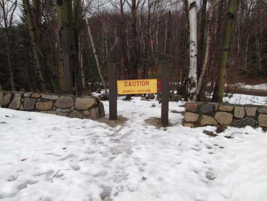
The Hancock Notch Trail trailhead

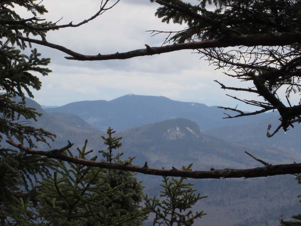
The Moats as seen from near the summit of Mt. Huntington
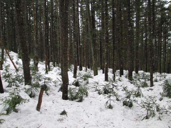
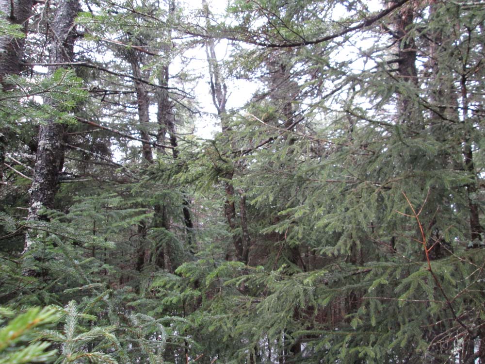
An area of open woods between the peaks
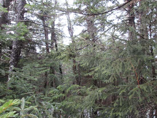
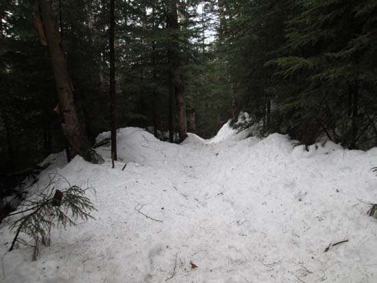
A lack of views from South Huntington
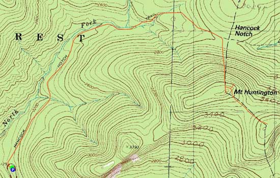

Directions to trailhead: Take Route 112 west from Route 16. After going over the pass, continue down hill a bit. The Hancock WMNF fee parking area will be on the left, just before a hairpin turn.
Back to Mt. Huntington Profile
Back to Mt. Huntington (South Peak) Profile
|