Home
States
Colorado
Connecticut
Maine
Massachusetts
New Hampshire
New York
Rhode Island
Utah
Vermont
View All
Lists
NE 4,000 Footers
NE 100 Highest
NH 4,000 Footers
NH 100 Highest
NH 52 With A View
NH Belknap Range
NH Ossipee 10
Links
Trail Conditions
Trip Log
Sunrises
Sunsets
About
|
Mt. Madison, Mt. Adams, Adams 4
Bean's Grant, NH, Chandler's Purchase, NH
Trailheads, measurements, times, distances, and maps are all approximate and relative to the hike(s) as shown below.
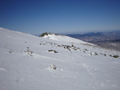
Looking down the Osgood Trail
Route: Valley Way, Osgood Trail, (Mt. Madison), Osgood Trail, Gulfside Trail, Air Line Trail, (Mt. Adams), Lowe's Path, (Adams 4), Lowe's Path, Grey Knob Trail, Hincks Trail, Spur Trail, Randolph Path, Short Line, Air Line
Though I knew the weather couldn't top the epic day I had in the Presidentials a month earlier, the favorable weekend forecast nonetheless drew me back to the northern peaks. While I had initially considered hiking Adams and Madison a day earlier, the wind forecast was a little too high for what I wanted - warm spring weather! Thus, I waited a day.
Arriving at Appalachia, I put on my snowshoes (though they weren't at all necessary) and headed up the Valley Way Trail. Though not as scenic as the Air Line, it nonetheless provided a direct route to the hut. Once at the hut, I took a good ten minutes to get my crampons on, then headed up to Madison. While there had been plenty of snow in between the rocks a month earlier, much of this stretch was bare today. Arriving at the empty summit, I had excellent views with limited winds. After a few photos, I headed back to the hut for some food in the sun.
My next stop was Adams, via the Gulfside and Air Line Trails. This route was basically nonestop frozen granular - it's still winter here! Nonetheless, the temperatures were decent and the winds minimal. The summit sported excellent views once again. Though it was tempting to loiter a bit, I decided to descend via the Lowe's Path and check out some new terrain.
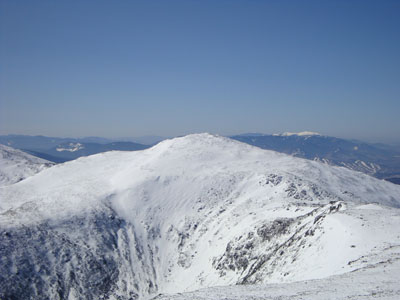
After crossing a vast snowfield, I soon arrived at the small knob known as Adams 4. The knob provided interest views of Jefferson and points well beyond, such as the Franconia Ridge.
Below here, I was very happy to see bare ground! Boy was it a welcome sight to see the alpine growth without any snow - is spring actually on its way?
Once in the trees, I misread a sign and headed up the Grey Knob Trail in search of a viewpoint I thought was .1 miles away. Had I read the sign more carefully, I would have realized the .1 mile referenced the hut, and was next to an arrow pointing in the opposite direction. Nonetheless, it was a scenic section of trail.
Back at that junction, I checked out the Quay, then headed over to the hut. Much smaller than a typical AMC hut, I decided against ducking in and instead continued my descent along the Hincks, then Spur, then Randolph, then Short Line, then Air Line trails. Beautiful weather for exploring new-to-me trails!
While it was a beautiful day, I was not satisfied with only a few hours on the trails. It was time for a bushwhack!
| Hike Ratings |
|
Getting To Trailhead: |
Easy |
| Destination: |
Mt. Madison |
|
Length: |
Moderate |
|
Steepness: |
Difficult |
|
Navigation: |
Moderate |
|
Views: |
Excellent |
|
Crowds: |
Moderate |
| Destination: |
Mt. Adams |
|
Length: |
Moderate |
|
Steepness: |
Difficult |
|
Navigation: |
Moderate |
|
Views: |
Excellent |
|
Crowds: |
Moderate |
| Destination: |
Adams 4 |
|
Length: |
Difficult |
|
Steepness: |
Difficult |
|
Navigation: |
Moderate |
|
Views: |
Excellent |
|
Crowds: |
Moderate |
|
| Hike Stats |
|
Date Hiked: |
Sunday, March 15, 2009 |
| Hike Commenced: |
8:04 AM |
| Parking Elevation: |
1,311' |
| Destination: |
Mt. Madison |
| Ascent Commenced: |
8:04 AM |
| Summit Reached: |
10:17 AM |
| Time Elapsed: |
02:13 |
| Trailhead Elevation: |
1,311' |
| Summit Elevation: |
5,367' |
| Vertical Gain: |
4,186' |
| Destination: |
Mt. Adams |
| Ascent Commenced: |
10:21 AM |
| Summit Reached: |
11:34 AM |
| Time Elapsed: |
01:13 |
| Trailhead Elevation: |
5,367' |
| Summit Elevation: |
5,774' |
| Vertical Gain: |
989' |
| Destination: |
Adams 4 |
| Ascent Commenced: |
11:36 AM |
| Summit Reached: |
11:54 AM |
| Time Elapsed: |
00:18 |
| Trailhead Elevation: |
5,774' |
| Summit Elevation: |
5,344' |
| Vertical Gain: |
50' |
|
|
| Hike Ended: |
2:29 PM |
| Hike Time Elapsed: |
6:25 |
| Hike Vertical Gain: |
5,475' |
|
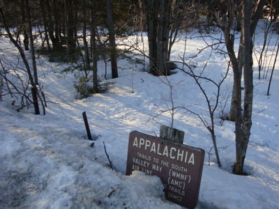
Valley Way Trail trailhead at Appalachia
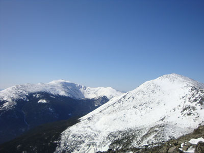
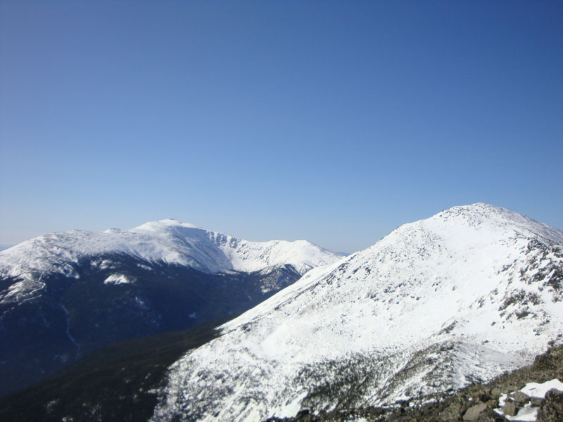
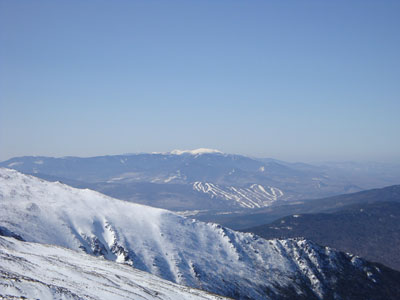
Looking at Mt. Washington and Mt. Adams from Mt. Madison
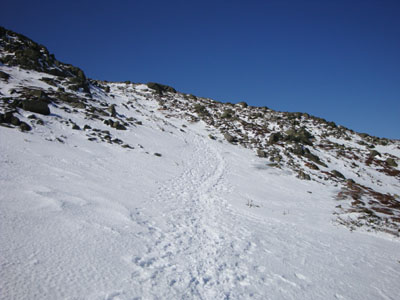
Looking up the the Gulfside Trail on the way to Mt. Adams
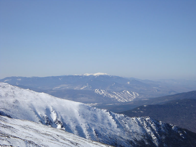
Looking at Mt. Jefferson from Mt. Adams
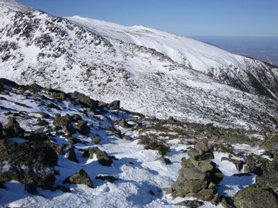
Looking down the Lowe's Path on the way to Adams 4
Looking at the Franconia Ridge from the summit of Adams 4


Directions to trailhead: Take US 2 West from Gorham to the Appalachia parking lot.
Back to Mt. Madison Profile
Back to Mt. Adams Profile
Back to Adams 4 Profile
|