Home
States
Colorado
Connecticut
Maine
Massachusetts
New Hampshire
New York
Rhode Island
Utah
Vermont
View All
Lists
NE 4,000 Footers
NE 100 Highest
NH 4,000 Footers
NH 100 Highest
NH 52 With A View
NH Belknap Range
NH Ossipee 10
Links
Trail Conditions
Trip Log
Sunrises
Sunsets
About
|
Mt. Madison, Mt. Adams, Mt. Jefferson, Mt. Washington, Mt. Monroe
Bean's Grant, NH, Chandler's Purchase, NH
Trailheads, measurements, times, distances, and maps are all approximate and relative to the hike(s) as shown below.
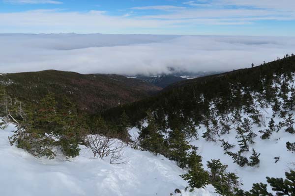
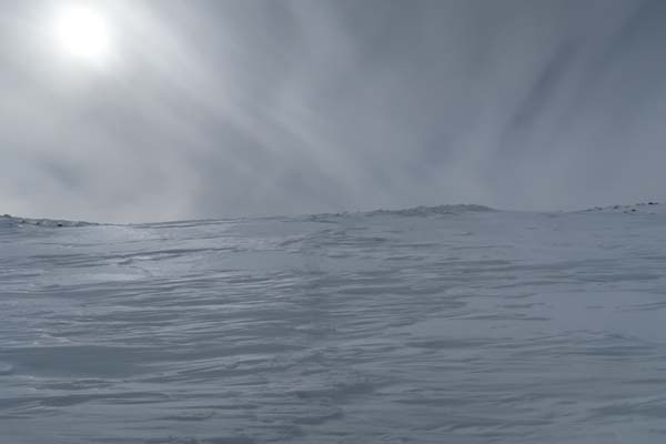
Looking down Valley Way on the way to Mt. Madison
Route: Valley Way, Osgood Trail, (Mt. Madison), Osgood Trail, Gulfside Trail, Air Line Trail, (Mt. Adams), Lowe's Path, Israel Ridge Trail, Gulfside Trail, Jefferson Loop, (Mt. Jefferson), Jefferson Loop, Gulfside Trail, (Mt. Washington), Crawford Path, snowfield, (Mt. Monroe), snowfield, Ammonoosuc Ravine Trail
Snowshoes, snowshoes, snowshoes. With these warm temperatures, one may be able to ascend on seemingly solid trail, but the snowpack softens dramatically as the sun gets higher in the sky (some fresh, very deep postholes observed today). Not only that, but if you're above treeline and things stop going to plan (clouds drop in unexpectedly, winds ramp up, etc.), snowshoes are your only surefire way to get into the trees and out of impending danger.
I wore Tubbs Flex Alps for the entire hike, which gave me really good traction, flotation on snowfields, and was comfortable under foot. We carried crampons and mountaineering axes in case of set up sideslope areas, but the sun softened things up enough that they stayed on our packs.
Valley Way was firm this morning, though it was annoyingly postholed in places. I found snowshoes ideal.
Osgood Trail was ideal for snowshoeing due to the length of the crampon purchase. We were able to stay on snow all the way to the summit. Some had Microspiked and lost purchased and slid.
From the hut to the top of Air Line, we bee lined around scrub and on snow fields, occasionally following Gulfside. There is a sideslope part way up that is a no fall zone.
We continued past the Air Line, then did a zigzag up the snowfields to Adams. Good snowshoeing. We then descended the snowfields to cut the corner, staying just west of Thunderstorm Junction, then contouring the side of Sam Adams to avoid a little lost elevation.
There is a wicked sideslope no fall zone ascending Jefferson from the col, so we threaded the needle on a small snow field partway toward the Cornice trail. Above this ledgy area, we had good going up the snowfield all the way to the summit.
We then beelined off Jefferson, hitting Gulfside at the southern Cornice junction. Good going on snowfields once again, which were a welcome break from dealing with postholes.
The dangerous slideslope snowfield just north of Sphinx Col isn't built up yet, so it's not the no fall zone that it can sometimes be.
The cutoff to the Jewell has been established near one of the first spring junctions. We stayed on the Gulfside until we approached the Cog Tracks, then followed those up toward the top, then beelined to the summit. Good snowshoeing.
Upper Crawford Path is a little bit off course, but okay going. The sideslope no fall zone approaching the hut is in place. If unsure about this section, I recommend ascending toward the Tuckerman Crossover, which avoids it without much additional distance or elevation.
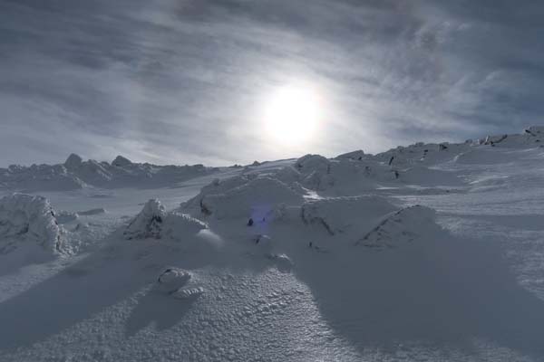
Hut drift is in place, allowing one to sit on the roof.
The popular route to Monroe right now is a direct bee line from the hut up to the ridge, which cuts off the Monroe Loop ascent and is probably safer.
Ammonoosuc Ravine Trail has deviated from the summer route and is currently north of it until approaching the upper summer water crossing. Some sticky snow in places. Steeps are a bit beat up from buttsliders and postholers. Plenty of postholes on the flats too.
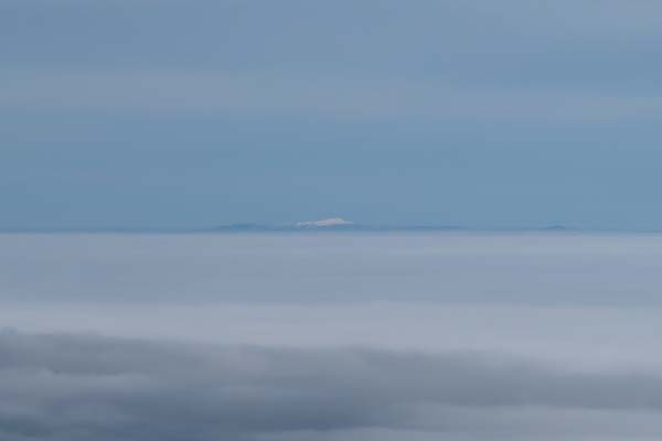
Very nice Presi weather today, starting with an undercast this morning and clearing thereafter. Occasional winds, but warm temperatures.
| Hike Ratings |
|
Getting To Trailhead: |
Easy |
| Destination: |
Mt. Madison |
|
Length: |
Moderate |
|
Steepness: |
Difficult |
|
Navigation: |
Moderate |
|
Views: |
Excellent |
|
Crowds: |
Moderate |
| Destination: |
Mt. Adams |
|
Length: |
Moderate |
|
Steepness: |
Difficult |
|
Navigation: |
Moderate |
|
Views: |
Excellent |
|
Crowds: |
Minimal |
| Destination: |
Mt. Jefferson |
|
Length: |
Difficult |
|
Steepness: |
Very Difficult |
|
Navigation: |
Moderate |
|
Views: |
Excellent |
|
Crowds: |
Minimal |
| Destination: |
Mt. Washington |
|
Length: |
Difficult |
|
Steepness: |
Difficult |
|
Navigation: |
Moderate |
|
Views: |
Excellent |
|
Crowds: |
Moderate |
| Destination: |
Mt. Monroe |
|
Length: |
Difficult |
|
Steepness: |
Difficult |
|
Navigation: |
Moderate |
|
Views: |
Excellent |
|
Crowds: |
Moderate |
|
| Hike Stats |
|
Date Hiked: |
Wednesday, February 22, 2017 |
| Parking Elevation: |
1,311' |
| Destination: |
Mt. Madison |
| Time Elapsed: |
02:41 |
| Trailhead Elevation: |
1,311' |
| Summit Elevation: |
5,367' |
| Vertical Gain: |
4,186' |
| Destination: |
Mt. Adams |
| Time Elapsed: |
00:50 |
| Trailhead Elevation: |
5,367' |
| Summit Elevation: |
5,774' |
| Vertical Gain: |
989' |
| Destination: |
Mt. Jefferson |
| Time Elapsed: |
01:12 |
| Trailhead Elevation: |
5,774' |
| Summit Elevation: |
5,712' |
| Vertical Gain: |
889' |
| Destination: |
Mt. Washington |
| Time Elapsed: |
01:30 |
| Trailhead Elevation: |
5,712' |
| Summit Elevation: |
6,288' |
| Vertical Gain: |
1,498' |
| Destination: |
Mt. Monroe |
| Time Elapsed: |
00:50 |
| Trailhead Elevation: |
6,288' |
| Summit Elevation: |
5,372' |
| Vertical Gain: |
390' |
|
|
| Hike Time Elapsed: |
8:47 |
| Hike Vertical Gain: |
7,952' |
|
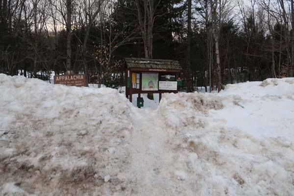
Valley Way Trail trailhead at Appalachia

Looking at Mt. Adams from Mt. Madison
Ascending a snowfield on the way to Mt. Adams
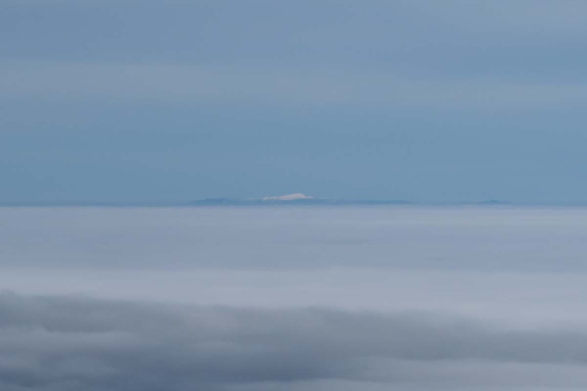
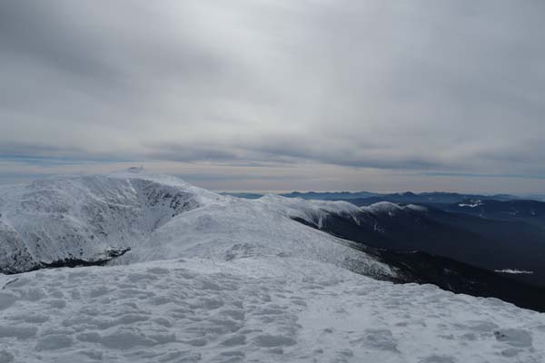
Looking at Mt. Mansfield from Mt. Adams
Ascending a snowfield on Mt. Jefferson
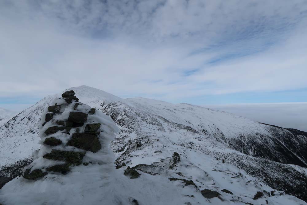
Looking at Mt. Washington from Mt. Jefferson

Looking up the Gulfside Trail on the way to Mt. Washington

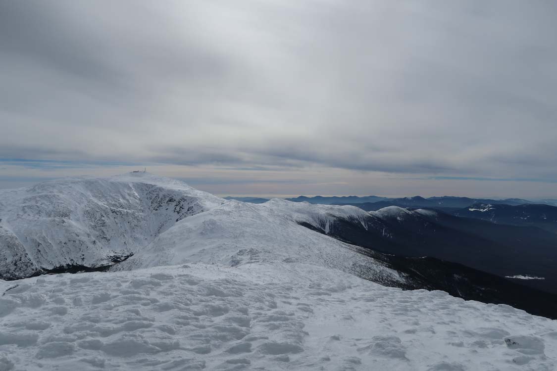
Looking at the Northern Presidentials from Mt. Washington
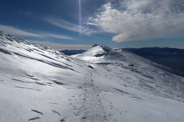
Looking down the Crawford Path on the way to Mt. Monroe
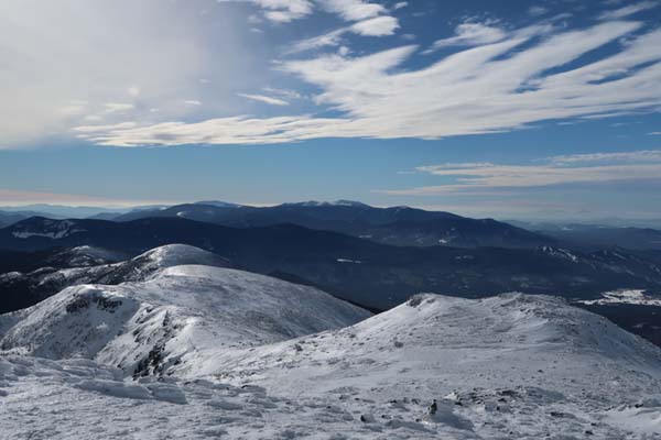
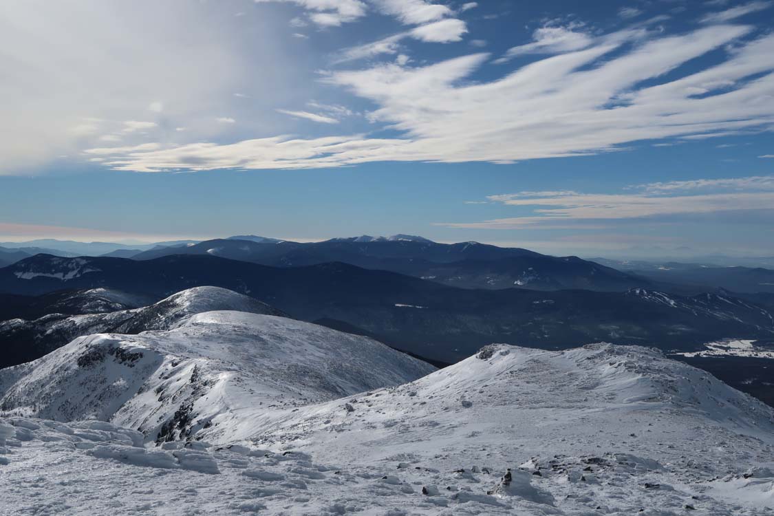
Looking at the Southern Presidentials from Mt. Monroe
Directions to trailhead: To get to the Cog Base Station in winter, take 302 West from Crawford Notch, then take a right onto Base Station Road. In winter 2016-17, there was plowed parking available at the Cog Base Station. To get to Appalachia from there, return to 302, then take US 3 North to 115, then US 2 East to the Appalachia parking lot and trailhead.
Back to Mt. Madison Profile
Back to Mt. Adams Profile
Back to Mt. Jefferson Profile
Back to Mt. Washington Profile
Back to Mt. Monroe Profile
|