Home
States
Colorado
Connecticut
Maine
Massachusetts
New Hampshire
New York
Rhode Island
Utah
Vermont
View All
Lists
NE 4,000 Footers
NE 100 Highest
NH 4,000 Footers
NH 100 Highest
NH 52 With A View
NH Belknap Range
NH Ossipee 10
Links
Trail Conditions
Trip Log
Sunrises
Sunsets
About
|
Mt. Madison, Mt. Adams, Mt. Jefferson, Mt. Washington, Mt. Monroe
Bean's Grant, NH, Chandler's Purchase, NH
Trailheads, measurements, times, distances, and maps are all approximate and relative to the hike(s) as shown below.
Looking up Valley Way on the way to Mt. Madison
Route: Valley Way, Osgood Trail, (Mt. Madison), Osgood Trail, Gulfside Trail, snowfields, (Mt. Adams), Lowe's Path, Israel Ridge Trail, snowfields, Gulfside Trail, snowfields, (Mt. Jefferson), Jefferson Loop, snowfields, Gulfside Trail, snowfields, (Mt. Washington), Crawford Path, snowfield, (Mt. Monroe), snowfield, Ammonoosuc Ravine Trail
Snowshoes the entire day. About as good as it gets right now for coverage above treeline. Look to where you want to go and go!
Valley Way was generally packed out until the Bruins area, then there was drifting and postholing with soft powder. Snow pack is probably about 5 feet deep near the top with blazes around shin level.
Osgood Trail had very good hardpack coverage. Snowshoes were ideal, but spikes were adequate on this stretch too.
Gulfside departing from the hut is hard to follow in the scrub with lots of false tracks (Microspikers finding spruce traps). We opted to ride the snowfields up to Adams with very nice coverage. Avoided, the PUD on Air Line, as well as the steeper rocky section.
Descending off Adams toward Thunderstorm Junction, Microspikers were finding out the hard way that they needed flotation. Lots of nasty postholes (punching through the hardpack crust into the crevasses between the rocks). Once again, mountain snowshoes (not the tubular frame ones) were ideal.
Ascending from Edmands Col, we initially entered the snowfield on Gulfside, but soon cut a hard right to avoid the sidehill. We then had a great long beeline to the summit on hardpack snowfields.
Descending off Jefferson, we once again beelined, pretty much skipping Jefferson Loop. The sideslope north of Sphinx isn't too bad yet. Sphinx trail sign is down. Ascending southbound from the col, the trail was choppy from all of the Microspike use. Ironically, since so many people were Microspiking, no one was able to break out/use the cutover to Jewell, so Microspikers were forced to climb all the way from Sphinx to the entrance of Jewell. There is more than enough snow to do that cutover right, should you have snowshoes and familiarity with the route (saves a nice chunk of vertical).
Ascending Washington proper from the west, there was a hodgepodge of conditions in the snowfields, including some powder drifts, frozen ice bumps, and thick rime.
Descending Washington, we once again took advantage of the snowpack and cut off the top of the Crawford Path, dropping in around the West Side junction. We also skipped the Crawford sideslope (no footbed) by staying a bit uphill.
As is often the case in winter, one can walk right up to the top of the roof of Lakes of the Clouds hut.
From the hut, we pretty much beelined up to Monroe on the snowfield. Coldest/windiest part of the day was on the Monroe ridge.
Descending from the hut, foot traffic has been off trail (too far north). Near the scrub, there was a lot of evidence of Microspikers finding postholing/finding spruce traps. There is a lot of snow. Upon entering the trees, the snowpack is 5 feet up high (one blaze is at the snow line).
Once in the trees, the footbed is awkward from lots of buttsliding. We had a very close call descending one of the steepest parts of the trail, when an out of control buttslider nearly took out my wife at a high speed without warning. Very close call. Needless to say, we were not as cordial we should have been, but had she not jumped off the trail (popping out of her snowshoe binding), there probably would have been broken bones and blood at that rate of speed.
The balance of the Ammo was fairly smooth sailing.
Mountain snowshoes (in our case Tubbs Flex) were ideal, though we did carry traction as a backup; there were a few areas where Microspikes would have been risky. No blue ice bulges encountered. Quite a few sections of snowfield had a "hollow" feel/sound to them, suggesting they may not be as supportive in the forecast warmer temperatures.
Though the weather wasn't quite as good as the prior day forecast suggested, it was nevertheless nice. Summits were in and out of the clouds and fortunately the wind wasn't too bad, though the ravine winds were cold. Not a 100+ mile view day, but still plenty to see. Occasional undercast as well. Lots of folks out. Provided we don't get a nasty rain storm or warm fog event coupled with the warmer forecast temperatures, the snowpack should hopefully hold up for awhile.
| Hike Ratings |
|
Getting To Trailhead: |
Easy |
| Destination: |
Mt. Madison |
|
Length: |
Moderate |
|
Steepness: |
Difficult |
|
Navigation: |
Moderate |
|
Views: |
Excellent |
|
Crowds: |
Moderate |
| Destination: |
Mt. Adams |
|
Length: |
Moderate |
|
Steepness: |
Difficult |
|
Navigation: |
Moderate |
|
Views: |
Excellent |
|
Crowds: |
Moderate |
| Destination: |
Mt. Jefferson |
|
Length: |
Difficult |
|
Steepness: |
Very Difficult |
|
Navigation: |
Moderate |
|
Views: |
Excellent |
|
Crowds: |
Moderate |
| Destination: |
Mt. Washington |
|
Length: |
Difficult |
|
Steepness: |
Difficult |
|
Navigation: |
Moderate |
|
Views: |
Excellent |
|
Crowds: |
Moderate |
| Destination: |
Mt. Monroe |
|
Length: |
Difficult |
|
Steepness: |
Difficult |
|
Navigation: |
Moderate |
|
Views: |
Excellent |
|
Crowds: |
Moderate |
|
| Hike Stats |
|
Date Hiked: |
Sunday, March 7, 2021 |
| Parking Elevation: |
1,311' |
| Destination: |
Mt. Madison |
| Time Elapsed: |
03:14 |
| Trailhead Elevation: |
1,311' |
| Summit Elevation: |
5,367' |
| Vertical Gain: |
4,186' |
| Destination: |
Mt. Adams |
| Time Elapsed: |
01:20 |
| Trailhead Elevation: |
5,367' |
| Summit Elevation: |
5,774' |
| Vertical Gain: |
989' |
| Destination: |
Mt. Jefferson |
| Time Elapsed: |
01:25 |
| Trailhead Elevation: |
5,774' |
| Summit Elevation: |
5,712' |
| Vertical Gain: |
889' |
| Destination: |
Mt. Washington |
| Time Elapsed: |
01:58 |
| Trailhead Elevation: |
5,712' |
| Summit Elevation: |
6,288' |
| Vertical Gain: |
1,498' |
| Destination: |
Mt. Monroe |
| Time Elapsed: |
00:56 |
| Trailhead Elevation: |
6,288' |
| Summit Elevation: |
5,372' |
| Vertical Gain: |
390' |
|
|
| Hike Time Elapsed: |
10:32 |
| Hike Vertical Gain: |
7,952' |
|
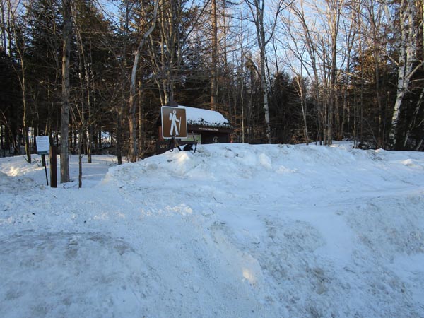
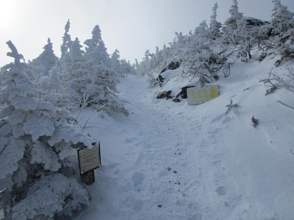
Valley Way Trail trailhead at Appalachia
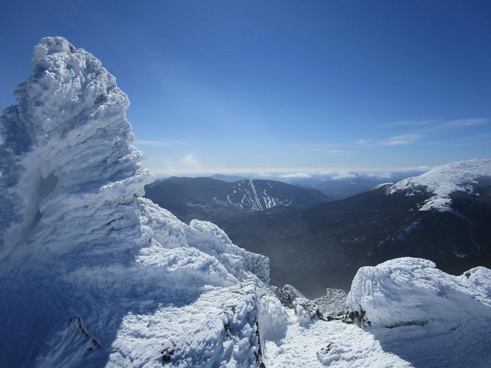
Looking at Wildcat from Mt. Madison
Ascending a snowfield on the way to Mt. Adams

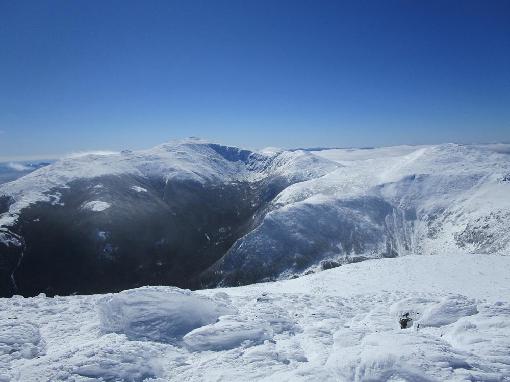
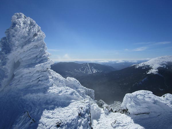
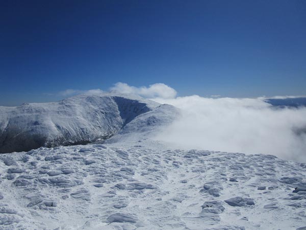
Looking at Mt. Washington and Mt. Jefferson from Mt. Adams
Ascending a snowfield on Mt. Jefferson
Looking at Mt. Washington from Mt. Jefferson

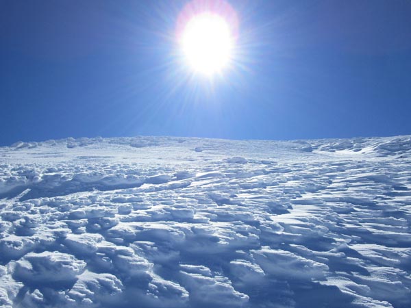
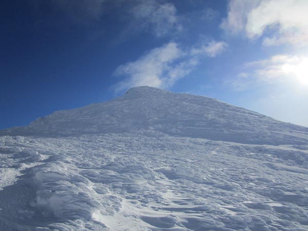
Looking up a snowfield on the way to Mt. Washington

Looking at the Northern Presidentials from Mt. Washington
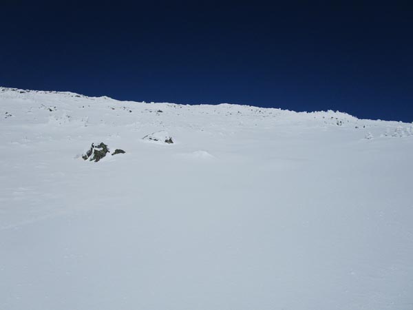
Ascending a snowfield on the way to Mt. Monroe
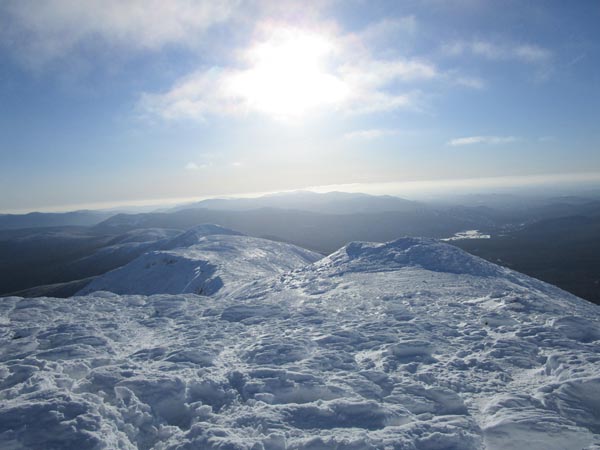
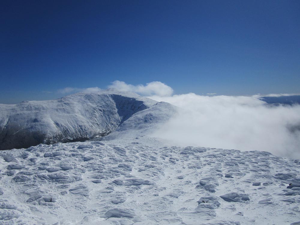
Looking at the Southern Presidentials from Mt. Monroe
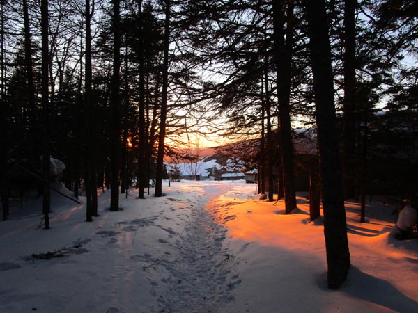
The bottom of the Ammonoosuc Ravine Trail
Directions to trailhead: To get to the Cog Base Station in winter, take 302 West from Crawford Notch, then take a right onto Base Station Road. In winter 2020-21, there was plowed parking/access available at the Cog Base Station for $10 per person. To get to Appalachia from there, return to 302, then take US 3 North to 115, then US 2 East to the Appalachia parking lot and trailhead.
Back to Mt. Madison Profile
Back to Mt. Adams Profile
Back to Mt. Jefferson Profile
Back to Mt. Washington Profile
Back to Mt. Monroe Profile
|