Home
States
Colorado
Connecticut
Maine
Massachusetts
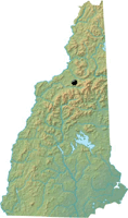
New Hampshire
New York
Rhode Island
Utah
Vermont
View All
Lists
NE 4,000 Footers
NE 100 Highest
NH 4,000 Footers
NH 100 Highest
NH 52 With A View
NH Belknap Range
NH Ossipee 10
Links
Trail Conditions
Trip Log
Sunrises
Sunsets
About
|
Mt. Martha
Carroll, NH
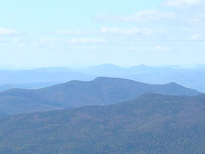
Mt. Martha and Owlshead as seen from Mt. Eisenhower
 Summary Summary
Once home to a fire tower, Mt. Martha (also known as Cherry Mountain) features multiple viewpoints from near its summit. There are also strong views from its northern subpeak, Owlshead.
Summit Elevation
3,573 feet
Summit Facilities
None.
Trip Reports:
Click on the date for photos, timestamps, and maps.
| Date of Hike |
Trail(s) |
Length |
Steepness |
Vertical |
|
| February 3, 2014 |
Cherry Mountain Trail, more |
Moderate |
Moderate |
1,953' |
| December 24, 2013 |
Cherry Mountain Trail, more |
Moderate |
Moderate |
1,953' |
| August 6, 2013 |
Cherry Mountain Trail, more |
Moderate |
Moderate |
1,953' |
| September 28, 2011 |
Cherry Mountain Trail, more |
Moderate |
Moderate |
1,683' |
| May 17, 2010 |
Cherry Mountain Trail, more |
Moderate |
Very Difficult |
2,566' |
| November 19, 2008 |
Cherry Mountain Trail, more |
Moderate |
Moderate |
1,953' |
|
More Information
- NH 52 With-A-View - Hiking list
- Cherry Mountain Tower - Forest Fire Lookout Association
|
