Home
States
Colorado
Connecticut
Maine
Massachusetts
New Hampshire
New York
Rhode Island
Utah
Vermont
View All
Lists
NE 4,000 Footers
NE 100 Highest
NH 4,000 Footers
NH 100 Highest
NH 52 With A View
NH Belknap Range
NH Ossipee 10
Links
Trail Conditions
Trip Log
Sunrises
Sunsets
About
|
Mt. Monroe, Mt. Franklin, Mt. Eisenhower, Mt. Pierce
Chandler's Purchase, NH, Sargent's Purchase, NH, Beans Grant, NH, Harts Location, NH
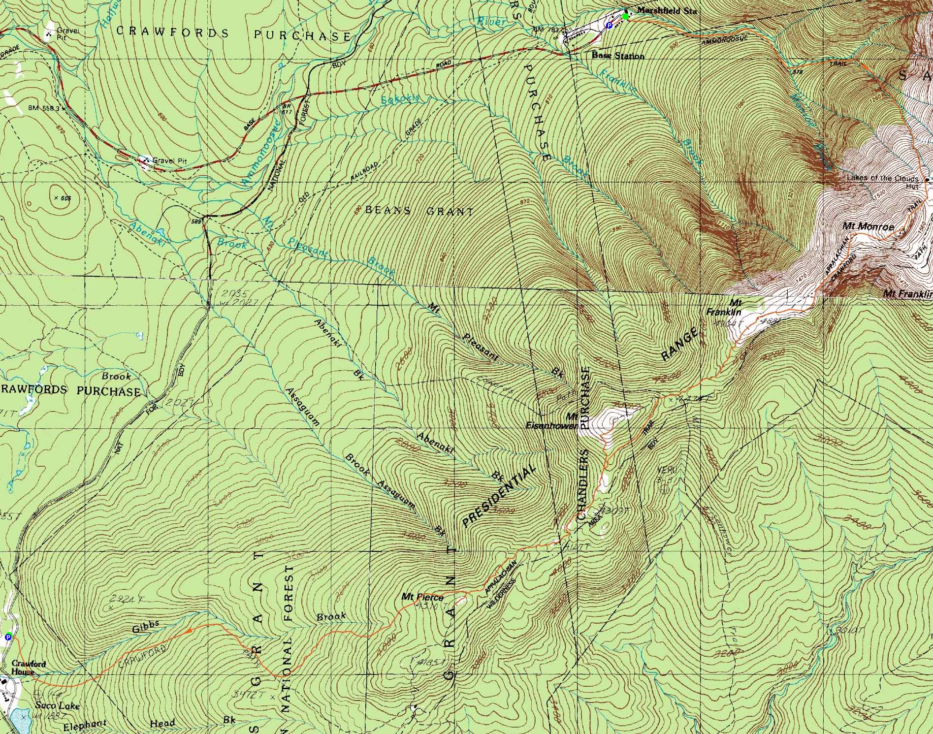
Trailheads, measurements, times, distances, and maps are all approximate and relative to the hike(s) as shown below.
Looking up the Monroe Loop
Route: Unknown trail, Ammonoosuc Ravine Trail, Crawford Path, Mount Monroe Loop, (Mt. Monroe), Mount Monroe Loop, Crawford Path, Franklin Loop, (Mt. Franklin), Franklin Loop, Crawford Path, Eisenhower Loop, (Mt. Eisenhower), Eisenhower Loop, Crawford Path, Webster Cliff Trail, (Mt. Pierce), Webster Cliff Trail, Crawford Path
After a heat wave, cool temperatures returned for the morning ascent. Good conditions and views.
| Hike Ratings |
|
Getting To Trailhead: |
Easy |
| Destination: |
Mt. Monroe |
|
Length: |
Moderate |
|
Steepness: |
Difficult |
|
Navigation: |
Easy |
|
Views: |
Excellent |
|
Crowds: |
Heavy |
| Destination: |
Mt. Franklin |
|
Length: |
Moderate |
|
Steepness: |
Difficult |
|
Navigation: |
Moderate |
|
Views: |
Excellent |
|
Crowds: |
Minimal |
| Destination: |
Mt. Eisenhower |
|
Length: |
Moderate |
|
Steepness: |
Difficult |
|
Navigation: |
Moderate |
|
Views: |
Excellent |
|
Crowds: |
Heavy |
| Destination: |
Mt. Pierce |
|
Length: |
Moderate |
|
Steepness: |
Difficult |
|
Navigation: |
Easy |
|
Views: |
Excellent |
|
Crowds: |
Heavy |
|
| Hike Stats |
|
Date Hiked: |
Sunday, July 24, 2011 |
| Time to Trailhead: |
00:04 |
| Parking Elevation: |
2,650' |
| Destination: |
Mt. Monroe |
| Time Elapsed: |
02:37 |
| Trailhead Elevation: |
2,740' |
| Summit Elevation: |
5,372' |
| Vertical Gain: |
2,732' |
| Destination: |
Mt. Franklin |
| Time Elapsed: |
00:38 |
| Trailhead Elevation: |
5,372' |
| Summit Elevation: |
5,004' |
| Vertical Gain: |
100' |
| Destination: |
Mt. Eisenhower |
| Time Elapsed: |
00:58 |
| Trailhead Elevation: |
5,004' |
| Summit Elevation: |
4,780' |
| Vertical Gain: |
550' |
| Destination: |
Mt. Pierce |
| Time Elapsed: |
00:53 |
| Trailhead Elevation: |
4,780' |
| Summit Elevation: |
4,310' |
| Vertical Gain: |
420' |
|
|
| Hike Time Elapsed: |
07:19 |
| Hike Vertical Gain: |
3,932' |
|
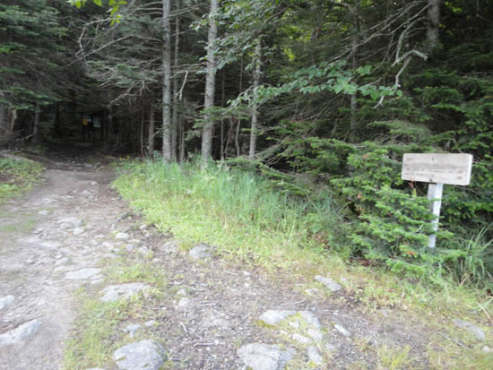
The trailhead for the Ammonoosuc Ravine Trail connector near the Marshfield Base Station
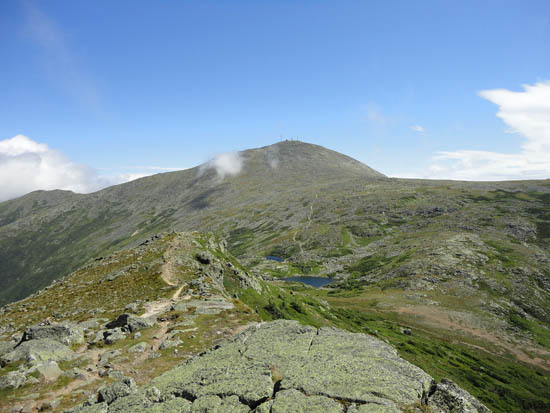
Looking at Mt. Washington from Mt. Monroe
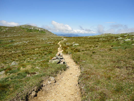
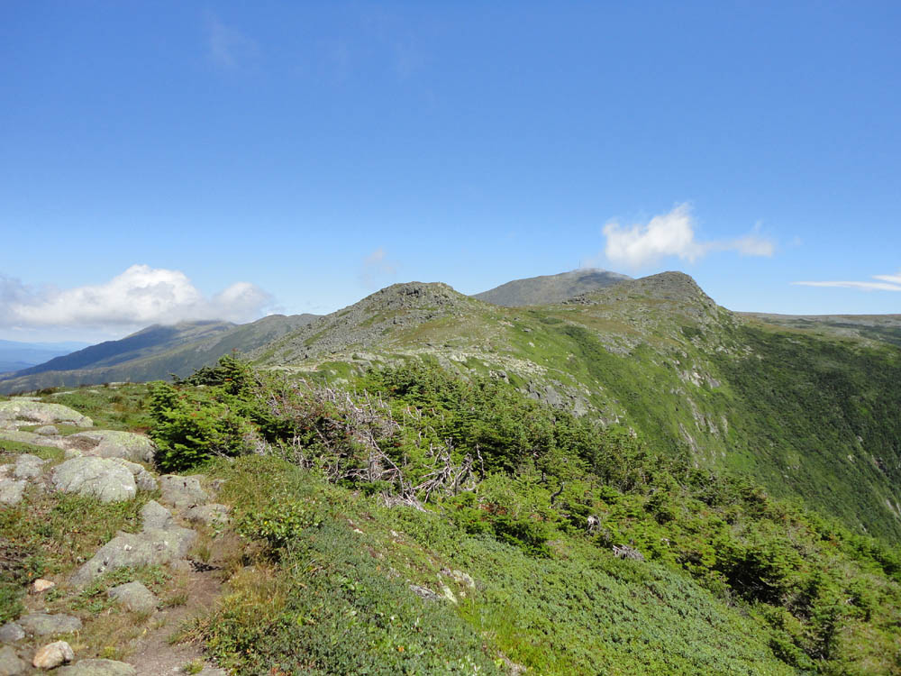
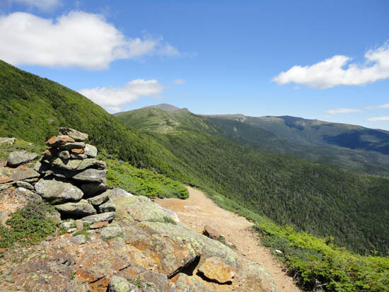
The Monroe Loop between Mt. Monroe and Little Monroe
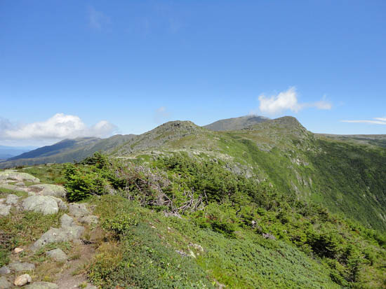
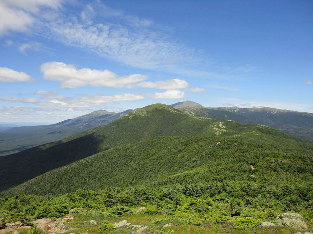
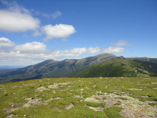
Looking at Mt. Monroe from Mt. Franklin
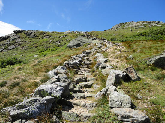
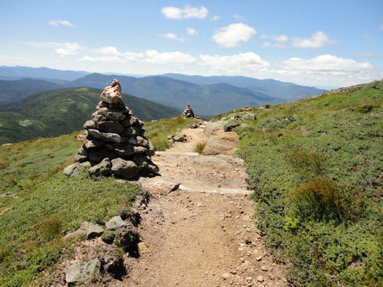
The Crawford Path around Mt. Eisenhower
Looking at Mt. Washington from Mt. Eisenhower
The Eisenhower Loop on the way to Mt. Pierce

Looking at Mt. Eisenhower, Mt. Jefferson, and Mt. Washington from near the summit of Mt. Pierce

Directions to trailhead: To get to the Crawford Connector parking area, Take Route 302 West from Bartlett into Carroll. Just after Saco Lake, take a right onto Mt. Clinton Road. Shortly thereafter, take a left into the WMNF fee parking area driveway and Crawford Connector trailhead. To get to the Cog Base Station in winter, take 302 West from Crawford Notch, then take a right onto Base Station Road. In summer 2011, $5 parking was available at the lower Cog Base Station parking lot. Looking up the mountain from the parking lot, the spur trail to the Ammonoosuc Ravine Trail begins up the hill to the right, a bit below two cabins.
Back to Mt. Monroe Profile
Back to Mt. Franklin Profile
Back to Mt. Eisenhower Profile
Back to Mt. Pierce Profile
|