Home
States
Colorado
Connecticut
Maine
Massachusetts
New Hampshire
New York
Rhode Island
Utah
Vermont
View All
Lists
NE 4,000 Footers
NE 100 Highest
NH 4,000 Footers
NH 100 Highest
NH 52 With A View
NH Belknap Range
NH Ossipee 10
Links
Trail Conditions
Trip Log
Sunrises
Sunsets
About
|
Mt. Osceola (Middle Peak)
Livermore, NH
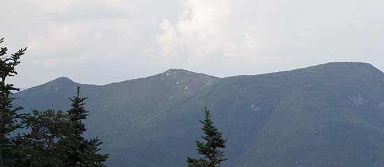
Middle Osceola as seen from Mt. Tecumseh
 Summary Summary
A wooded, trailless subpeak of Mt. Osceola, Middle Osceola features strong views from a near summit cliff.
Summit Elevation
4,220 feet
Summit Facilities
None.
Trails
The Mt. Osceola Trail ascends from Tripoli Road (closed to vehicles late fall through mid spring), over Mt. Osceola and Mt. Osceola, then descends down to the Greeley Ponds Trail, 1.3 miles south of Route 112.
Trip Reports:
Click on the date for photos, timestamps, and maps.
More Information
|
