Home
States
Colorado
Connecticut
Maine
Massachusetts
New Hampshire
New York
Rhode Island
Utah
Vermont
View All
Lists
NE 4,000 Footers
NE 100 Highest
NH 4,000 Footers
NH 100 Highest
NH 52 With A View
NH Belknap Range
NH Ossipee 10
Links
Trail Conditions
Trip Log
Sunrises
Sunsets
About
|
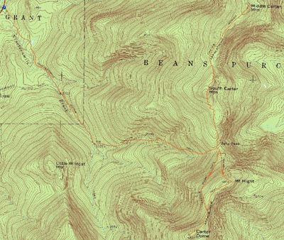
South Carter Mountain, Middle Carter Mountain, Carter Dome, Mt. Hight
Green's Grant, NH, Bean's Purchase, NH
Trailheads, measurements, times, distances, and maps are all approximate and relative to the hike(s) as shown below.
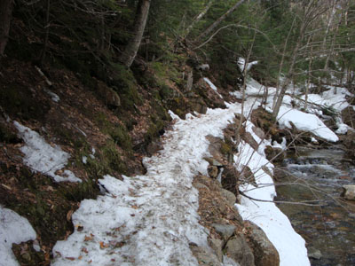
Looking up the Nineteen Mile Brook Trail on the way to South Carter
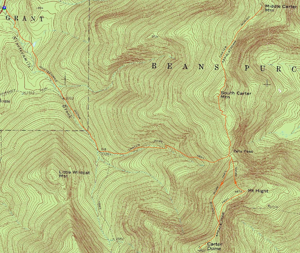
Route: Nineteen Mile Trail, Carter Dome Trail, Carter-Moriah Trail, (South Carter Mountain), Carter-Moriah Trail, (Middle Carter Mountain), Carter-Moriah Trail, (South Carter Mountain), Carter-Moriah Trail, Carter Dome Trail, Carter-Moriah Trail, (Carter Dome), Carter-Moriah Trail, (Mt. Hight), Carter-Moriah Trail, Carter Dome Trail, Nineteen Mile Trail
The weather forecast was mediocre, but I decided to head out anyways and do something in the Carters, banking on the Presidentials to hold back the clouds. Since southern forecasts had called for a decreasingly cloudy day, I waited a bit before heading up to Pinkham.
Arriving at the trailhead, I could see the Presidentials were indeed holding back the clouds and fog, keeping things partly sunny. Nonetheless, I was feeling a bit sluggish at first. I ended up Microspiking up to the Carter Dome junction on a fairly firm, yet monorailed Nineteen Mile Brook Trail, before switching over to snowshoes.
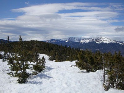
Though the two water crossings on the Carter Dome Trail were open, they were nonetheless rockhoppable. Reaching Zeta Pass, I headed up to South Carter first, ascending on plenty more monorail. Upon reaching the summit, I bushwhacked about 10 or 15 feet east of the trail to a snowpack-aided viewpoint.
The next stop was Middle Carter. Though windy, the ridge was in the clear, making for great views. The variety of clouds in the sky only aided the scenery.
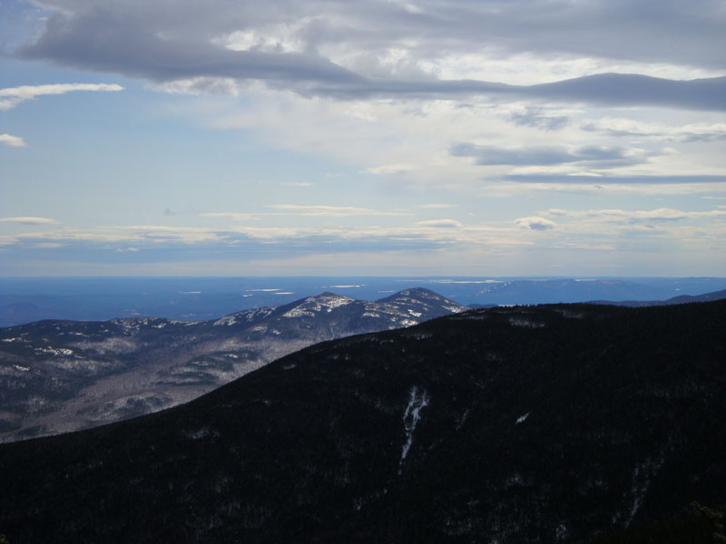
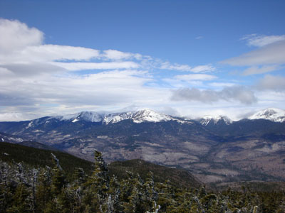
After reaching the summit, I continued a few hundred feet north to a Presidential vista. The view was excellent, with the peaks barely visible as they struggled to hold back the fog and clouds.
My next stop was Carter Dome. Though there had been some melting, there was still a tremendous amount of snow on the ridge and summit. As such, the views were quite nice from the drift adjacent to the highpoint, ranging from the Sandwich Range to the Presidentials and Carters.
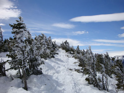
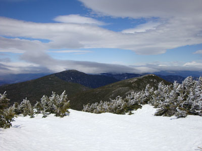
My final stop for the day was Mt. Hight. Drifted and filled with various tracks, the footbed meanders off trail in a few places. As was the case a few weeks earlier, I somehow wandered off the trail proper just prior to the summit - I was tempted to backtrack and find out where the tracks went wrong, but nonetheless I was ready to call it a day. The views from Mt. Hight were quite nice, as usual.
I ended up staying in my snowshoes all the way back to Nineteen Mile Brook - at that point, it was time to bareboot the rest of the way to the parking lot. A surprisingly nice day to be out, contrary to the forecast!
| Hike Ratings |
|
Getting To Trailhead: |
Easy |
| Destination: |
South Carter Mountain |
|
Length: |
Moderate |
|
Steepness: |
Difficult |
|
Navigation: |
Easy |
|
Views: |
Excellent |
|
Crowds: |
Moderate |
| Destination: |
Middle Carter Mountain |
|
Length: |
Moderate |
|
Steepness: |
Difficult |
|
Navigation: |
Moderate |
|
Views: |
Excellent |
|
Crowds: |
Minimal |
| Destination: |
Carter Dome |
|
Length: |
Difficult |
|
Steepness: |
Difficult |
|
Navigation: |
Easy |
|
Views: |
Excellent |
|
Crowds: |
Minimal |
| Destination: |
Mt. Hight |
|
Length: |
Difficult |
|
Steepness: |
Difficult |
|
Navigation: |
Moderate |
|
Views: |
Excellent |
|
Crowds: |
Minimal |
|
| Hike Stats |
|
Date Hiked: |
Sunday, April 5, 2009 |
| Hike Commenced: |
8:49 AM |
| Parking Elevation: |
1,485' |
| Destination: |
South Carter Mountain |
| Ascent Commenced: |
8:49 AM |
| Summit Reached: |
10:51 AM |
| Time Elapsed: |
02:02 |
| Trailhead Elevation: |
1,485' |
| Summit Elevation: |
4,430' |
| Vertical Gain: |
3,015' |
| Destination: |
Middle Carter Mountain |
| Ascent Commenced: |
10:59 AM |
| Summit Reached: |
11:33 AM |
| Time Elapsed: |
00:34 |
| Trailhead Elevation: |
4,430' |
| Summit Elevation: |
4,610' |
| Vertical Gain: |
595' |
| Destination: |
Carter Dome |
| Ascent Commenced: |
11:40 AM |
| Summit Reached: |
1:12 PM |
| Time Elapsed: |
01:32 |
| Trailhead Elevation: |
4,675' |
| Summit Elevation: |
4,832' |
| Vertical Gain: |
1,307' |
| Destination: |
Mt. Hight |
| Ascent Commenced: |
1:21 PM |
| Summit Reached: |
1:44 PM |
| Time Elapsed: |
00:23 |
| Trailhead Elevation: |
4,832' |
| Summit Elevation: |
4,675' |
| Vertical Gain: |
165' |
|
|
| Hike Ended: |
3:48 PM |
| Hike Time Elapsed: |
06:59 |
| Hike Vertical Gain: |
5,162' |
|
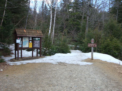
The Nineteen Mile Brook Trail trailhead on Route 16

Looking at the Baldfaces from near the summit of South Carter
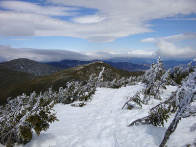
The Carter-Moriah Trail between South and Middle Carter
Looking at Mt. Washington from near the summit of Middle Carter
Looking up the Carter-Moriah Trail near Carter Dome
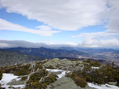
Looking at the Carters and Mt. Hight from Carter Dome
The Carter-Moriah Trail on the way to Mt. Hight
Looking northeast into Maine from Mt. Hight

Directions to trailhead: Take Route 16 North past the Mt. Washington Auto Road entrance. Shortly thereafter, the Nineteen Mile Brook Trail WMNF fee parking area and trailhead are on the right side of the road, immediately after the brook.
Back to South Carter Mountain Profile
Back to Middle Carter Mountain Profile
Back to Carter Dome Profile
Back to Mt. Hight Profile
|