Home
States
Colorado
Connecticut
Maine
Massachusetts
New Hampshire
New York
Rhode Island
Utah
Vermont
View All
Lists
NE 4,000 Footers
NE 100 Highest
NH 4,000 Footers
NH 100 Highest
NH 52 With A View
NH Belknap Range
NH Ossipee 10
Links
Trail Conditions
Trip Log
Sunrises
Sunsets
About
|
Welch Mountain, Foss Mountain, Green Mountain, Mt. Tecumseh, Mt. Tecumseh (West Peak), Mt. Tecumseh (Northwest Peak)
Thornton, NH, Waterville Valley, NH, Livermore, NH
Trailheads, measurements, times, distances, and maps are all approximate and relative to the hike(s) as shown below.
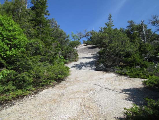
Heading up the Welch-Dickey Loop Trail to Welch Mountain
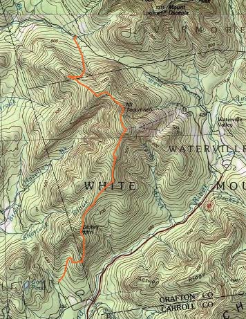
Route: Welch-Dickey Loop Trail, (Welch Mountain), Welch-Dickey Loop Trail, herd path, (Foss Mountain), herd path, (Green Mountain), bushwhack, Sosman Trail, (Mt. Tecumseh), Mt. Tecumseh Trail, (West Tecumseh), Mt. Tecumseh Trail, bushwhack, (Northwest Tecumseh), bushwhack, Mt. Tecumseh Trail
Really neat traverse. Started off with the traditional counterclockwise ascent up Welch - mostly dry and in good shape. We then continued into the col and up to the first ledges of Dickey, from where we followed the vague herd path (as mentioned in the WMG) to the northern ledges of Dickey (which are mandatory for redliners and well worth it for those just out hiking).
From the furthest ledge, we hopped in on an old herd path, which was a little vague at first, but then very easy to follow, presumably the remains of the original trail to Mt. Tecumseh. Lots of nice views as we ascended Foss Mountain (labelled just as an elevation on the USGS map) and Green Mountain.
The herd path pretty much dead ended at the recognized summit of Green Mountain, so we then bushwhacked along the ridge, generally in good woods with a thick spot in the col, as well as just before we popped out near the communications tower near the top of the ski area (noted a freshly cut bootleg ski trail just before it...not sure where it goes, but seems to be slabbing west).
Sosman was smooth as normal and Tecumseh was pretty busy. We then dropped down the Tripoli side of the Mt. Tecumseh, over West Tecumseh, then hitting the next saddle, bushwhacked in generally open woods to the wooded northwestern peak, then doubled back to the trail and descended to Tripoli Road. This side of the trail was also mostly dry and in good shape.
| Hike Ratings |
|
Getting To Trailhead: |
Easy |
| Destination: |
Welch Mountain |
|
Length: |
Moderate |
|
Steepness: |
Difficult |
|
Navigation: |
Easy |
|
Views: |
Excellent |
|
Crowds: |
Moderate |
| Destination: |
Foss Mountain |
|
Length: |
Moderate |
|
Steepness: |
Difficult |
|
Navigation: |
Difficult |
|
Views: |
Excellent |
|
Crowds: |
Minimal |
| Destination: |
Green Mountain |
|
Length: |
Moderate |
|
Steepness: |
Easy |
|
Navigation: |
Moderate |
|
Views: |
Excellent |
|
Crowds: |
Minimal |
| Destination: |
Mt. Tecumseh |
|
Length: |
Moderate |
|
Steepness: |
Difficult |
|
Navigation: |
Difficult |
|
Views: |
Excellent |
|
Crowds: |
Heavy |
| Destination: |
West Tecumseh |
|
Length: |
Difficult |
|
Steepness: |
Difficult |
|
Navigation: |
Easy |
|
Views: |
Excellent |
|
Crowds: |
Minimal |
| Destination: |
Northwest Tecumseh |
|
Length: |
Difficult |
|
Steepness: |
Moderate |
|
Navigation: |
Difficult |
|
Views: |
Minimal |
|
Crowds: |
Minimal |
|
| Hike Stats |
|
Date Hiked: |
Sunday, June 8, 2014 |
| Parking Elevation: |
1,080' |
| Destination: |
Welch Mountain |
| Time Elapsed: |
01:01 |
| Trailhead Elevation: |
1,090' |
| Summit Elevation: |
2,605' |
| Distance: |
2 miles |
| Vertical Gain: |
1,545' |
| Destination: |
Foss Mountain |
| Time Elapsed: |
01:40 |
| Trailhead Elevation: |
2,605' |
| Summit Elevation: |
3,312' |
| Vertical Gain: |
812' |
| Destination: |
Green Mountain |
| Time Elapsed: |
00:21 |
| Trailhead Elevation: |
3,312' |
| Summit Elevation: |
3,540' |
| Vertical Gain: |
258' |
| Destination: |
Mt. Tecumseh |
| Time Elapsed: |
00:21 |
| Trailhead Elevation: |
3,540' |
| Summit Elevation: |
4,003' |
| Vertical Gain: |
743' |
| Destination: |
Mt. Tecumseh (West Peak) |
| Time Elapsed: |
00:21 |
| Trailhead Elevation: |
4,003' |
| Summit Elevation: |
3,766' |
| Vertical Gain: |
146' |
| Destination: |
Mt. Tecumseh (Northwest Peak) |
| Time Elapsed: |
00:21 |
| Trailhead Elevation: |
3,766' |
| Summit Elevation: |
3,156' |
| Vertical Gain: |
176' |
|
|
| Hike Time Elapsed: |
07:58 |
| Hike Vertical Gain: |
3,720' |
|
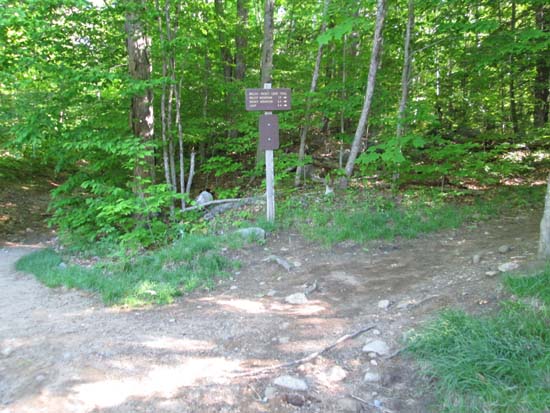
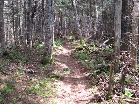
The Welch-Dickey Loop Trail trailhead
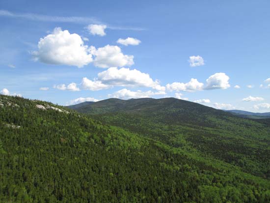
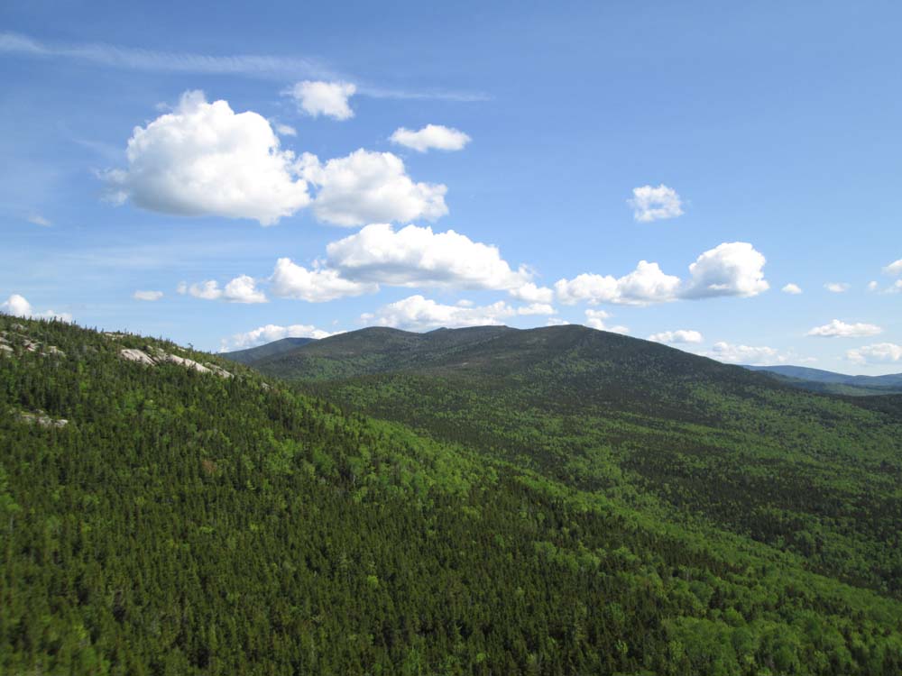
Looking at Foss Mountain and Mt. Tecumseh from Welch Mountain
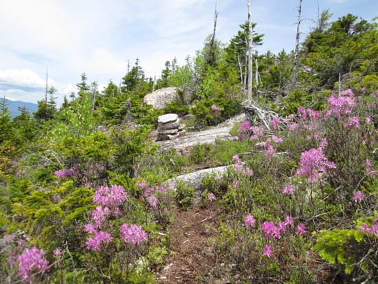
The herd path between Dickey Mountain and Foss Mountain
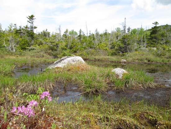
A tarn between Dickey Mountain and Foss Mountain
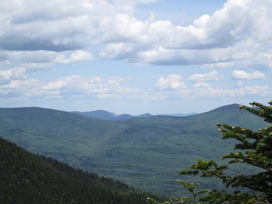
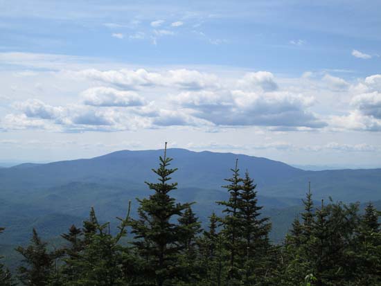
Looking at the Tripyramids from Foss Mountain
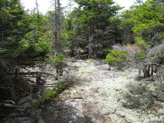
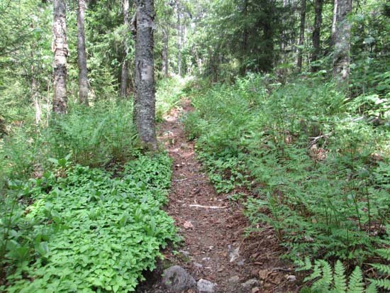
The herd path to Green Mountain
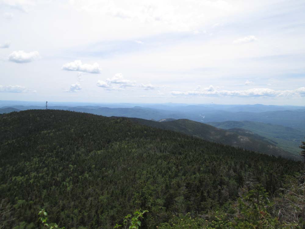
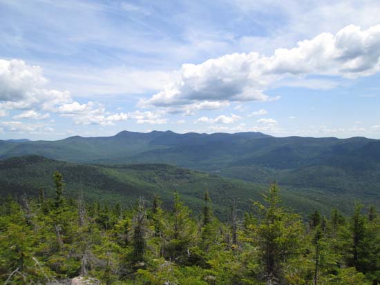
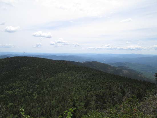
Looking northeast from Green Mountain
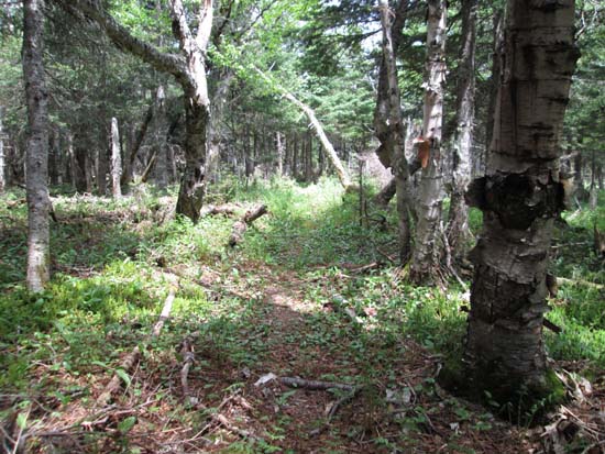
Bushwhacking between Green Mountain and Mt. Tecumseh
Looking toward Welch and Dickey from near the summit of Mt. Tecumseh
The Mt. Tecumseh Trail on the way to West Tecumseh
Looking at Mt. Moosilauke from near the summit of West Tecumseh
The Mt. Tecumseh Trail on the way to Northwest Tecumseh
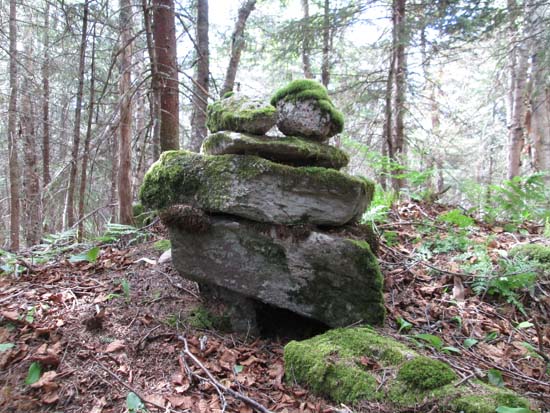
The wood summit of Northwest Tecumseh

Directions to trailhead: Take Route 49 to Six Mile Bridge - take a left there and go up the hill. Take a right onto Orris Road. National Forest pay parking lot will be on the right after a short drive. To get to the west Mt. Tecumseh Trail trailhead, return to Route 49, then take it north to Tripoli Road, heading west over the height of land. The trailhead and parking lot will eventually be on the left.
Back to Welch Mountain Profile
Back to Foss Mountain Profile
Back to Green Mountain Profile
Back to Mt. Tecumseh Profile
Back to Mt. Tecumseh (West Peak) Profile
Back to Mt. Tecumseh (Northwest Peak) Profile
|