Home
States
Colorado
Connecticut
Maine
Massachusetts
New Hampshire
New York
Rhode Island
Utah
Vermont
View All
Lists
NE 4,000 Footers
NE 100 Highest
NH 4,000 Footers
NH 100 Highest
NH 52 With A View
NH Belknap Range
NH Ossipee 10
Links
Trail Conditions
Trip Log
Sunrises
Sunsets
About
|
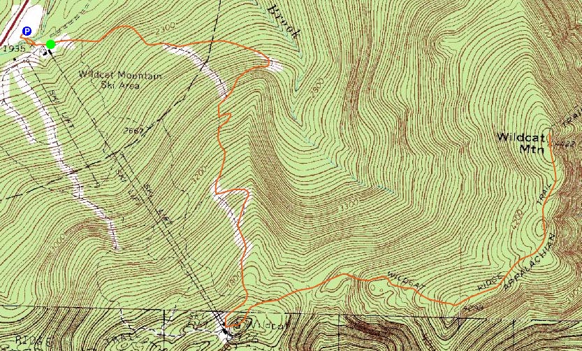
Wildcat D, Wildcat C, Wildcat B, Wildcat A
Pinkham's Grant, NH, Bean's Grant, NH
Trailheads, measurements, times, distances, and maps are all approximate and relative to the hike(s) as shown below.
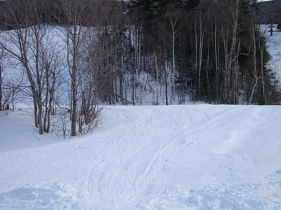
Looking down Lower Polecat on the way to Wildcat D
Route: Lower Polecat, Middle Polecat, Upper Polecat, Wildcat Ridge Trail, (Wildcat D), Wildcat Ridge Trail, (Wildcat C), Wildcat Ridge Trail, (Wildcat B), Wildcat Ridge Trail, (Wildcat A), Wildcat Ridge Trail, (Wildcat B), Wildcat Ridge Trail, (Wildcat C), Wildcat Ridge Trail, (Wildcat D), Wildcat Ridge Trail, Upper Polecat, Middle Polecat, Lower Polecat
My plan was to take a half day off from work and head out and test my injured foot. All was going well until I received a last minute assignment, which put me about two hours behind schedule.
Experimenting with different taping and wrapping techniques (ranging from taping the ball of the foot, to taping the middle toes together (bad idea) to wrapping the foot in an ace banadage), I settled on a snug taping of the ball of the foot, as to modify the way I land on the foot in question (and thus not flexing it as much). While still sore, things seemed more managable.
With a good foot of fresh powder on the ground, I was happy to see the Polecat ski trail had been groomed, making the snowshoeing much easier. Above the top of the ski area, however, I was on my own. It took me particularly long to get up the short, steep, and unbroken section of trail leading to D peak, as the unpacked snow was a bit deep and inconsistent in terms of density.
While the summit of D peak doesn't have views in the summer due to the closed observation deck, there was enough snowpack to allow for a view over the trees of Mt. Washington.
While my foot was sore, the taping was preventing the near-agony I was experiencing on my previous two hikes. Thus, with just about enough time to get to A peak by the end of daylight, I decided to go for it.
C peak seemed to take forever to ascend - new snow depths ranged from 1-3 feet, with the steeper ascents particularly annoying. After passing by the false summit outlooks, I finally reached the actual near-summit viewpoint, which provided great views of the Presidentials and points to the southeast.
My next stop was B peak. While not as rough as the section of trail between D and C, there were still a few short, steep dips and plenty of drifted areas.
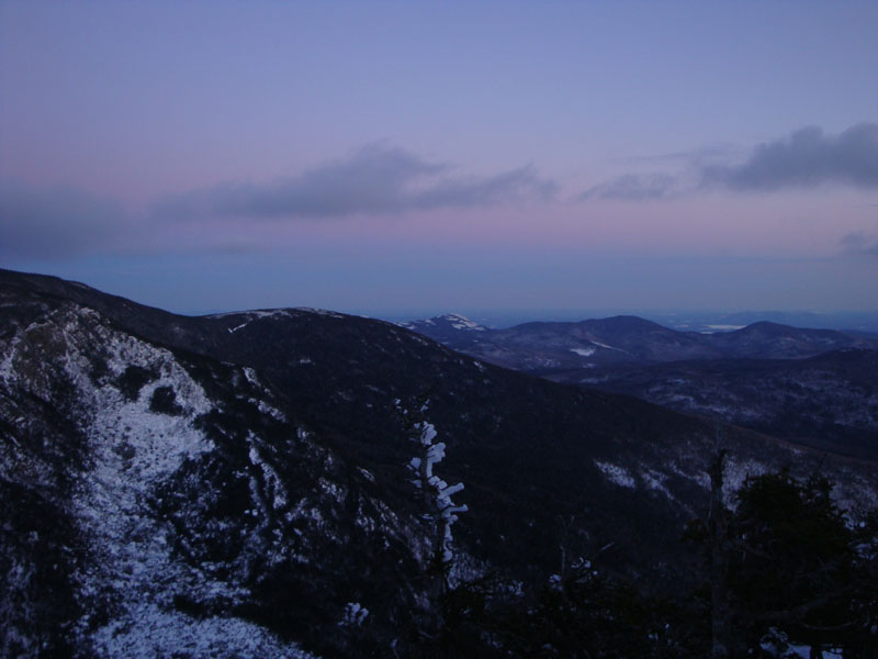
I reached the B peak just prior to sunset. While there were some nice colors seen through the trees, there was no clear view of the southwestern sky. Nonetheless, I was able to see some nice colorful clouds over Mt. Washington.
The stretch from Wildcat B to A was perhaps the easiest of the whole ridge - though there was still some drifting, the terrain was fairly tame. I arrived at the A peak viewpoint just in time to catch the last glimpse of colored clouds to the east.
After suiting up for colder temperatures and turning on my headlamp a few minutes after leaving A peak, I was on my way back to the ski area. I found the Wildcat Ridge Trail to be particularly nice in the dark - the stars overhead and the lights of Shawnee Peak, North Conway, and Gorham were particularly striking - as was the lack of light throughout the undeveloped wilderness elsewhere. The views from C peak were absolutely amazing at this point - I could even see the lights along the Atlantic Coast! I could also see that someone had taken advantage of my trailbreaking - a feline creature of some sort had decided to venture out onto the trail at some point.
Back at the ski area, I spent the first portion of the descent trying to avoid a snowcat and freshly groomed trail (any sort of use of freshly groomed trail prior to the ski area opening is a pet peeve of cat operators). Once below his current work area, I shut off my headlamp and did the rest of the descent with the faint crescent moonlight. I found looking at a slightly illuminated cloud on top of Mt. Washington, as well as looking at multiple headlamps descending somewhere around Lion's Head to be particularly neat.
| Hike Ratings |
|
Getting To Trailhead: |
Easy |
| Destination: |
Wildcat D |
|
Length: |
Moderate |
|
Steepness: |
Difficult |
|
Navigation: |
Easy |
|
Views: |
Excellent |
|
Crowds: |
Heavy |
| Destination: |
Wildcat C |
|
Length: |
Moderate |
|
Steepness: |
Difficult |
|
Navigation: |
Moderate |
|
Views: |
Excellent |
|
Crowds: |
Minimal |
| Destination: |
Wildcat B |
|
Length: |
Difficult |
|
Steepness: |
Difficult |
|
Navigation: |
Moderate |
|
Views: |
Moderate |
|
Crowds: |
Minimal |
| Destination: |
Wildcat A |
|
Length: |
Difficult |
|
Steepness: |
Difficult |
|
Navigation: |
Moderate |
|
Views: |
Excellent |
|
Crowds: |
Minimal |
|
| Hike Stats |
|
Date Hiked: |
Thursday, January 29, 2009 |
| Hike Commenced: |
1:48 PM |
| Parking Elevation: |
1,960' |
| Destination: |
Wildcat D |
| Ascent Commenced: |
1:52 PM |
| Summit Reached: |
3:10 PM |
| Time Elapsed: |
01:18 |
| Trailhead Elevation: |
1,950' |
| Summit Elevation: |
4,062' |
| Vertical Gain: |
2,112' |
| Destination: |
Wildcat C |
| Ascent Commenced: |
3:11 PM |
| Summit Reached: |
4:17 PM |
| Time Elapsed: |
01:06 |
| Trailhead Elevation: |
4,070' |
| Summit Elevation: |
4,285' |
| Vertical Gain: |
585' |
| Destination: |
Wildcat B |
| Ascent Commenced: |
4:17 PM |
| Summit Reached: |
4:42 PM |
| Time Elapsed: |
00:25 |
| Trailhead Elevation: |
4,285' |
| Summit Elevation: |
4,305' |
| Vertical Gain: |
195' |
| Destination: |
Wildcat A |
| Ascent Commenced: |
4:43 PM |
| Summit Reached: |
4:58 PM |
| Time Elapsed: |
00:15 |
| Trailhead Elevation: |
4,305' |
| Summit Elevation: |
4,422' |
| Vertical Gain: |
182' |
|
|
| Hike Ended: |
7:19 PM |
| Hike Time Elapsed: |
05:31 |
| Hike Vertical Gain: |
3,709' |
|
The end (beginning) of Lower Polecat next to the summit chairlift/gondola
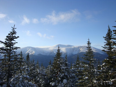
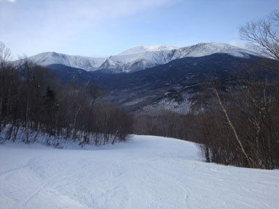
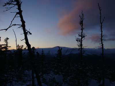
Looking west at Mt. Washington from Wildcat D
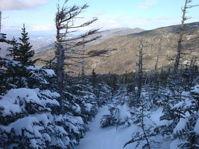
Wildcat Ridge Trail to Wildcat C
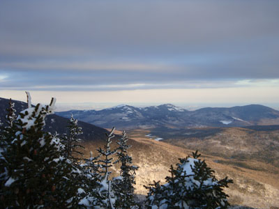
Looking at the Baldfaces from near the summit of Wildcat C
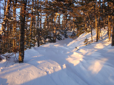
Wildcat Ridge Trail to Wildcat B
Sunset colored clouds over Mt. Washington as seen from near the Wildcat B summit
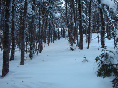
Wildcat Ridge Trail to Wildcat A

Slight sunset colors as seen from near the summit of Wildcat A
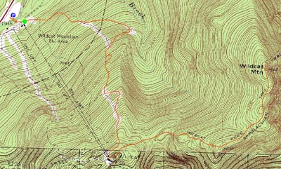

Directions to trailhead: Take Route 16 North from Jackson to the Wildcat Ski Area entrance. The Polecat ski trail is located next to the summit quad/gondola base terminal.
Back to Wildcat D Profile
Back to Wildcat C Profile
Back to Wildcat B Profile
Back to Wildcat A Profile
|