Home
States
Colorado
Connecticut
Maine
Massachusetts
New Hampshire
New York
Rhode Island
Utah
Vermont
View All
Lists
NE 4,000 Footers
NE 100 Highest
NH 4,000 Footers
NH 100 Highest
NH 52 With A View
NH Belknap Range
NH Ossipee 10
Links
Trail Conditions
Trip Log
Sunrises
Sunsets
About
|
Wildcat D, Wildcat C, Wildcat B, Wildcat A
Pinkham's Grant, NH, Bean's Grant, NH
Trailheads, measurements, times, distances, and maps are all approximate and relative to the hike(s) as shown below.
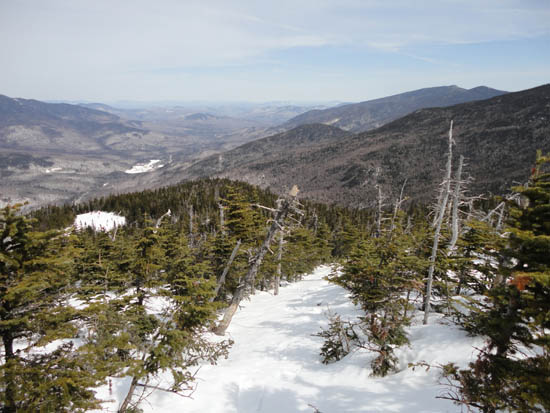
Looking down the Straycat ski trail
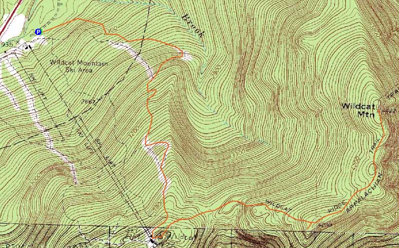
Route: Straycat, Middle Polecat, Upper Polecat, Wildcat Ridge Trail, (Wildcat D), Wildcat Ridge Trail, (Wildcat C), Wildcat Ridge Trail, (Wildcat B), Wildcat Ridge Trail, (Wildcat A), Wildcat Ridge Trail, (Wildcat B), Wildcat Ridge Trail, (Wildcat C), Wildcat Ridge Trail, (Wildcat D), Wildcat Ridge Trail, Upper Polecat, Middle Polecat, Straycat
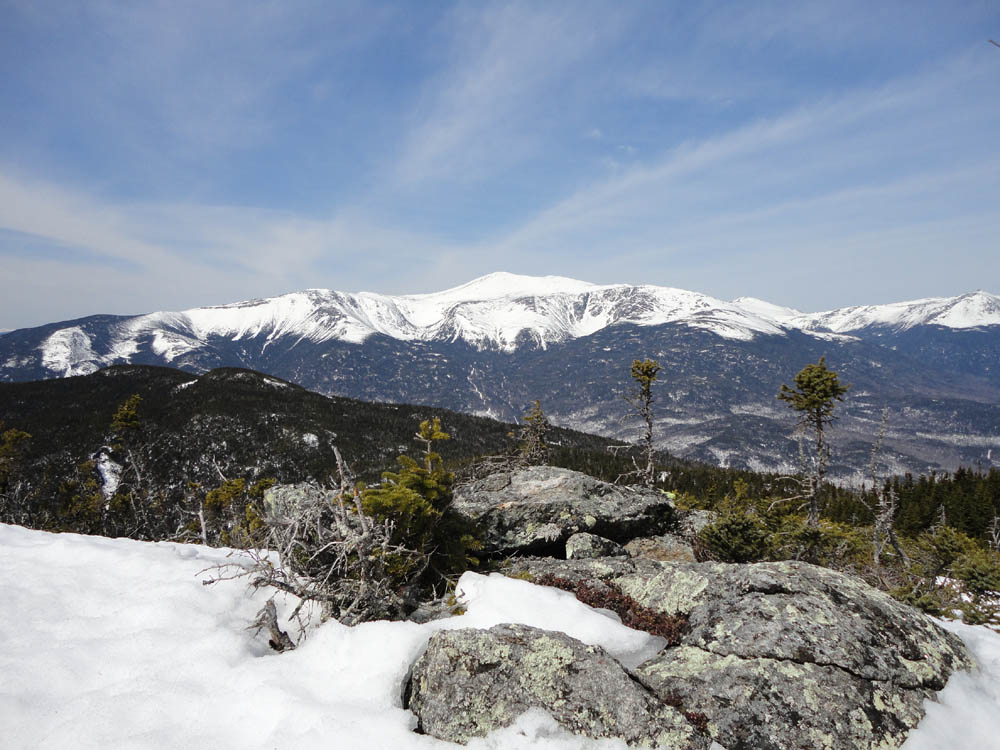
On what ended up being a 'bank error in your favor' forecast, I headed to the Wildcats. With bright, warm conditions, I snowshoed up the ski trails to the observation deck on Wildcat D, from where there were excellent views of Mt. Washington. From there, I continued down the Wildcat Ridge Trail, keeping my eye on some ledges on Wildcat C. After reaching Wildcat C, I backtracked a bit down the trail, the bushwhacked over to the ledges, from where I found perhaps the best Presidential view from the ridge.
From there, I returned to the trail and continued over Wildcat B to Wildcat A, from where there were excellent views again, though clouds were starting to build back in.
On the way back, we stopped at the Wildcat C ledges again for an extended break, then returned to Wildcat D and down the ski trails. A nice spring day in the Whites.
| Hike Ratings |
|
Getting To Trailhead: |
Easy |
| Destination: |
Wildcat D |
|
Length: |
Moderate |
|
Steepness: |
Difficult |
|
Navigation: |
Easy |
|
Views: |
Excellent |
|
Crowds: |
Heavy |
| Destination: |
Wildcat C |
|
Length: |
Moderate |
|
Steepness: |
Difficult |
|
Navigation: |
Moderate |
|
Views: |
Excellent |
|
Crowds: |
Minimal |
| Destination: |
Wildcat B |
|
Length: |
Difficult |
|
Steepness: |
Difficult |
|
Navigation: |
Moderate |
|
Views: |
Excellent |
|
Crowds: |
Minimal |
| Destination: |
Wildcat A |
|
Length: |
Difficult |
|
Steepness: |
Difficult |
|
Navigation: |
Moderate |
|
Views: |
Excellent |
|
Crowds: |
Minimal |
|
| Hike Stats |
|
Date Hiked: |
Sunday, April 10, 2011 |
| Parking Elevation: |
1,950' |
| Destination: |
Wildcat D |
| Time Elapsed: |
01:11 |
| Trailhead Elevation: |
1,950' |
| Summit Elevation: |
4,062' |
| Vertical Gain: |
2,112' |
| Destination: |
Wildcat C |
| Time Elapsed: |
00:37 |
| Trailhead Elevation: |
4,070' |
| Summit Elevation: |
4,285' |
| Vertical Gain: |
585' |
| Destination: |
Wildcat B |
| Time Elapsed: |
00:16 |
| Trailhead Elevation: |
4,285' |
| Summit Elevation: |
4,305' |
| Vertical Gain: |
195' |
| Destination: |
Wildcat A |
| Time Elapsed: |
00:13 |
| Trailhead Elevation: |
4,305' |
| Summit Elevation: |
4,422' |
| Vertical Gain: |
182' |
|
|
| Hike Vertical Gain: |
3,699' |
|
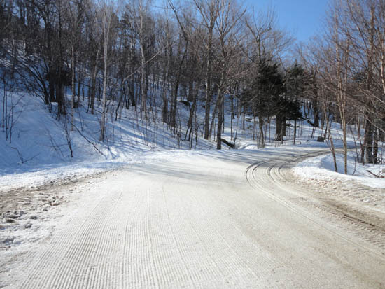
The bottom of the access trail to the Straycat ski trail at Wildcat lot C
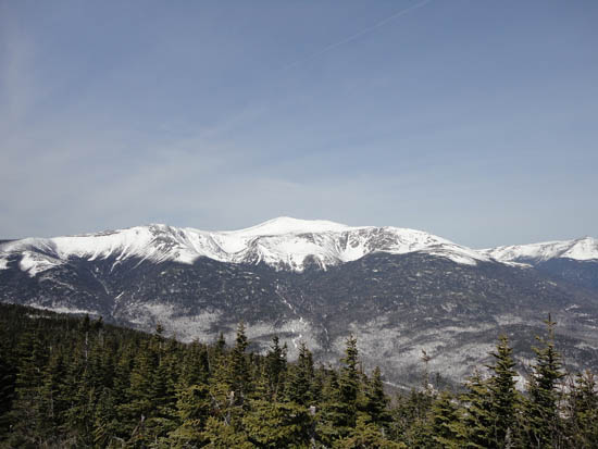
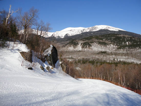
Looking at Mt. Washington from Wildcat D
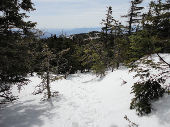
Walking on the treetops on the Wildcat Ridge Trail to Wildcat C

Looking Mt. Washington from a view ledge near the summit of Wildcat C
Wildcat Ridge Trail to Wildcat B

Carter Dome as seen from near the summit of Wildcat B
Wildcat Ridge Trail to Wildcat A
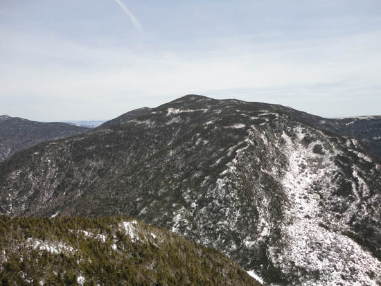
Carter Dome as seen from near the summit of Wildcat A
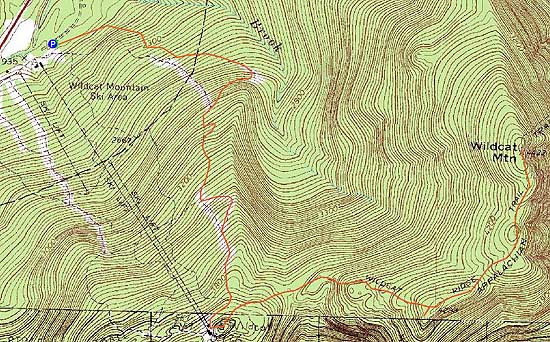

Directions to trailhead: Take Route 16 North from Jackson past the Wildcat Ski Area main entrance. The C Lot access road is the next right, with trailside parking at the end of the road.
Back to Wildcat D Profile
Back to Wildcat C Profile
Back to Wildcat B Profile
Back to Wildcat A Profile
|