Home
States
Colorado
Connecticut
Maine
Massachusetts
New Hampshire
New York
Rhode Island
Utah
Vermont
View All
Lists
NE 4,000 Footers
NE 100 Highest
NH 4,000 Footers
NH 100 Highest
NH 52 With A View
NH Belknap Range
NH Ossipee 10
Links
Trail Conditions
Trip Log
Sunrises
Sunsets
About
|
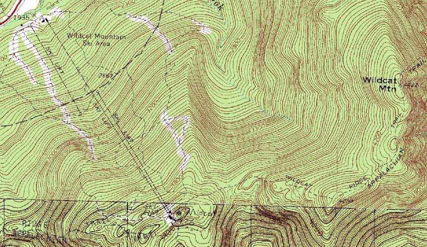
Wildcat D, Wildcat C, Wildcat B, Wildcat A
Pinkham's Grant, NH, Bean's Grant, NH
Trailheads, measurements, times, distances, and maps are all approximate and relative to the hike(s) as shown below.
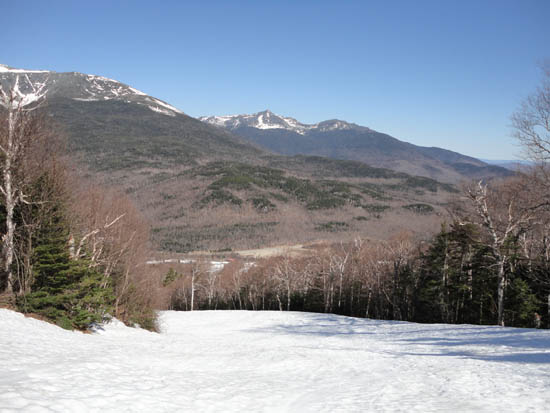
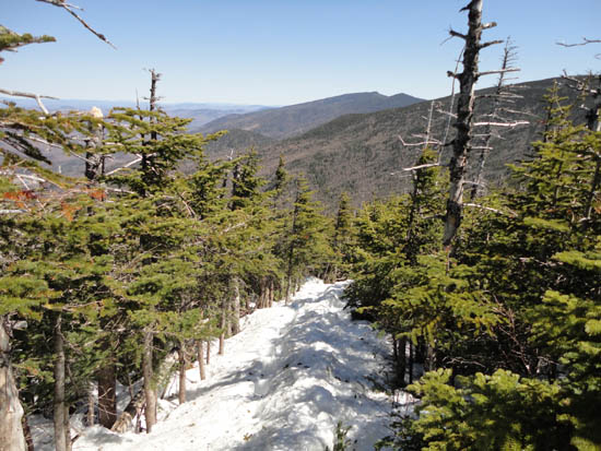
Looking down one of the ski trails on the way to Wildcat D
Route: Ski trails, Wildcat Ridge Trail, (Wildcat D), Wildcat Ridge Trail, (Wildcat C), Wildcat Ridge Trail, (Wildcat B), Wildcat Ridge Trail, (Wildcat A), Wildcat Ridge Trail, (Wildcat B), Wildcat Ridge Trail, (Wildcat C), Wildcat Ridge Trail, bushwhack, ski trails
With an awesome bluebird day, we headed to Wildcat. Though the ski area was closed for the season, some ski trails still had top to bottom coverage. With cool overnight temperatures, we were able to boot up without sinking into the snow. After a few leisurely breaks, we donned snowshoes and headed across the ridge on a snow monorail. Depths ranged from probably two to six feet, though there was noticably less snow than a few weeks earlier.
After an extended break at the Wildcat A ledge, we headed back across to Wildcat C, then bushwhacked out to the superb ledges, where we had excellent views of the back of Wildcat D and the Presidentials.
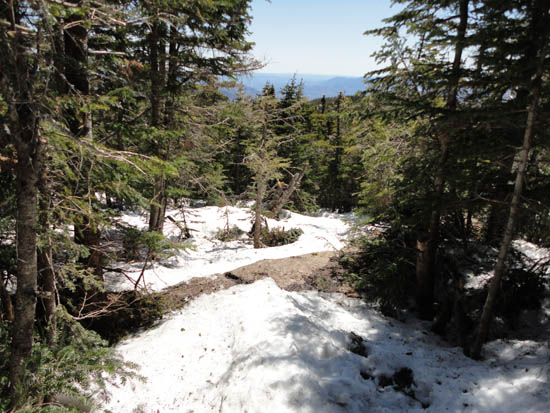
Back on the Wildcat Ridge Trail, we dropped into the col, then climbed up a bit, then did a very short bushwhack back to the ski trails, cutting off the climb back to the summit of D peak.
| Hike Ratings |
|
Getting To Trailhead: |
Easy |
| Destination: |
Wildcat D |
|
Length: |
Moderate |
|
Steepness: |
Difficult |
|
Navigation: |
Easy |
|
Views: |
Excellent |
|
Crowds: |
Heavy |
| Destination: |
Wildcat C |
|
Length: |
Moderate |
|
Steepness: |
Difficult |
|
Navigation: |
Easy |
|
Views: |
Excellent |
|
Crowds: |
Minimal |
| Destination: |
Wildcat B |
|
Length: |
Moderate |
|
Steepness: |
Difficult |
|
Navigation: |
Easy |
|
Views: |
Moderate |
|
Crowds: |
Minimal |
| Destination: |
Wildcat A |
|
Length: |
Moderate |
|
Steepness: |
Difficult |
|
Navigation: |
Easy |
|
Views: |
Excellent |
|
Crowds: |
Minimal |
|
| Hike Stats |
|
Date Hiked: |
Sunday, May 1, 2011 |
| Parking Elevation: |
1,960' |
| Destination: |
Wildcat D |
| Time Elapsed: |
02:00 |
| Trailhead Elevation: |
1,950' |
| Summit Elevation: |
4,062' |
| Vertical Gain: |
2,112' |
| Destination: |
Wildcat C |
| Time Elapsed: |
01:04 |
| Trailhead Elevation: |
4,070' |
| Summit Elevation: |
4,285' |
| Vertical Gain: |
585' |
| Destination: |
Wildcat B |
| Time Elapsed: |
00:32 |
| Trailhead Elevation: |
4,285' |
| Summit Elevation: |
4,305' |
| Vertical Gain: |
195' |
| Destination: |
Wildcat A |
| Time Elapsed: |
00:17 |
| Trailhead Elevation: |
4,305' |
| Summit Elevation: |
4,422' |
| Vertical Gain: |
182' |
|
|
| Hike Vertical Gain: |
3,559' |
|
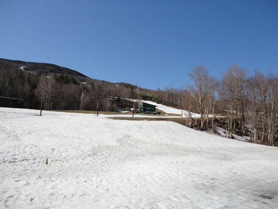
The bottom of the ski area
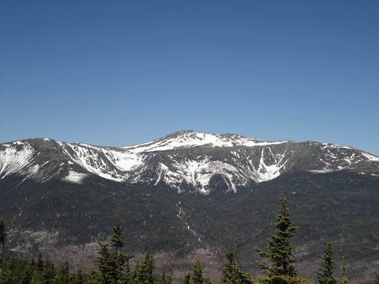
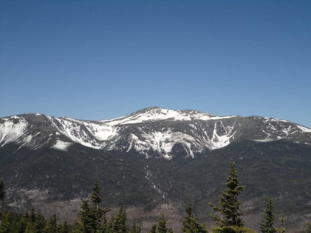
Mt. Washington as seen from Wildcat D
Wildcat Ridge Trail to Wildcat C

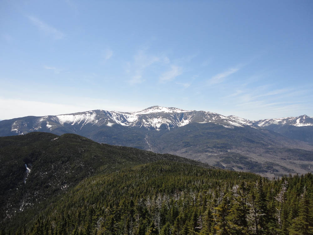
Mt. Washington as seen from the ledges near the summit of Wildcat C
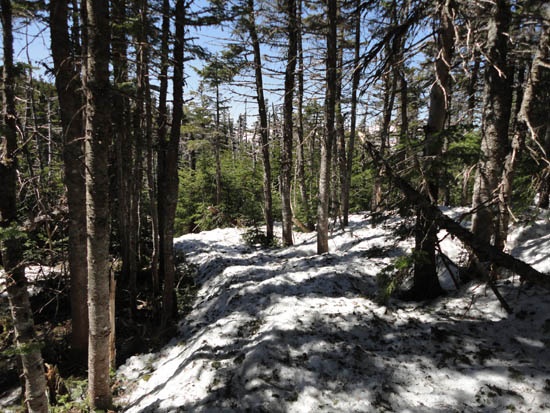
Wildcat Ridge Trail to Wildcat B
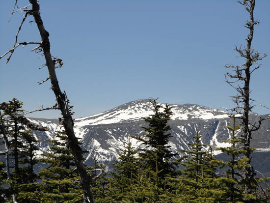
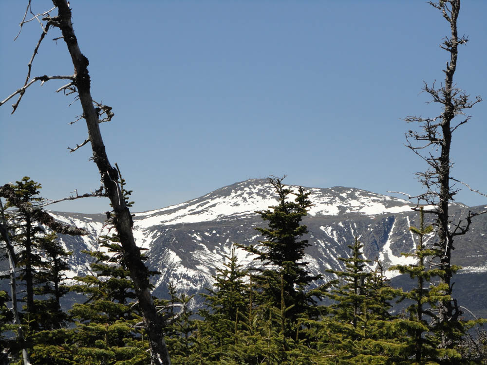
Mt. Washington as seen from Wildcat B
Wildcat Ridge Trail to Wildcat A
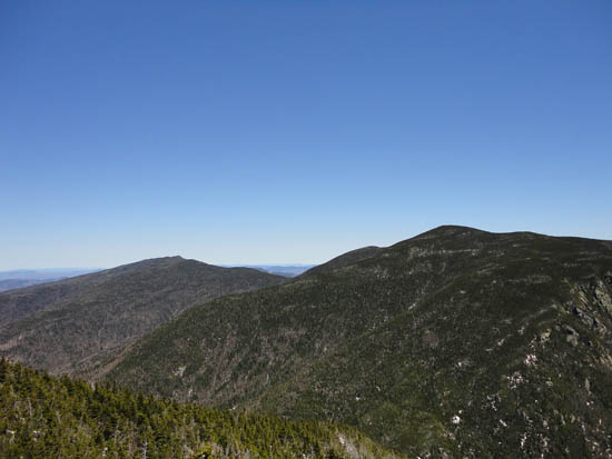
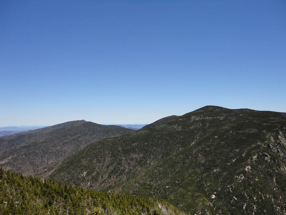
The Carters as seen from the Wildcat A vista
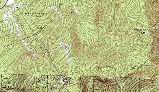

Directions to trailhead: Take Route 16 North from Jackson to the Wildcat Ski Area entrance. The Polecat ski trail is located next to the summit quad/gondola base terminal.
Back to Wildcat D Profile
Back to Wildcat C Profile
Back to Wildcat B Profile
Back to Wildcat A Profile
|