Home
States
Colorado
Connecticut
Maine
Massachusetts
New Hampshire
New York
Rhode Island
Utah
Vermont
View All
Lists
NE 4,000 Footers
NE 100 Highest
NH 4,000 Footers
NH 100 Highest
NH 52 With A View
NH Belknap Range
NH Ossipee 10
Links
Trail Conditions
Trip Log
Sunrises
Sunsets
About
|
Mt. Lethe, Middle Carter Mountain, South Carter Mountain, Carter Dome, Wildcat A, Wildcat B, Wildcat C, Wildcat D
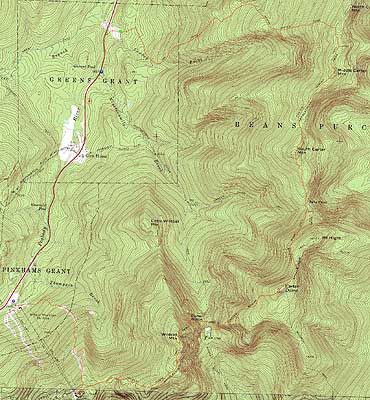
Green's Grant, NH, Bean's Purchase, NH, Pinkhams Grant, NH
Trailheads, measurements, times, distances, and maps are all approximate and relative to the hike(s) as shown below.
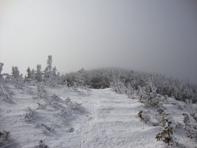
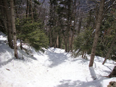
Looking up the Carter-Moriah Trail on the way to Mt. Lethe
Route: Route 16, Camp Dodge road, unknown trail, Imp Trail, North Carter Trail, Carter-Moriah Trail, bushwhack, (Mt. Lethe), bushwhack, Carter-Moriah Trail, (Middle Carter Mountain), Carter-Moriah Trail, (South Carter Mountain), Carter-Moriah Trail, Carter Dome Trail, Carter-Moriah Trail, (Carter Dome), Carter-Moriah Trail, Nineteen Mile Brook Trail, Wildcat Ridge Trail, (Wildcat A), Wildcat Ridge Trail, (Wildcat B), Wildcat Ridge Trail, (Wildcat C), Wildcat Ridge Trail, (Wildcat D), Wildcat Ridge Trail, Polecat, Tomcat Schuss, Lower Polecat
With a decent forecast (but not superb enough to warrant a Presi trip), we opted to head over to the Carters and Wildcats. After spotting a vehicle at the ski area, we parked at Nineteen Mile Brook and walked to Camp Dodge. Beyond the camp buildings, we headed up the logging road to the Imp Trail, taking a right and heading up the icy path. Upon reaching the North Carter Trail, I put on my snowshoes for the balance of the hike. Once on the ridge, we hopped onto a herd path (to our left), then did a short bushwhack to the small knob known as Mt. Lethe. Once there, we had passing views of Maine and the Presidentials (in between gusts of cloud blowing through).
The next stop was Middle Carter, once again with brief views. Beyond there, the trail was a bit drifted as we worked our way to South Carter - no views from the view ledge, due to the fog.
After climbing out of Zeta Pass, I had a bit of a hunger bonk. Nonetheless, we made it up to the summit, where we once again had no views due to the fog.
The descent was a bit of a challenge, due to a hardpacked, slippery, steep trail - I was just on the outer limits of my snowshoe traction. After a food break next to the frozen lake, we headed up the steep climb to Wildcat A. By this point, the fog had moved out, resulting in excellent views.
The major climbs behind us, we moved across the ridge, having excellent views at multiple outlooks, eventually reaching the ski area and descending on the trails.
| Hike Ratings |
|
Getting To Trailhead: |
Moderate |
| Destination: |
Mt. Lethe |
|
Length: |
Moderate |
|
Steepness: |
Difficult |
|
Navigation: |
Difficult |
|
Views: |
Excellent |
|
Crowds: |
Minimal |
| Destination: |
Middle Carter Mountain |
|
Length: |
Moderate |
|
Steepness: |
Difficult |
|
Navigation: |
Moderate |
|
Views: |
Moderate (due to weather) |
|
Crowds: |
Minimal |
| Destination: |
South Carter Mountain |
|
Length: |
Moderate |
|
Steepness: |
Difficult |
|
Navigation: |
Moderate |
|
Views: |
Minimal (due to weather) |
|
Crowds: |
Moderate |
| Destination: |
Carter Dome |
|
Length: |
Moderate |
|
Steepness: |
Difficult |
|
Navigation: |
Easy |
|
Views: |
Minimal (due to weather) |
|
Crowds: |
Heavy |
| Destination: |
Wildcat A |
|
Length: |
Difficult |
|
Steepness: |
Very Difficult |
|
Navigation: |
Moderate |
|
Views: |
Excellent |
|
Crowds: |
Heavy |
| Destination: |
Wildcat B |
|
Length: |
Difficult |
|
Steepness: |
Difficult |
|
Navigation: |
Moderate |
|
Views: |
Moderate |
|
Crowds: |
Minimal |
| Destination: |
Wildcat C |
|
Length: |
Difficult |
|
Steepness: |
Difficult |
|
Navigation: |
Moderate |
|
Views: |
Excellent |
|
Crowds: |
Minimal |
| Destination: |
Wildcat D |
|
Length: |
Difficult |
|
Steepness: |
Difficult |
|
Navigation: |
Moderate |
|
Views: |
Excellent |
|
Crowds: |
Minimal |
|
| Hike Stats |
|
Date Hiked: |
Saturday, February 13, 2010 |
| Hike Commenced: |
7:32 AM |
| Parking Elevation: |
1,485' |
| Destination: |
Mt. Lethe |
| Ascent Commenced: |
7:43 AM |
| Summit Reached: |
10:02 AM |
| Time Elapsed: |
02:19 |
| Trailhead Elevation: |
1,490' |
| Summit Elevation: |
4,584' |
| Vertical Gain: |
3,164' |
| Destination: |
Middle Carter Mountain |
| Ascent Commenced: |
10:03 AM |
| Summit Reached: |
10:19 AM |
| Time Elapsed: |
00:16 |
| Trailhead Elevation: |
4,584' |
| Summit Elevation: |
4,610' |
| Vertical Gain: |
150' |
| Destination: |
South Carter Mountain |
| Ascent Commenced: |
10:20 AM |
| Summit Reached: |
11:00 AM |
| Time Elapsed: |
00:40 |
| Trailhead Elevation: |
4,610' |
| Summit Elevation: |
4,430' |
| Vertical Gain: |
415' |
| Destination: |
Carter Dome |
| Ascent Commenced: |
11:01 AM |
| Summit Reached: |
11:56 AM |
| Time Elapsed: |
00:55 |
| Trailhead Elevation: |
4,675' |
| Summit Elevation: |
4,832' |
| Vertical Gain: |
1,347' |
| Destination: |
Wildcat A |
| Ascent Commenced: |
11:56 AM |
| Summit Reached: |
1:35 PM |
| Time Elapsed: |
01:39 |
| Trailhead Elevation: |
4,832' |
| Summit Elevation: |
4,422' |
| Vertical Gain: |
1,204' |
| Destination: |
Wildcat B |
| Ascent Commenced: |
1:39 PM |
| Summit Reached: |
1:49 PM |
| Time Elapsed: |
00:10 |
| Trailhead Elevation: |
4,422' |
| Summit Elevation: |
4,305' |
| Vertical Gain: |
65' |
| Destination: |
Wildcat C |
| Ascent Commenced: |
1:49 PM |
| Summit Reached: |
2:04 PM |
| Time Elapsed: |
00:15 |
| Trailhead Elevation: |
4,305' |
| Summit Elevation: |
4,285' |
| Vertical Gain: |
182' |
| Destination: |
Wildcat D |
| Ascent Commenced: |
2:08 PM |
| Summit Reached: |
2:40 PM |
| Time Elapsed: |
00:32 |
| Trailhead Elevation: |
4,285' |
| Summit Elevation: |
4,062' |
| Vertical Gain: |
362' |
|
|
| Hike Ended: |
3:23 PM |
| Hike Time Elapsed: |
07:51 |
| Hike Vertical Gain: |
6,984' |
|
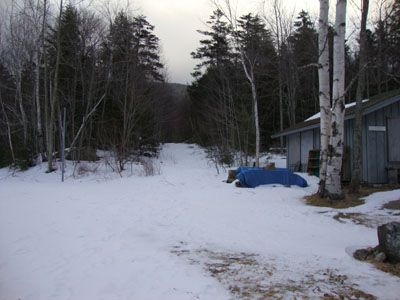
The beginning of the logging road at Camp Dodge
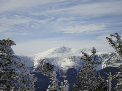
Looking at the Presidentials from Mt. Lethe
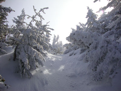
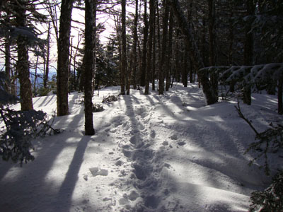
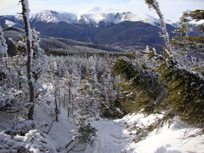
The Carter-Moriah Trail between Mt. Lethe and Middle Carter
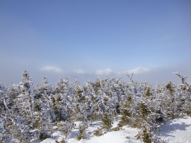
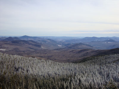
Looking into Maine from Middle Carter
The Carter-Moriah Trail between South and Middle Carter
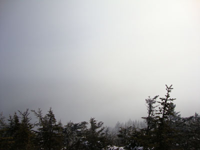
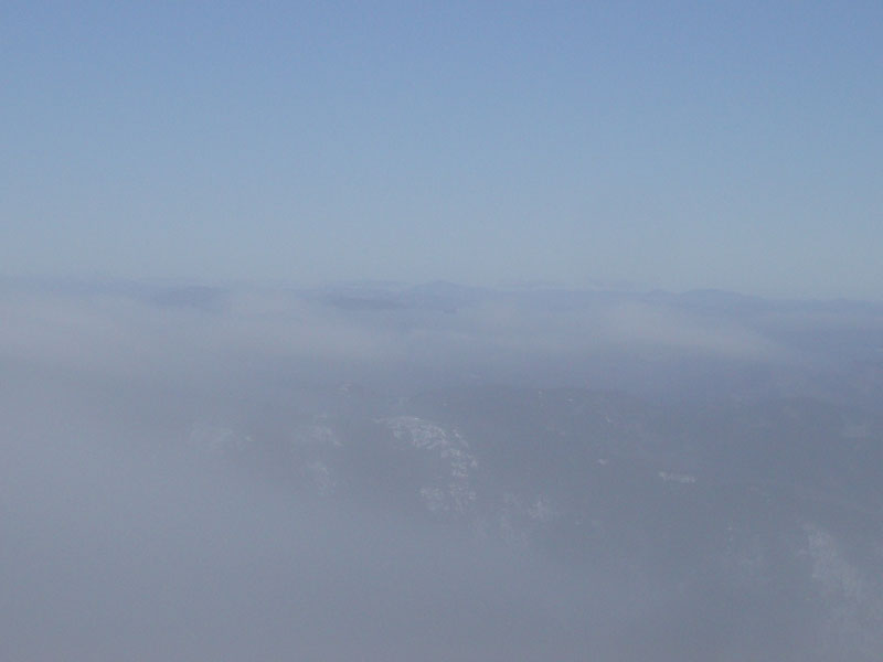
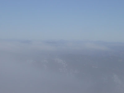
Looking at fog from South Carter
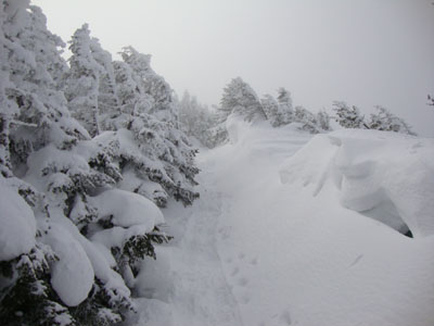
The Carter-Moriah Trail on the way to Carter Dome
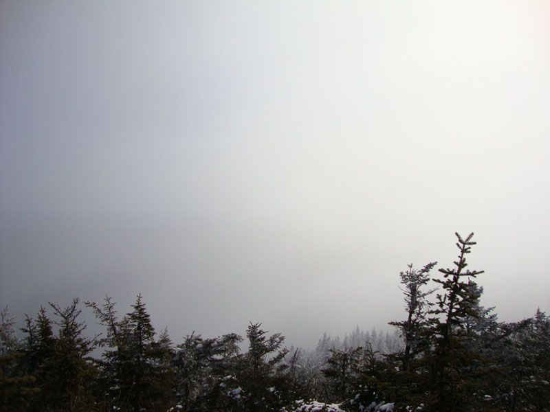
Looking at fog from Carter Dome
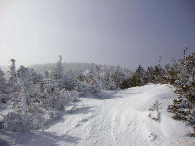
The Carter-Moriah Trail on the way to Wildcat A
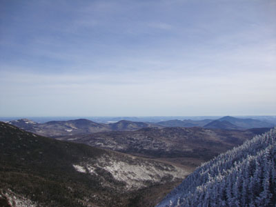
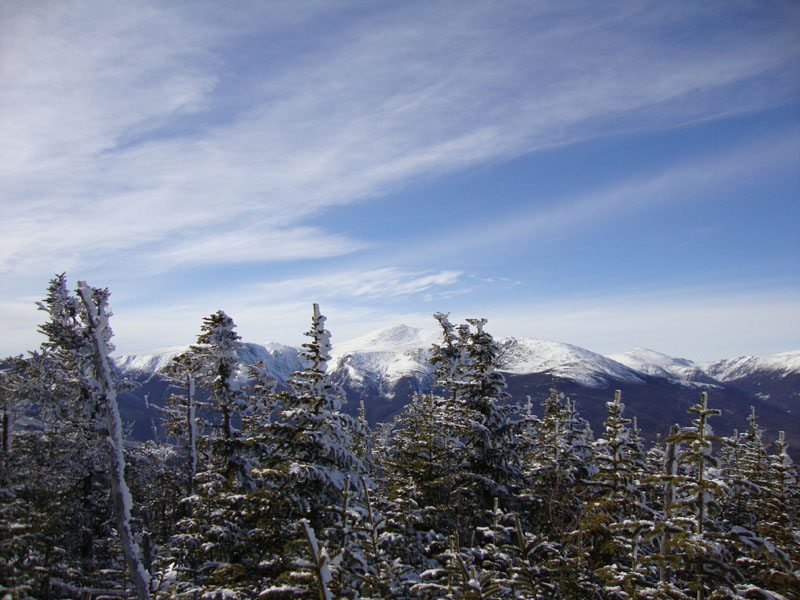
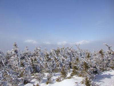
Looking at the Baldfaces and Kearsarge North from the Wildcat A view ledge
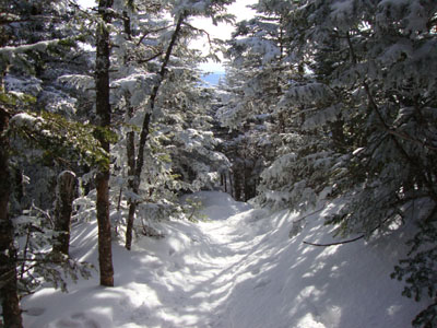
The Wildcat Ridge Trail between Wildcat A and Wildcat B

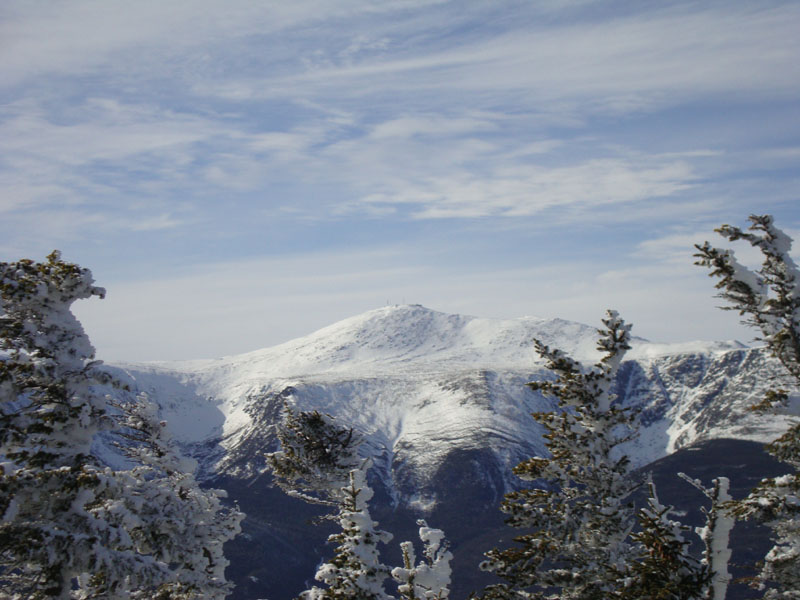
Looking at Mt. Washington from near the summit of Wildcat B
The Wildcat Ridge Trail between Wildcat B and Wildcat C
Looking at Mt. Washington from near the summit of Wildcat C
The Wildcat Ridge Trail between Wildcat C and Wildcat D
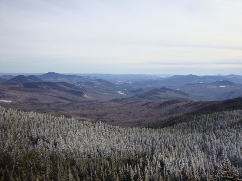
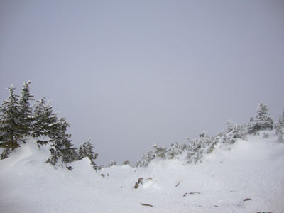
Looking south from near the summit of Wildcat D

Directions to trailhead: Take Route 16 North past the Mt. Washington Auto Road entrance. Shortly thereafter, the Nineteen Mile Brook Trail WMNF fee parking area is on the right side of the road. A clockwise loop hike can be had by walking north on Route 16 to and then up Camp Dodge Road, bearing left at a junction, then walking straight up the road to a logging road (a workshop of some sort will be on the right next to the beginning of the logging road). The logging road leads to the Imp Trail.
Back to Mt. Lethe Profile
Back to Middle Carter Mountain Profile
Back to South Carter Mountain Profile
Back to Carter Dome Mountain Profile
Back to Wildcat A Profile
Back to Wildcat B Profile
Back to Wildcat C Profile
Back to Wildcat D Profile
|